MyTopo
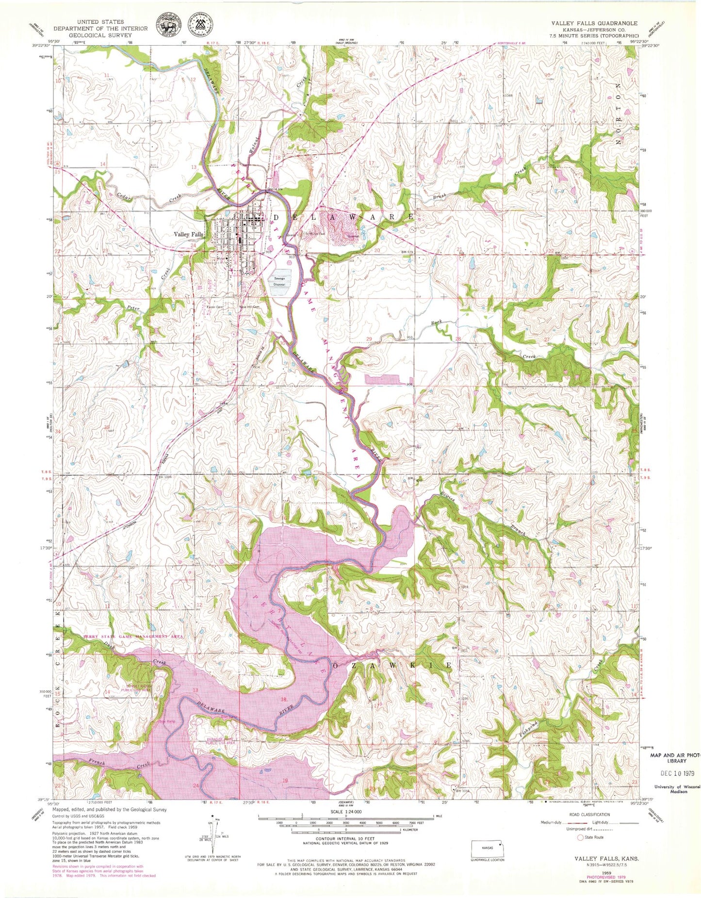
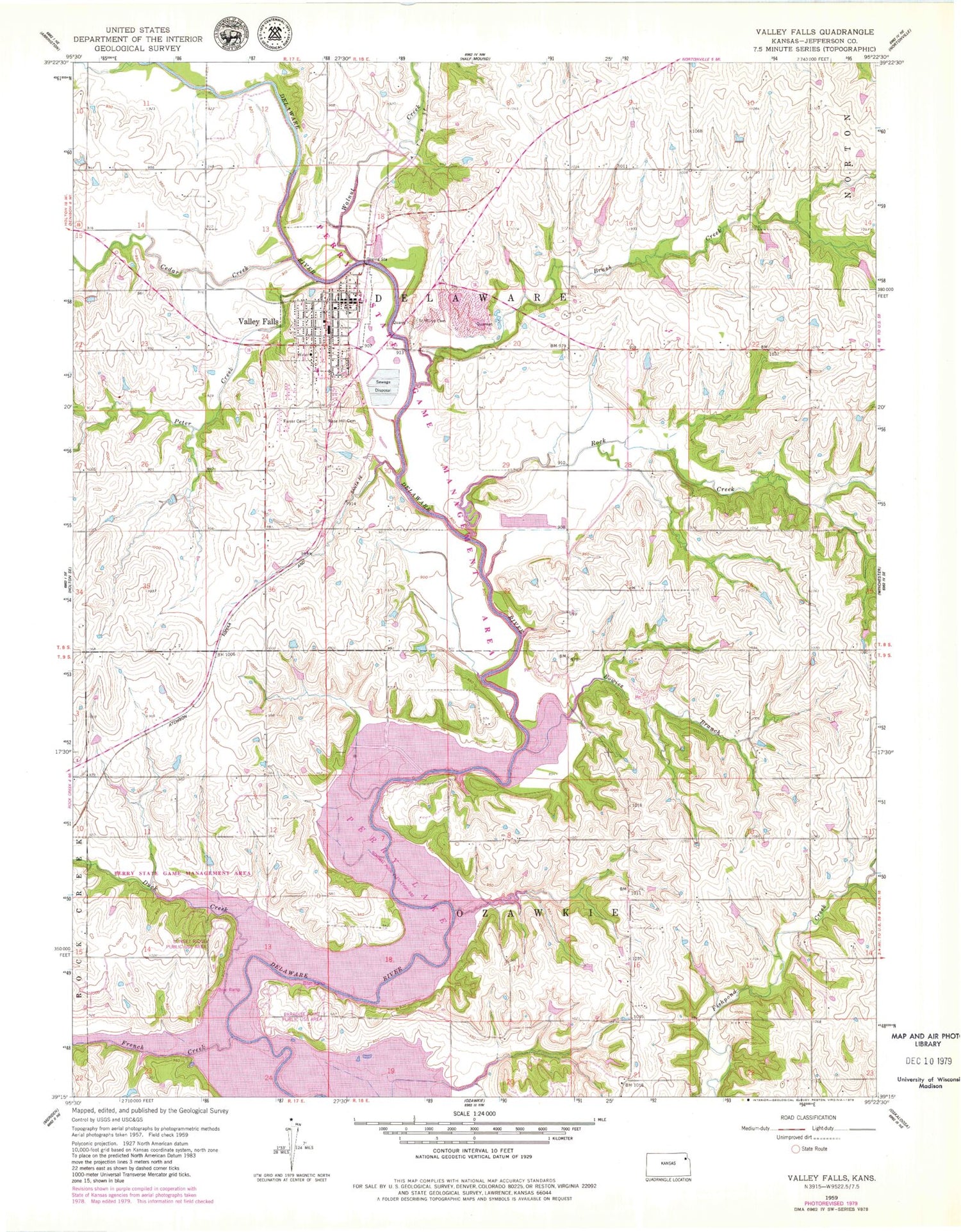
Classic USGS Valley Falls Kansas 7.5'x7.5' Topo Map
Couldn't load pickup availability
Historical USGS topographic quad map of Valley Falls in the state of Kansas. Map scale may vary for some years, but is generally around 1:24,000. Print size is approximately 24" x 27"
This quadrangle is in the following counties: Jefferson.
The map contains contour lines, roads, rivers, towns, and lakes. Printed on high-quality waterproof paper with UV fade-resistant inks, and shipped rolled.
Contains the following named places: Bowies Branch, Brush Creek, Calvary Baptist Church, Cedar Creek, City of Valley Falls, Delaware Township Library, Duck Creek, Farrar Cemetery, First Christian Church, French Creek, Linnwood Place Assisted Living Facility, McConnaugheys Mobile Home Park, Nesbitt School, Paradise Point Public Use Area, Perry Wildlife Area, Peter Creek, Rock Creek, Rose Hill Cemetery, Saint Mary's Cemetery, Saint Marys Immaculate Conception Church, Saint Paul Lutheran Church, Sunset Ridge Public Use Area, Township of Delaware, Township of Ozawkie, Valley Falls, Valley Falls City Hall, Valley Falls Elementary School, Valley Falls Fairgrounds, Valley Falls Fire Department, Valley Falls High School, Valley Falls Historical Society Museum, Valley Falls Middle School, Valley Falls Police Department, Valley Falls Post Office, Valley Falls Unified School District Office, Valley Falls United Methodist Church, Valley Falls Wastewater Treatment Plant, Valley Falls Water Tower, Walnut Creek, ZIP Code: 66088