MyTopo
Classic USGS Valley Mills Texas 7.5'x7.5' Topo Map
Couldn't load pickup availability
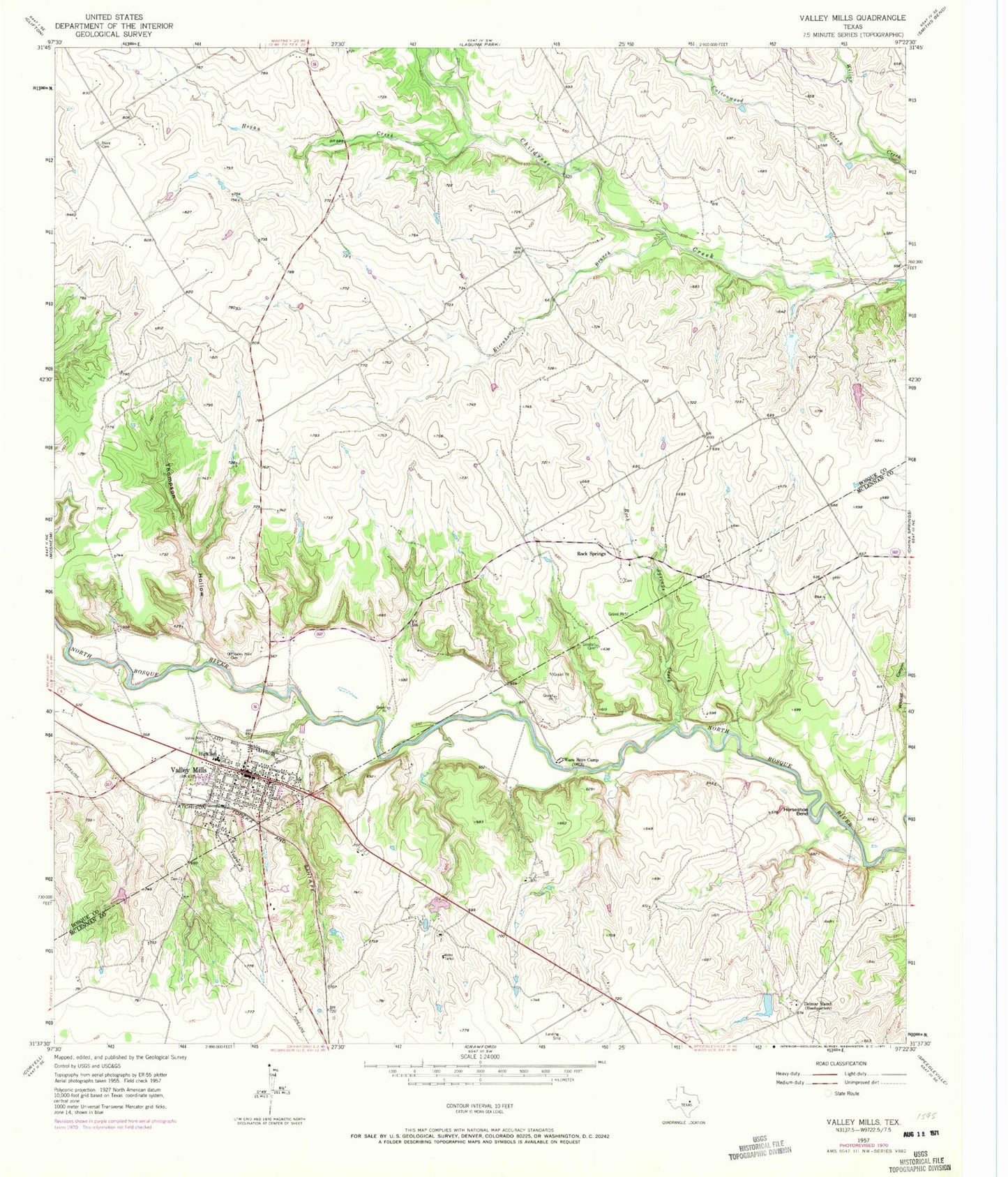
Historical USGS topographic quad map of Valley Mills in the state of Texas. Map scale may vary for some years, but is generally around 1:24,000. Print size is approximately 24" x 27"
This quadrangle is in the following counties: Bosque, McLennan.
The map contains contour lines, roads, rivers, towns, and lakes. Printed on high-quality waterproof paper with UV fade-resistant inks, and shipped rolled.
Contains the following named places: Bass Lake, Bass Lake Dam, City of Valley Mills, Cottonwood Creek, Delmar Ranch, Eisenhower Branch, Goodall Cemetery, Hall Lake, Hall Lake Dam, Hogan Creek, Horseshoe Bend, Markum Lake Number 1, Markum Lake Number 1 Dam, Markum Lake Number 2, Markum Lake Number 2 Dam, Old Valley Mills Cemetery, Rock Springs, Rock Springs Creek, Taylor Lake, Taylor Lake Dam, Thiele Cemetery, Thompson Hollow, Valley Mills, Valley Mills Cemetery, Valley Mills City Hall, Valley Mills Police Department, Valley Mills Post Office, Waco Boys Camp