
MyTopo
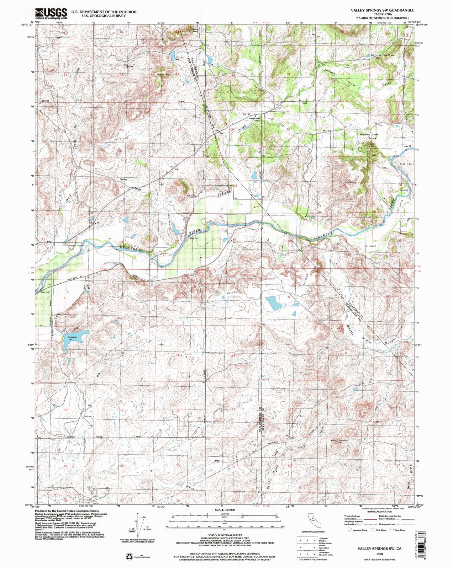
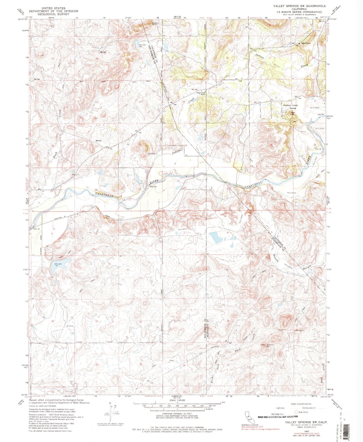
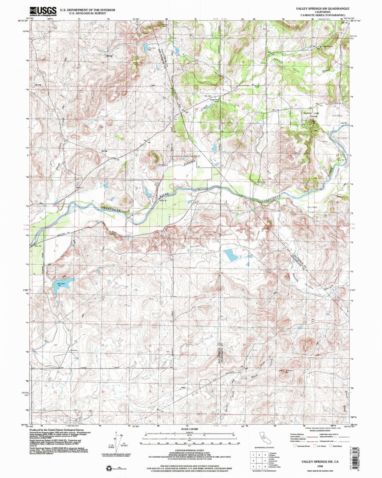
Classic USGS Valley Springs SW California 7.5'x7.5' Topo Map
Couldn't load pickup availability
Historical USGS topographic quad map of Valley Springs SW in the state of California. Map scale may vary for some years, but is generally around 1:24,000. Print size is approximately 24" x 27"
This quadrangle is in the following counties: Calaveras, San Joaquin, Stanislaus.
The map contains contour lines, roads, rivers, towns, and lakes. Printed on high-quality waterproof paper with UV fade-resistant inks, and shipped rolled.
Contains the following named places: Douglas School, Foothill Sanitary Landfill, Gilmore 571 Dam, Indian Creek, Jenny Lind Fire Protection District Station 1 Headquarters, Mother Lode Acres, Oak Grove, Opal Hill, Ospital Ranch, South Gulch, Stone Corral Church, Stone Corral Ranch, ZIP Code: 95230