MyTopo
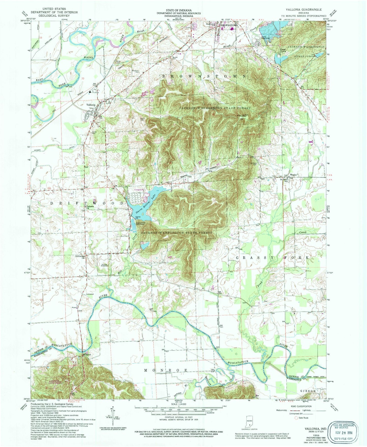
Classic USGS Vallonia Indiana 7.5'x7.5' Topo Map
Couldn't load pickup availability
Historical USGS topographic quad map of Vallonia in the state of Indiana. Typical map scale is 1:24,000, but may vary for certain years, if available. Print size: 24" x 27"
This quadrangle is in the following counties: Jackson, Washington.
The map contains contour lines, roads, rivers, towns, and lakes. Printed on high-quality waterproof paper with UV fade-resistant inks, and shipped rolled.
Contains the following named places: Burrell Cemetery, Camp Pyoca, Delaney Creek, Driftwood Church, Duncan Branch, Hough Creek, Jackson-Washington State Forest, Mill Creek, Miller Cemetery, Millport, Peters Cemetery, Pond Creek, Saint Pauls Cemetery, Saint Pauls School, Singer Ditch, Smallwood Ditch, Smith Cemetery, Snyder Ditch, Starve Hollow, Starve Hollow Lake, Stockwisch Ditch, Vallonia, Vallonia Church, Weathers Cemetery, Wegan, Woodmansee Cemetery, Starve Hollow State Beach, Lake Pyoca, Lake Pyoca Dam, Knob Lake Saw-Mill Hollow Dam, Knob Lake, Starve Hollow Lake Dam, Hillview Lake Dam, Hillview Lake, Knob Creek, De Laneys Creek Post Office (historical), Township of Driftwood, Vallonia Census Designated Place, Driftwood Volunteer Fire Department, Jackson County Sheriff's Office, Vallonia Post Office