MyTopo
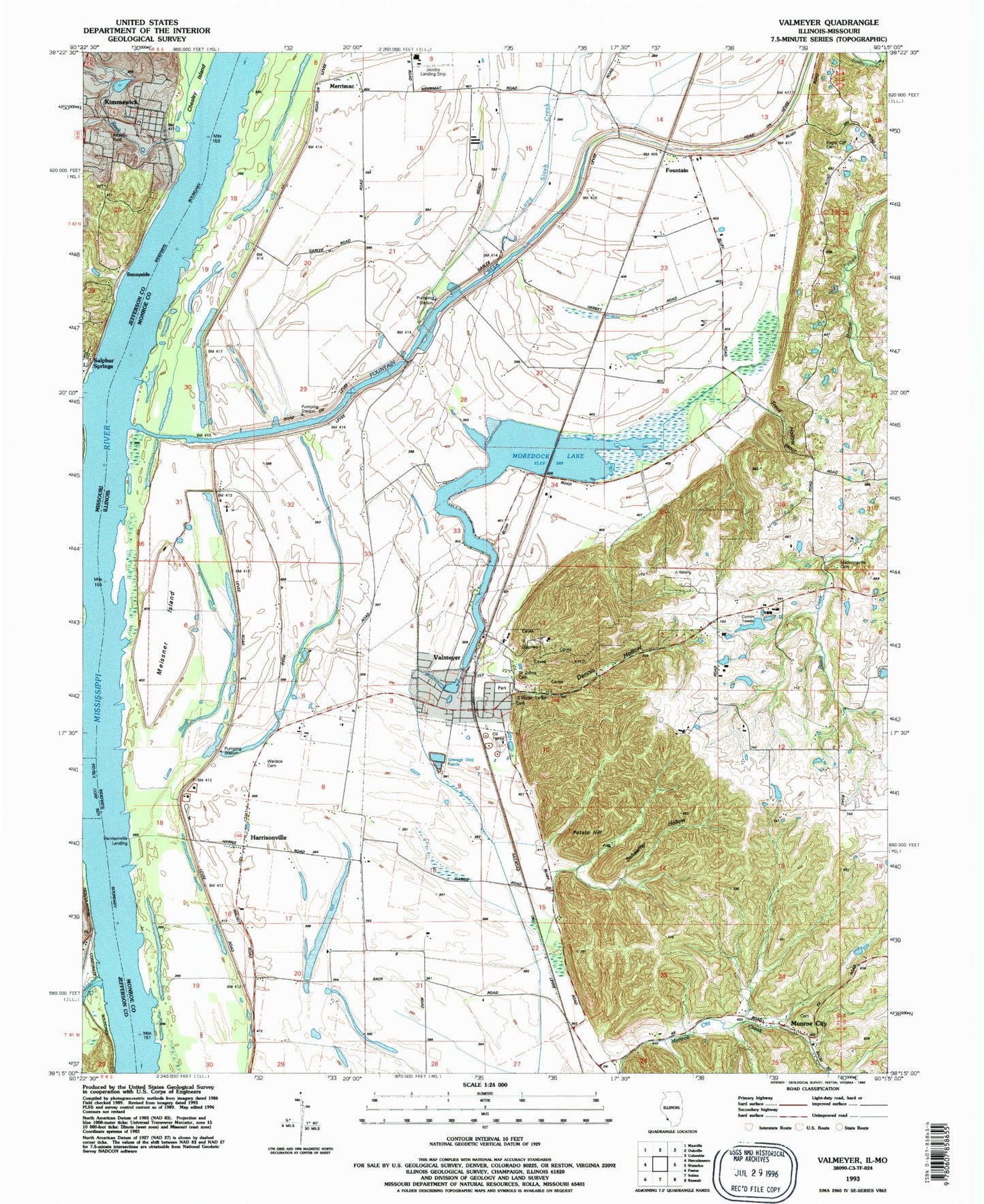
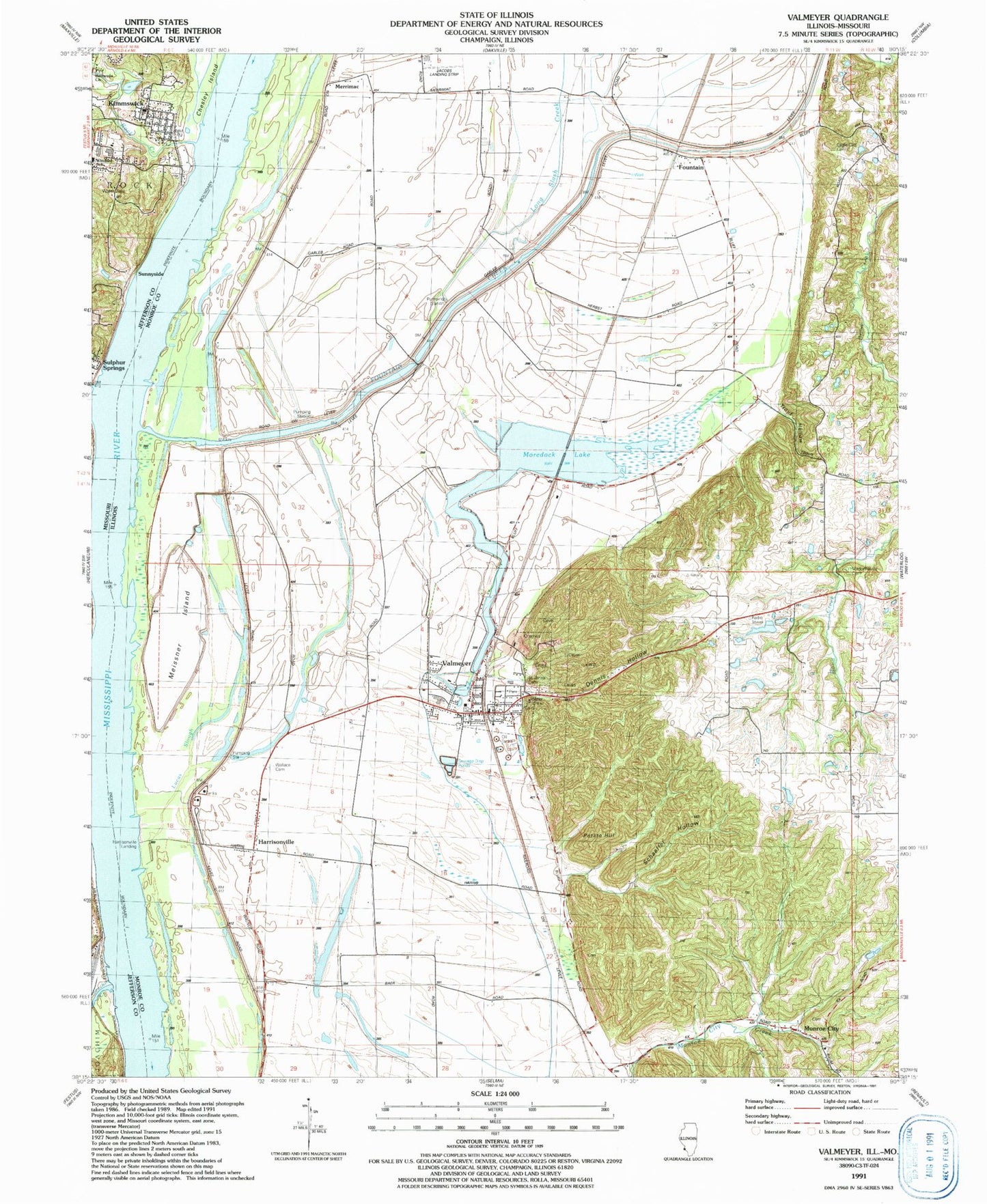
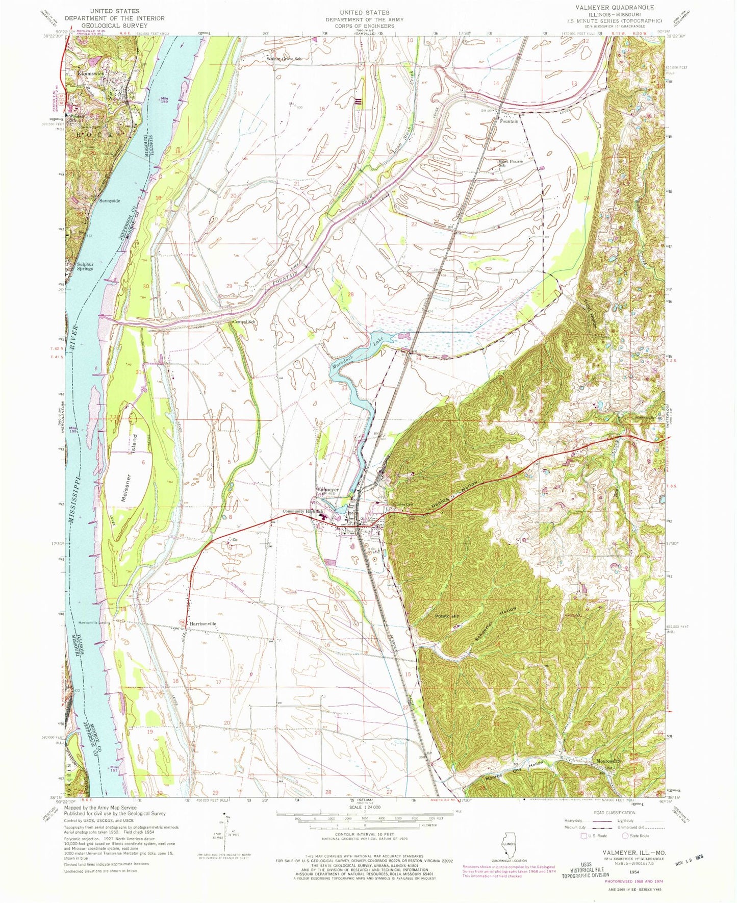
Classic USGS Valmeyer Illinois 7.5'x7.5' Topo Map
Couldn't load pickup availability
Historical USGS topographic quad map of Valmeyer in the states of Illinois, Missouri. Map scale may vary for some years, but is generally around 1:24,000. Print size is approximately 24" x 27"
This quadrangle is in the following counties: Jefferson, Monroe.
The map contains contour lines, roads, rivers, towns, and lakes. Printed on high-quality waterproof paper with UV fade-resistant inks, and shipped rolled.
Contains the following named places: Bethesda Church, Central School, City of Kimmswick, Dennis Hollow, Eagle Cliff Cemetery, Election Precinct 15, Election Precinct 20, Fountain, Fountain Creek, Glaize Creek, Harrisonville, Harrisonville Landing, Imperial Census Designated Place, Joachim Creek, Kimmswick, Kimmswick Wastewater Treatment Plant, Leber Stock Farm, Long Slash Creek, Lucas Slough, Meissner Island, Merrimac, Miles Hollow School, Monroe City, Monroe City Cemetery, Monroe City Hollow, Moredock Lake, Potato Hill, Rock Creek, Saint Johns Cemetery, Saint Josephs Church, Schaeffer Hollow, Sullivan Field, Sulphur Springs, Sunnyside, Trout Hollow, Valmeyer, Valmeyer Community School, Valmeyer Fire Protection District, Valmeyer Post Office, Village of Valmeyer, Wallace Cemetery, Walnut Grove School, Waters Point, Woodville, ZIP Codes: 62295, 63053