MyTopo
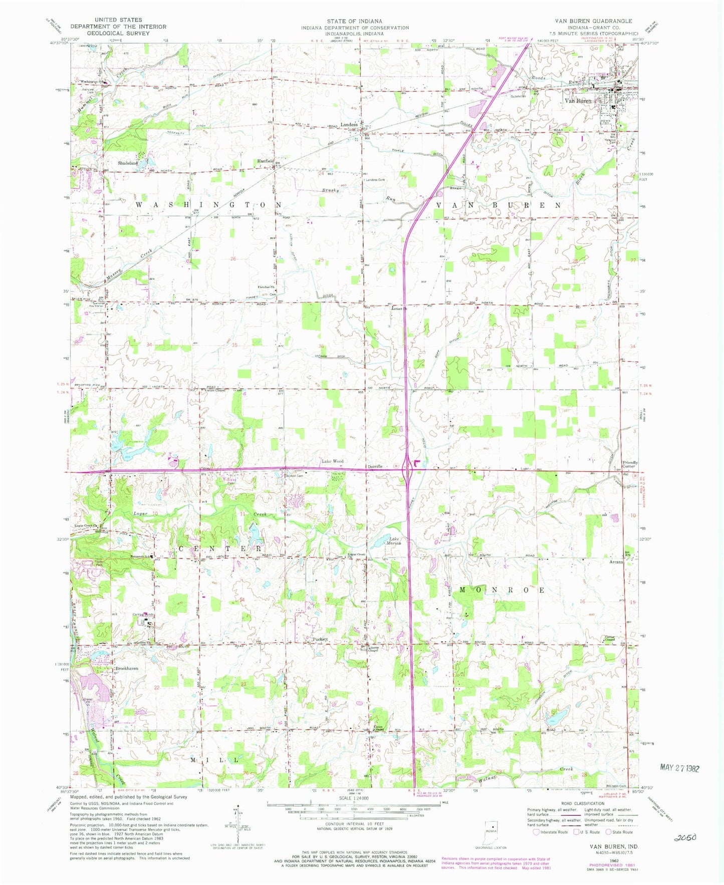
Classic USGS Van Buren Indiana 7.5'x7.5' Topo Map
Couldn't load pickup availability
Historical USGS topographic quad map of Van Buren in the state of Indiana. Map scale may vary for some years, but is generally around 1:24,000. Print size is approximately 24" x 27"
This quadrangle is in the following counties: Grant.
The map contains contour lines, roads, rivers, towns, and lakes. Printed on high-quality waterproof paper with UV fade-resistant inks, and shipped rolled.
Contains the following named places: Antioch Church, Arcana, Atkinson Cemetery, Baker Ditch, Brookhaven, Brookhaven Addition Lake, Brookhaven Addition Lake Dam, Brushy Run, Buck Run Ditch, Burson Cemetery, Center Chapel, Club Run, Covenant Presbyterian Church, Dooville, Fairview Cemetery, Fletcher Church, Friendly Corner, Goff Ditch, Grant County Emergency Medical Services, Grant County Emergency Medical Services - Van Buren Medic 6, Grant County Emergency Medical Services Washington Medic 11, Griffin Church, Hanfield, Johnson Ditch, Lake Marion, Lake Wood, Landess, Landess Cemetery, Landess Census Designated Place, Liberty Chapel, Lincoln Country Club Lake, Lincoln Country Club Lake Dam, Locust Chapel, Loew Lake Dam South, Ludlum Ditch, Lugar Creek Church, Monroe Ditch, Moriarity Ditch, Necessity Ditch, Pulley Ditch, Roosevelt School, Shadeland, Taylor Lake, Taylor Lake Dam, Tinkle Ditch, Tippey Ditch, Town of Van Buren, Township of Center, Township of Monroe, Township of Van Buren, Township of Washington, Union Chapel, Unthank Ditch, Van Buren, Van Buren Cemetery, Van Buren Elementary and Middle School, Van Buren Police Department, Van Buren Post Office, Van Buren Volunteer Fire Department, Walnut Creek, Washington Elementary School, Washington Township Volunteer Fire Department Marion