MyTopo
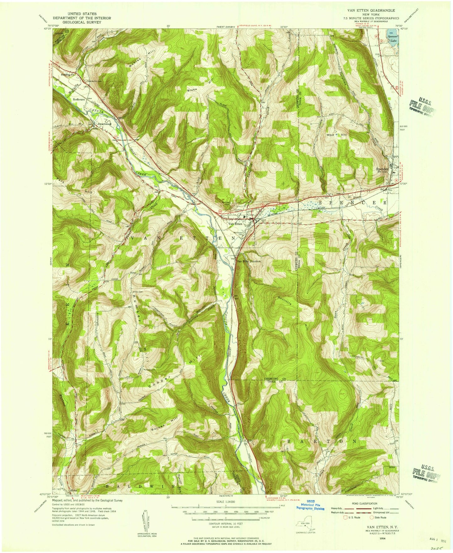
Classic USGS Van Etten New York 7.5'x7.5' Topo Map
Couldn't load pickup availability
Historical USGS topographic quad map of Van Etten in the state of New York. Map scale may vary for some years, but is generally around 1:24,000. Print size is approximately 24" x 27"
This quadrangle is in the following counties: Chemung, Schuyler, Tioga.
The map contains contour lines, roads, rivers, towns, and lakes. Printed on high-quality waterproof paper with UV fade-resistant inks, and shipped rolled.
Contains the following named places: Assembly of God Church, Baker Creek, Barnes Hill, Blake Hill, Burheight Creek, Canfield Memorial Cemetery, Cayuta Creek Bridge, Cooper Hill, Darling Creek, Doolittle Hill, Jenkins Cemetery, Johnson Creek, Langford Creek, McDuffy Creek, Mount Hope Cemetery, Nobles Hill, Rumsey Cemetery, Rumsey Hill, Saint Pius X Church, Spencer Lake, Spencer-Van Etten Elementary School, Spencer-Van Etten High School, Swartwood, Swartwood Cemetery, Town of Van Etten, Van Etten, Van Etten Census Designated Place, Van Etten Community United Church, Van Etten Junction, Van Etten Post Office, Van Etten Volunteer Fire Department, Village of Van Etten, West Hill, Westbrook Cemetery, ZIP Code: 14889