MyTopo
Classic USGS Van Tassell Wyoming 7.5'x7.5' Topo Map
Regular price
$16.95
Regular price
Sale price
$16.95
Unit price
per
Couldn't load pickup availability
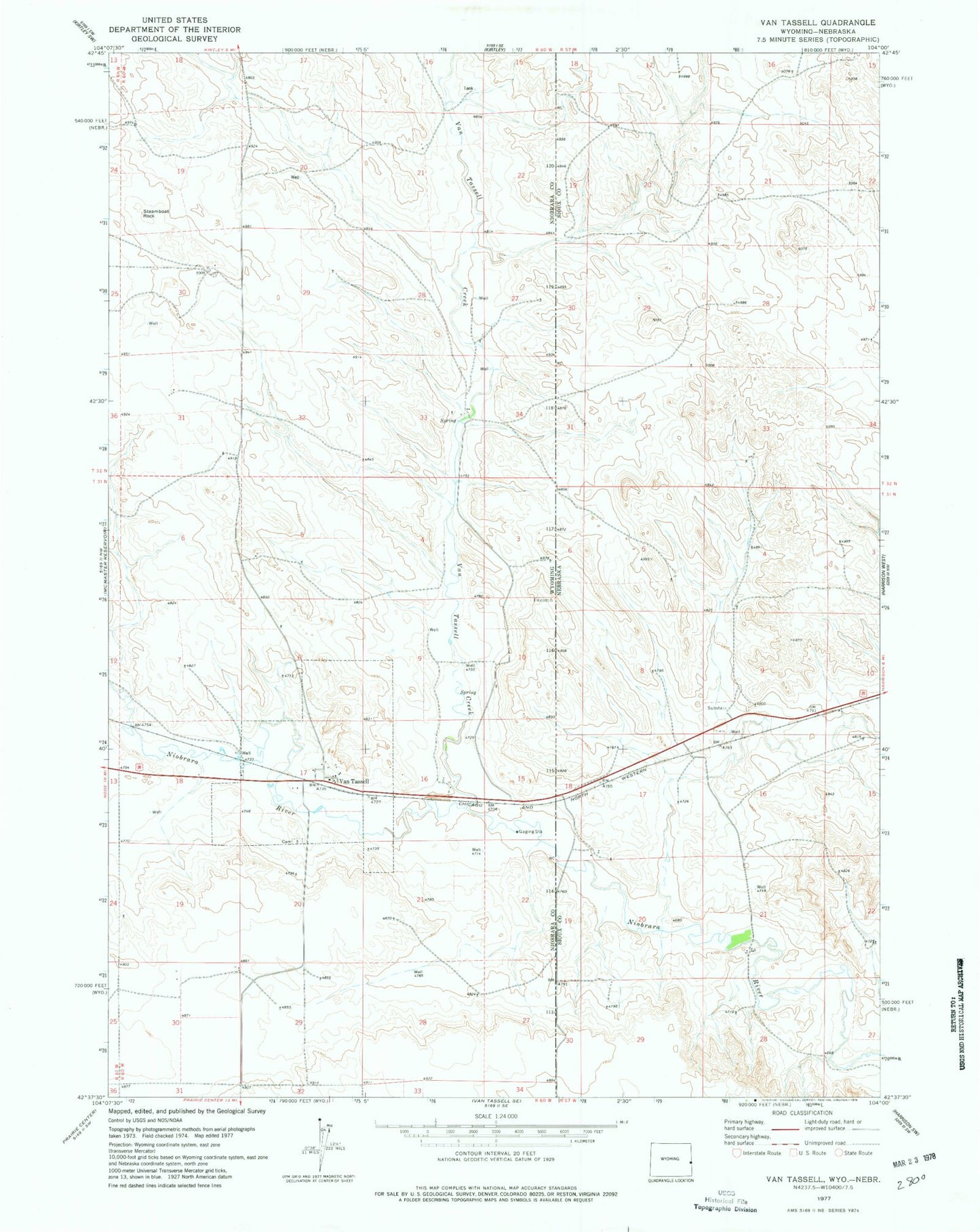
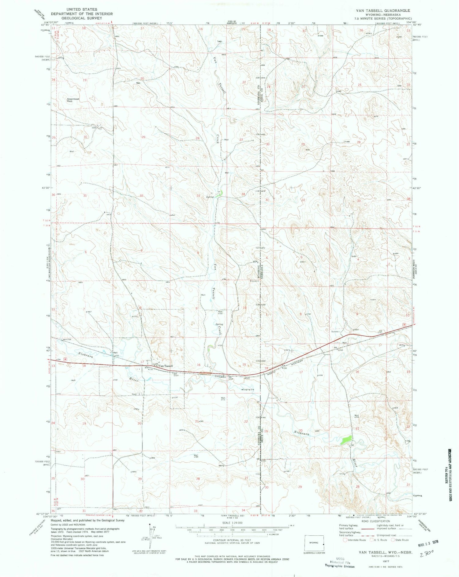
Historical USGS topographic quad map of Van Tassell in the states of Wyoming, Nebraska. Map scale may vary for some years, but is generally around 1:24,000. Print size is approximately 24" x 27"
This quadrangle is in the following counties: Niobrara, Sioux.
The map contains contour lines, roads, rivers, towns, and lakes. Printed on high-quality waterproof paper with UV fade-resistant inks, and shipped rolled.
Contains the following named places: Coffee Siding, Coffee Siding Historical Marker, Niobrara County Rural Fire District, Steamboat Rock, Town of Van Tassell, Van Tassell, Van Tassell Cemetery, Van Tassell Creek, Van Tassell Post Office, ZIP Code: 82242