MyTopo
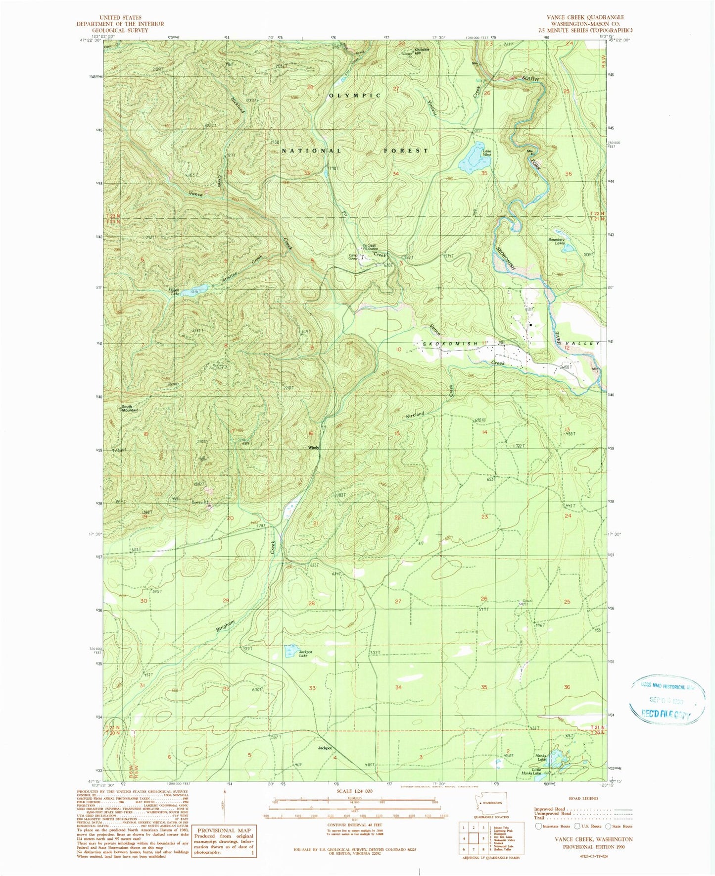
Classic USGS Vance Creek Washington 7.5'x7.5' Topo Map
Couldn't load pickup availability
Historical USGS topographic quad map of Vance Creek in the state of Washington. Map scale may vary for some years, but is generally around 1:24,000. Print size is approximately 24" x 27"
This quadrangle is in the following counties: Mason.
The map contains contour lines, roads, rivers, towns, and lakes. Printed on high-quality waterproof paper with UV fade-resistant inks, and shipped rolled.
Contains the following named places: Aristine Creek, Bingham Creek Reload, Boundary Lakes, Camp 3, Camp Govey, Fir Creek, Fir Creek Guard Station, Fir Creek Reload, Fir Creek Work Center, Flat Creek, Grisdale Hill, Grisdale Hill Lookout, Hanks Lake, Haven Lake, High Steel Bridge, Jackpot Lake, Jackpot Siding, Kirkland Creek, Lake West, Little Hanks Lake, Nicklund Creek, Simpson Lookout, South Mountain, Vance Creek, Vincent Creek, West Lake Dam, Windy Siding