MyTopo
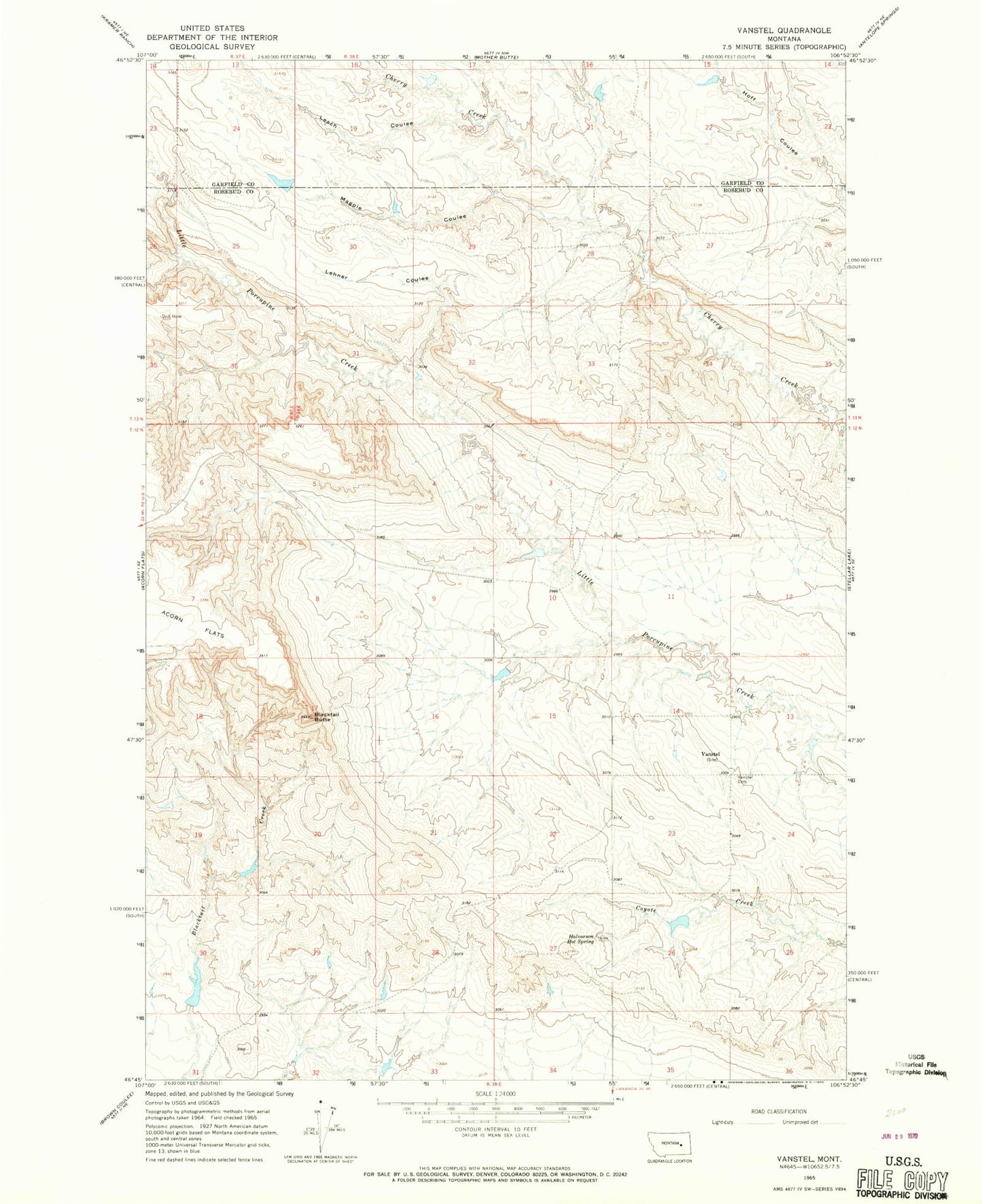
Classic USGS Vanstel Montana 7.5'x7.5' Topo Map
Couldn't load pickup availability
Historical USGS topographic quad map of Vanstel in the state of Montana. Map scale may vary for some years, but is generally around 1:24,000. Print size is approximately 24" x 27"
This quadrangle is in the following counties: Garfield, Rosebud.
The map contains contour lines, roads, rivers, towns, and lakes. Printed on high-quality waterproof paper with UV fade-resistant inks, and shipped rolled.
Contains the following named places: 03N39E08CBBB01 Well, 12N38E27AD__01 Well, Blacktail Butte, Cherry Creek Number 12 Dam, Cherry Creek Number 15 Dam, Cherry Creek Number 17 Dam, Halvorson Hot Spring, Leach Coulee, Lehner Coulee, Magpie Coulee, Schiffer Number 6 Dam, Vanstel, Vanstel Cemetery, Vanstel Post Office, Vanstel School