MyTopo
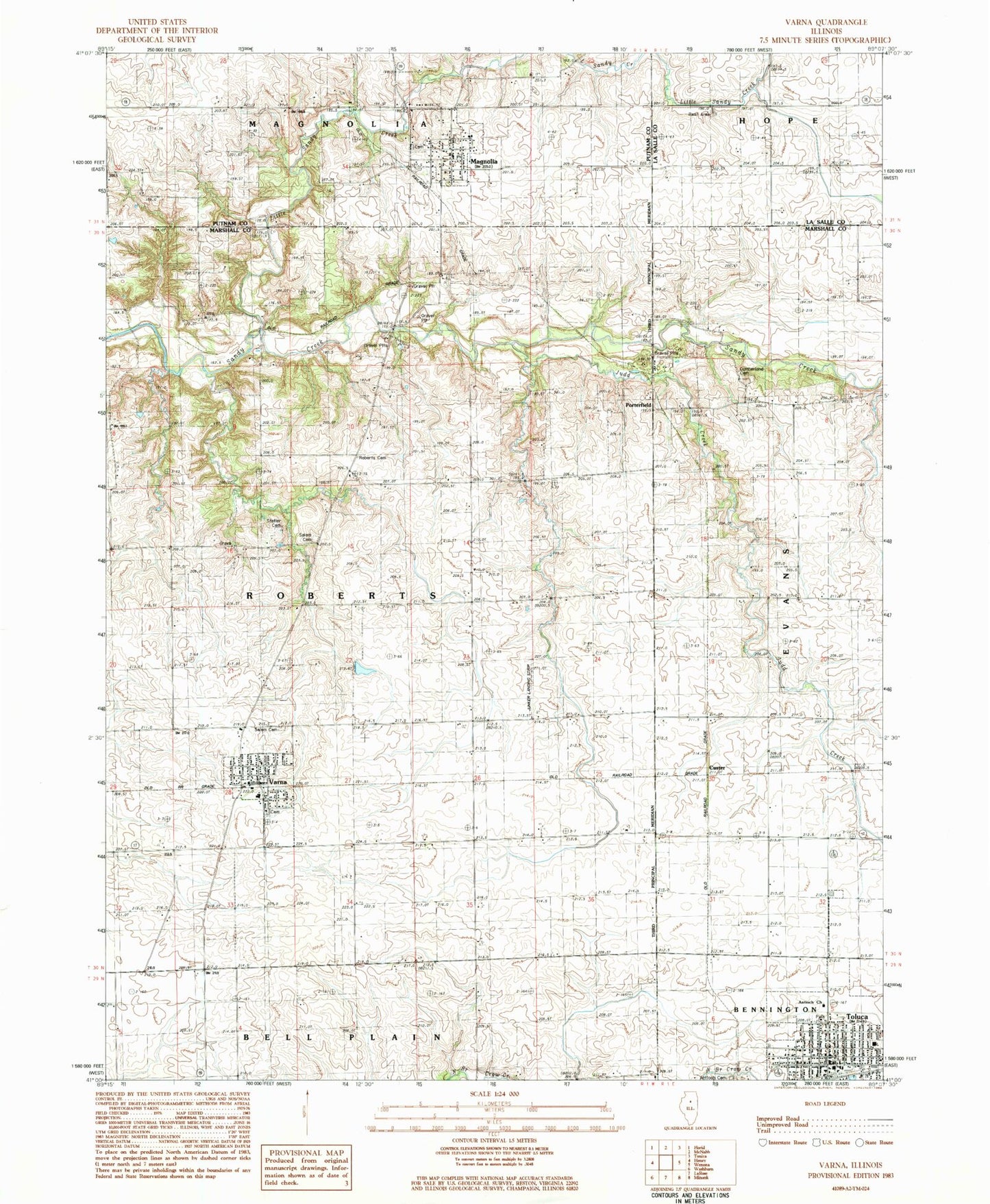
Classic USGS Varna Illinois 7.5'x7.5' Topo Map
Couldn't load pickup availability
Historical USGS topographic quad map of Varna in the state of Illinois. Map scale may vary for some years, but is generally around 1:24,000. Print size is approximately 24" x 27"
This quadrangle is in the following counties: LaSalle, Marshall, Putnam.
The map contains contour lines, roads, rivers, towns, and lakes. Printed on high-quality waterproof paper with UV fade-resistant inks, and shipped rolled.
Contains the following named places: Antioch Cemetery, Antioch Christian Church, Arnold School, Beckwith School, Brushy College School, City of Toluca, Cumberland Cemetery, Custer, Fairview School, Fieldcrest Elementary School-West, Fieldcrest Middle School-West, First Evangelical Lutheran Church, First Lutheran Cemetery Number 2, Gaylords Branch, Judd Creek, Judd School, Junker Landing Strip, Little Sandy Creek, Lloyd School, Magnolia, Magnolia Cemetery, Magnolia Fire Department, Magnolia Post Office, Myers Creek, Porterfield, Roberts Branch, Roberts Cemetery, Saint Anns Church, Salem Cemetery, Statler Cemetery, Statler School, Toluca, Toluca City Hall, Toluca Police Department, Toluca Post Office, Township of Roberts, Union School, Varna, Varna Elementary School, Varna Fire Protection District, Varna Post Office, Village of Magnolia, Village of Varna, ZIP Codes: 61336, 61375