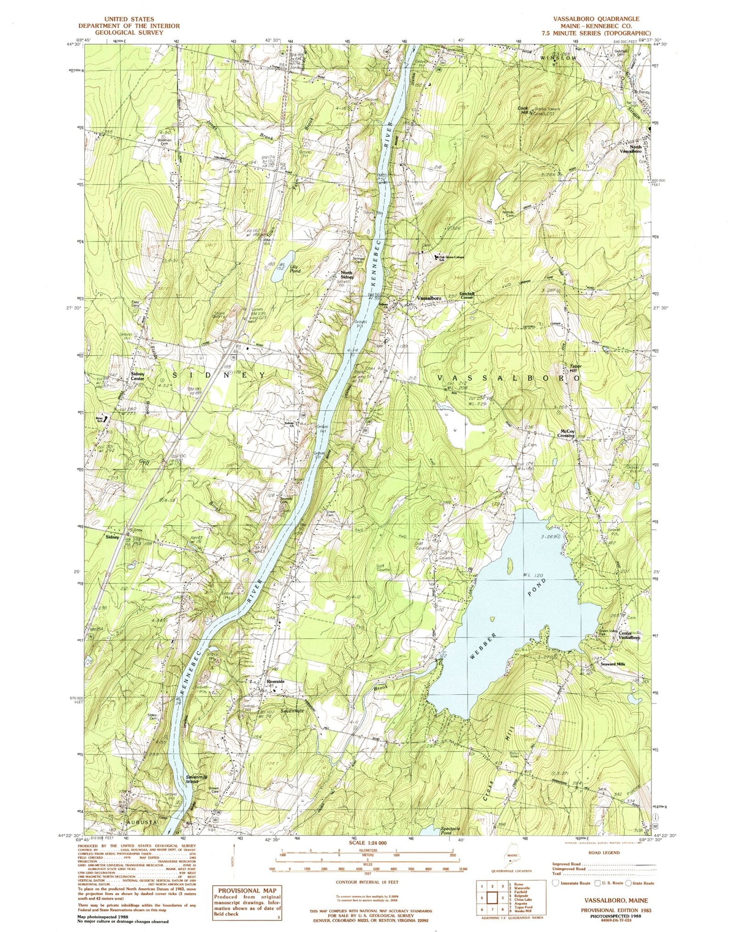
MyTopo
Classic USGS Vassalboro Maine 7.5'x7.5' Topo Map
Couldn't load pickup availability
Historical USGS topographic quad map of Vassalboro in the state of Maine. Map scale may vary for some years, but is generally around 1:24,000. Print size is approximately 24" x 27"
This quadrangle is in the following counties: Kennebec.
The map contains contour lines, roads, rivers, towns, and lakes. Printed on high-quality waterproof paper with UV fade-resistant inks, and shipped rolled.
Contains the following named places: Bog Brook, Bowman Cemetery, Brown Cemetery, Center Vassalboro, Center Vassalboro Baptist Cemetery, Center Vassalboro Baptist Cemetery Extension, Clark - Goff Cemetery, Cook Hill, Cross Hill, Cross Hill Cemetery, Field Cemetery, Fields Brook, Fox Field, Getchell Cemetery, Getchell Corner, Goff Brook, Green Valley Park, James H Bean Elementary School, Jones Brook, Lily Pond, Longfellow School, Maine Criminal Justice Academy, Maple Grove Cemetery, McCoy Crossing, NFI Sidney River Bend School, Nichols Cemetery, North Sidney, Oak Grove Cemetery, Oak Grove-Coburn School, Riverside, Seaward Mills, Seven Mile Brook, Seven Mile Brook Dam, Sevenmile Brook, Sevenmile Island, Sibley Cemetery, Sidney, Sidney Center, Sidney Fire Department, Sidney Fire Department Engine Company 6, Springer Cemetery, Taber Hill, Thayer Corner School, Town Farm Brook, Town of Vassalboro, Union Cemetery, Vassalboro, Vassalboro Community School, Vassalboro Fire Department Riverside Station, Webber Pond, Webber Pond Dam, Webber Pond Road Cemetery, WJBI-FM (Winslow), WMEW-FM (Waterville), ZIP Codes: 04962, 04989