MyTopo
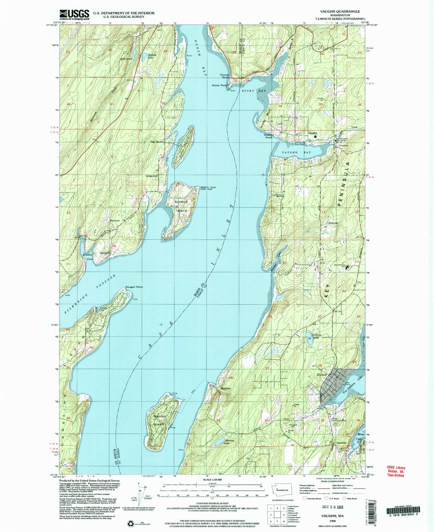
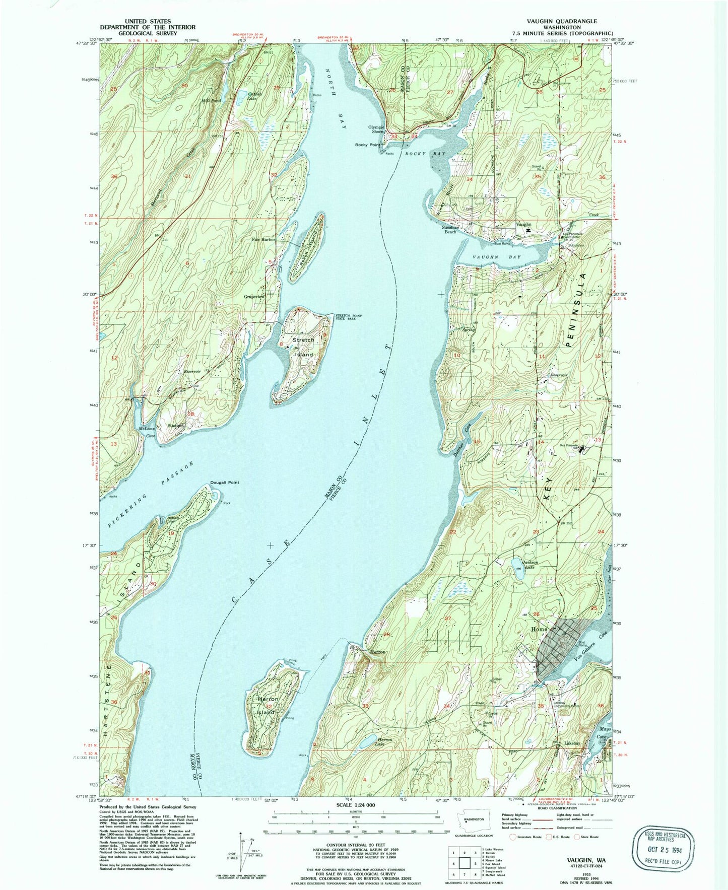
Classic USGS Vaughn Washington 7.5'x7.5' Topo Map
Couldn't load pickup availability
Historical USGS topographic quad map of Vaughn in the state of Washington. Typical map scale is 1:24,000, but may vary for certain years, if available. Print size: 24" x 27"
This quadrangle is in the following counties: Mason, Pierce.
The map contains contour lines, roads, rivers, towns, and lakes. Printed on high-quality waterproof paper with UV fade-resistant inks, and shipped rolled.
Contains the following named places: Case Inlet, Catfish Lake, Dougall Point, Dutcher Cove, Grapeview School, Herron Island, Herron Lake, Indian Cove, Jackson Lake, Lakebay School, McLane Cove, Mill Pond, Olympic Shore, Reach Island, Rocky Bay, Rocky Point, Stadium, Stretch Island, Sunshine Beach, Vaughn Bay, Von Geldern Cove, Windy Bluff, Fair Harbor, Grapeview, Herron, Stretch Point State Park, Home, Vaughn, Lakebay, Detroit (historical), Vaughn Elementary School, Key Peninsula Middle School, Rocky Creek, Key Peninsula, Haleys Dam, Haleys Lagoon, Vaughn Creek, Allyn-Grapeview Census Designated Place (historical), Rocky Bay Airport, Herron Island Census Designated Place, Home Census Designated Place, Key Center Census Designated Place, Vaughn Census Designated Place, Grapeview Census Designated Place, Pierce County Fire Protection District 16 Key Peninsula Fire Department Station 5, Pierce County Fire Protection District 16 Key Peninsula Fire Department Station 3, Pierce County Fire Protection District 16 Key Peninsula Fire Department Station 6, Rocky Bay Health Care Facility, Lakebay Marina, Fair Harbor Marina, Mason County Fire District 3, Lakebay Post Office, Grapeview Post Office, Vaughn Bay Cemetery