MyTopo
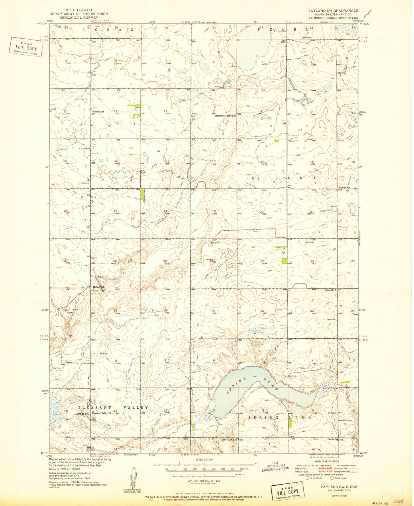
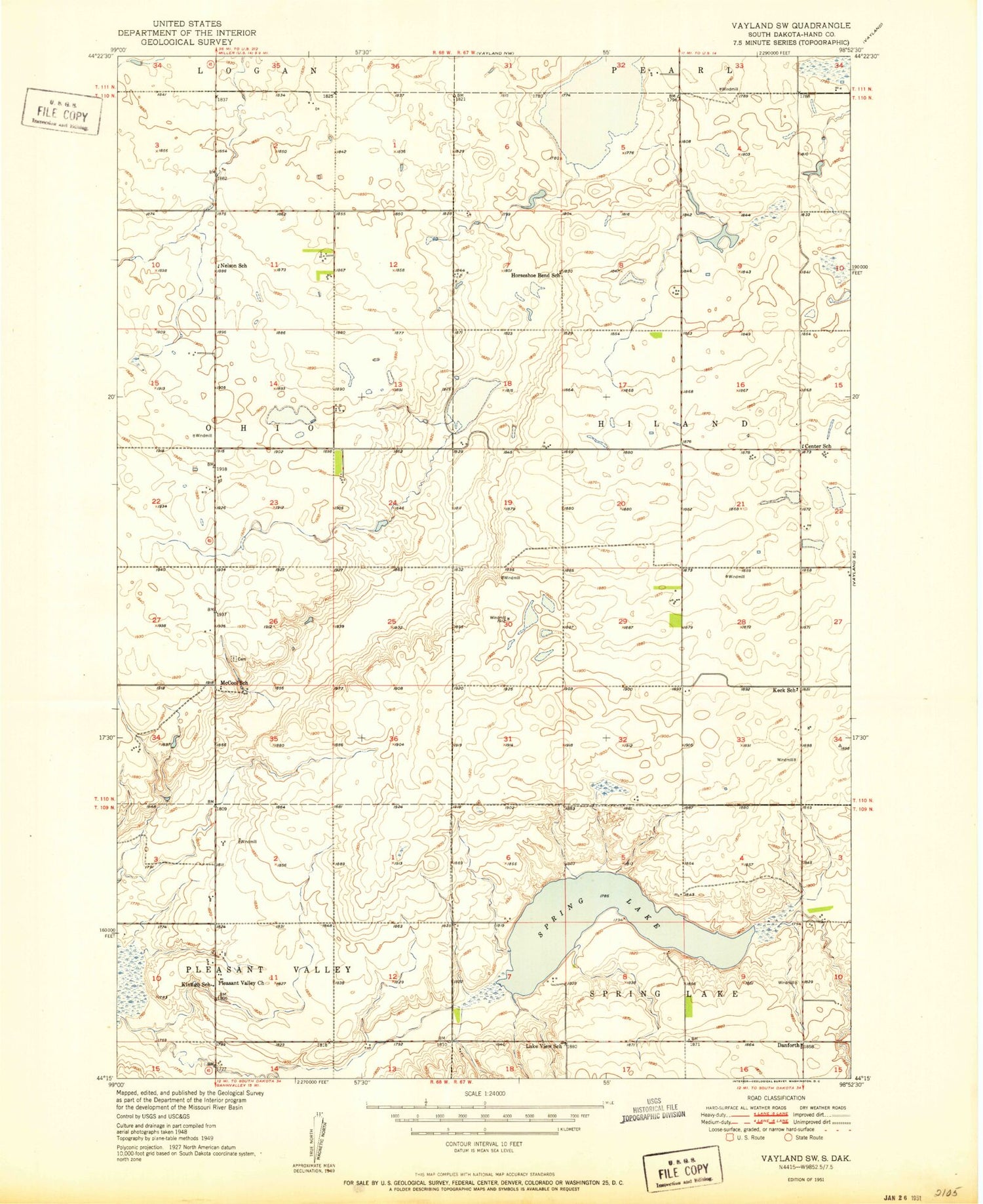
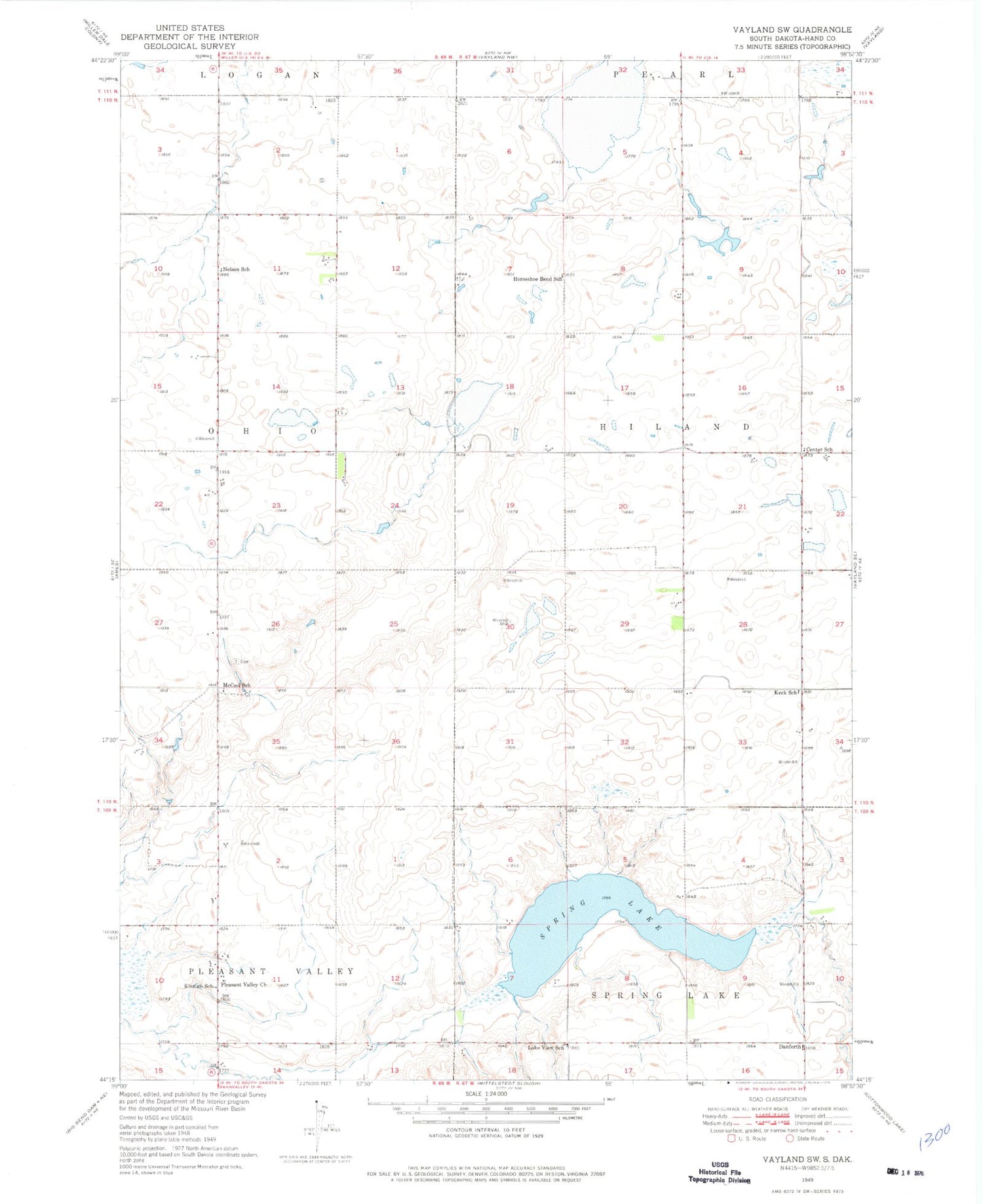
Classic USGS Vayland SW South Dakota 7.5'x7.5' Topo Map
Couldn't load pickup availability
Historical USGS topographic quad map of Vayland SW in the state of South Dakota. Map scale may vary for some years, but is generally around 1:24,000. Print size is approximately 24" x 27"
This quadrangle is in the following counties: Hand.
The map contains contour lines, roads, rivers, towns, and lakes. Printed on high-quality waterproof paper with UV fade-resistant inks, and shipped rolled.
Contains the following named places: C McGillvrey Dam, Center School, Danforth, Dean, Hand County Waterfowl Production Area, Hiland Township Hall, Horseshoe Bend School, Keck School, Kintigh School, Lake View School, McCool School, Nelson School, Ohio School, Pleasant Valley Church, Spring Lake, Sunshine Bible Elementary School, Sunshine Bible High School, Sweetland, Township of Hiland, Wall Lake