MyTopo
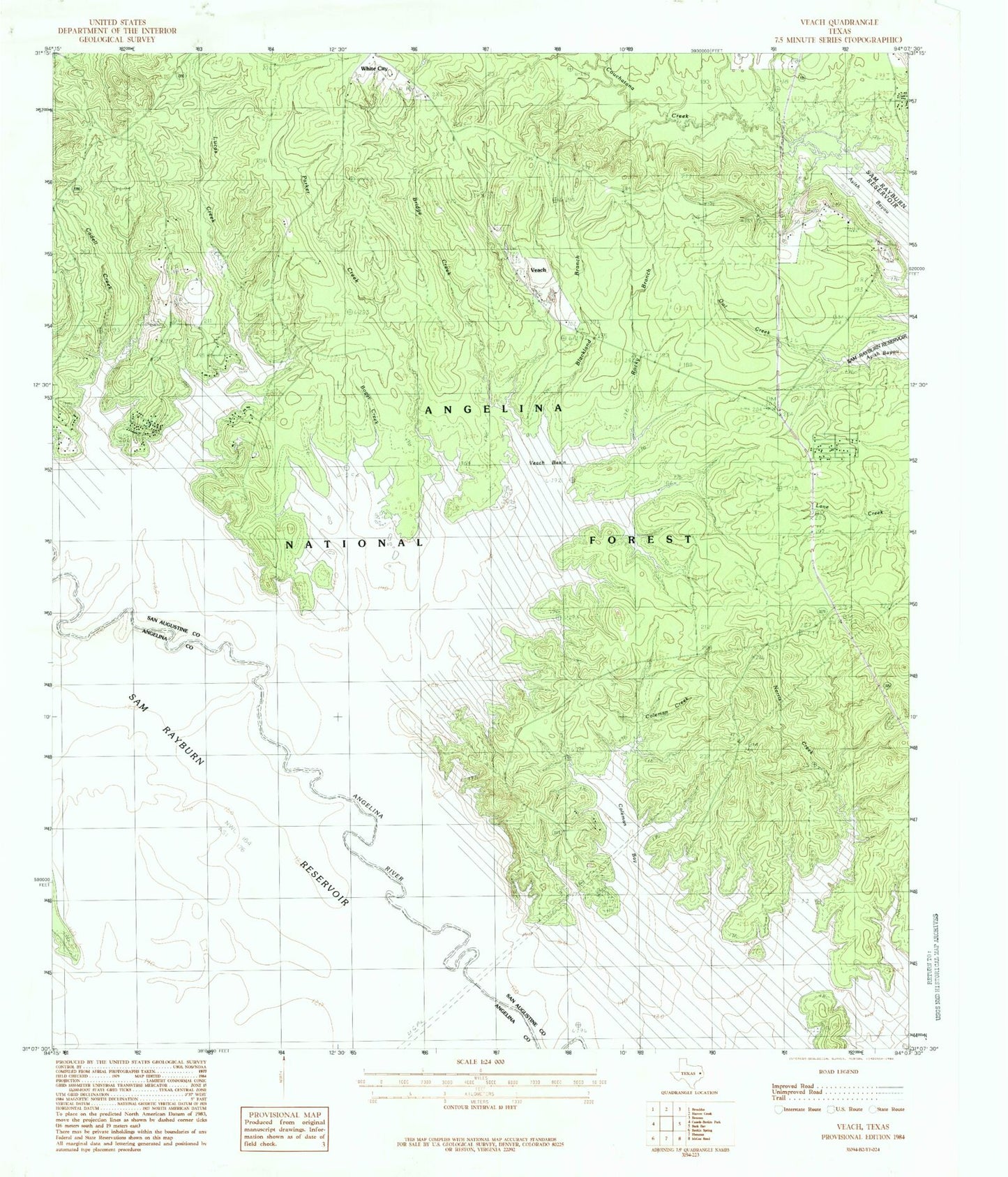
Classic USGS Veach Texas 7.5'x7.5' Topo Map
Couldn't load pickup availability
Historical USGS topographic quad map of Veach in the state of Texas. Map scale may vary for some years, but is generally around 1:24,000. Print size is approximately 24" x 27"
This quadrangle is in the following counties: Angelina, San Augustine.
The map contains contour lines, roads, rivers, towns, and lakes. Printed on high-quality waterproof paper with UV fade-resistant inks, and shipped rolled.
Contains the following named places: Blackland Branch, Boggy Creek, Bridge Creek, Cadell Creek, Campbell Branch, Caney Creek, Coleman Bay, Coleman Cemetery, Coleman Creek, Concord Church, Five Fingers, High Point Lookout, High Point Lookout Tower, Hornsby Creek, Little Caney Creek, Lucas Cemetery, Lucas Creek, McGilberry Cemetery, McGilberry Lake, Mott Cemetery, New Hope Cemetery, Oak Grove Church, Parker Creek, Rocky Branch, Rocky Creek, Sinclair Cemetery, Veach, Veach Basin, Williams Cemetery, Yellow Ridge Church, ZIP Code: 75929