MyTopo
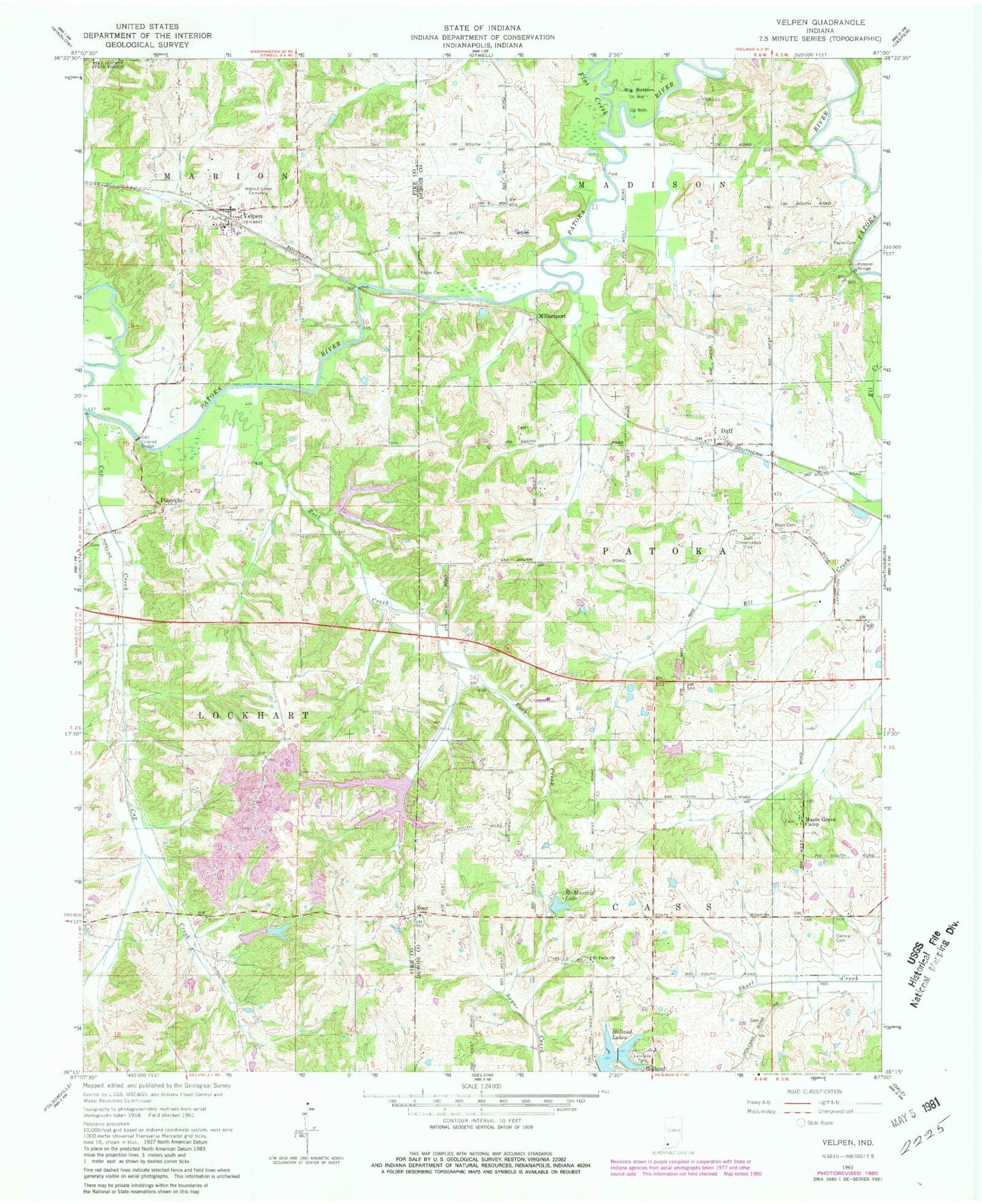
Classic USGS Velpen Indiana 7.5'x7.5' Topo Map
Couldn't load pickup availability
Historical USGS topographic quad map of Velpen in the state of Indiana. Map scale may vary for some years, but is generally around 1:24,000. Print size is approximately 24" x 27"
This quadrangle is in the following counties: Dubois, Pike.
The map contains contour lines, roads, rivers, towns, and lakes. Printed on high-quality waterproof paper with UV fade-resistant inks, and shipped rolled.
Contains the following named places: Beadens Creek, Central German Methodist Cemetery, Cup Creek, Duff, Duff Conservation Club, Flat Creek, Holland Lake, Holland Old Water Supply Dam Number 1, Kessner Bridge, Lake Edward, Lake Edward Dam, Lake Helmerich, Lake Helmerich Dam, Lake Molly, Lake Molly Dam, Lake William, Lake William Dam, Maple Grove Camp, Mayo Cemetery, McMurtrie Lake, Millersport, Payne Cemetery, Pikeville, Risley Cemetery, Rock Creek, Saint Paul United Church of Christ Cemetery, Stilwell Cemetery, Velpen, Velpen Post Office, Walnut Grove Cemetery, Zoar, ZIP Code: 47590