
MyTopo
Classic USGS Venedy Illinois 7.5'x7.5' Topo Map
Couldn't load pickup availability
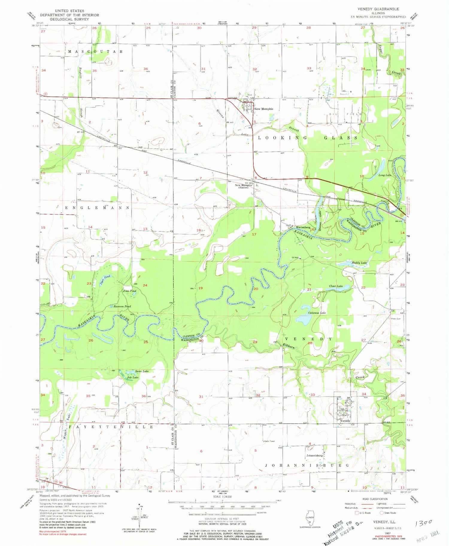
Historical USGS topographic quad map of Venedy in the state of Illinois. Map scale may vary for some years, but is generally around 1:24,000. Print size is approximately 24" x 27"
This quadrangle is in the following counties: Clinton, St. Clair, Washington.
The map contains contour lines, roads, rivers, towns, and lakes. Printed on high-quality waterproof paper with UV fade-resistant inks, and shipped rolled.
Contains the following named places: Beer Dairy Farm, Calamus Lake, Clear Lake, Dyer Pond, Elkhorn Creek, Fischer's RLA Airport, Jew Lake, Jims Pond, Johannisburg, Long Lake, Miller Cemetery, Muddy Lake, New Memphis, New Memphis Post Office, New Memphis Station, Okawville Fire Protection District Venedy Station, Queens Lake, Queens Lake Branch, Queens Lake Station, Raccoon Pond, Saint John United Church of Christ Cemetery, Swan Lake, Township of Venedy, Venedy, Village of Venedy, Wagon Lake, Wertenberg, Woodland School, ZIP Codes: 62265, 62266


