MyTopo
Classic USGS Ventana Cones California 7.5'x7.5' Topo Map
Couldn't load pickup availability
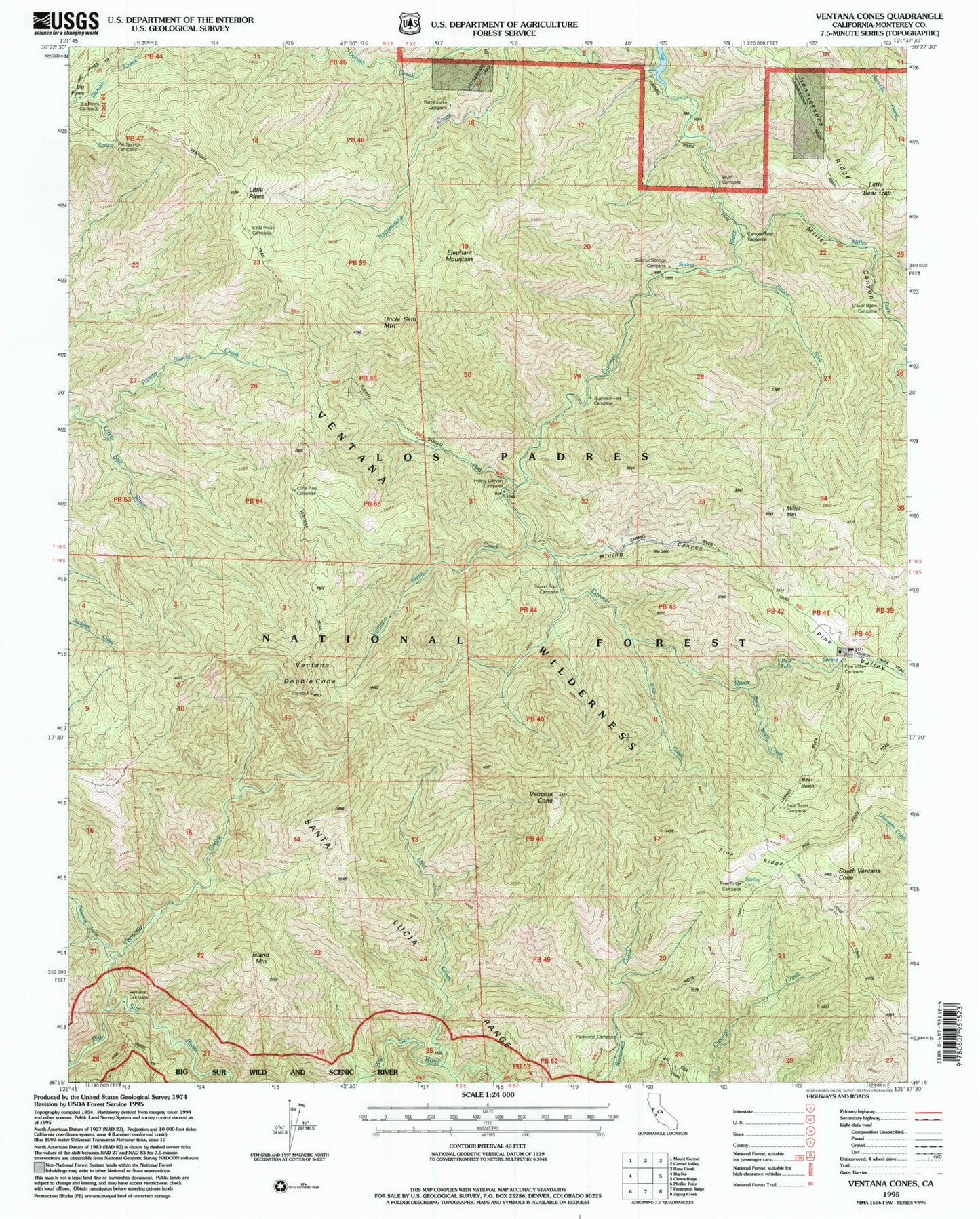
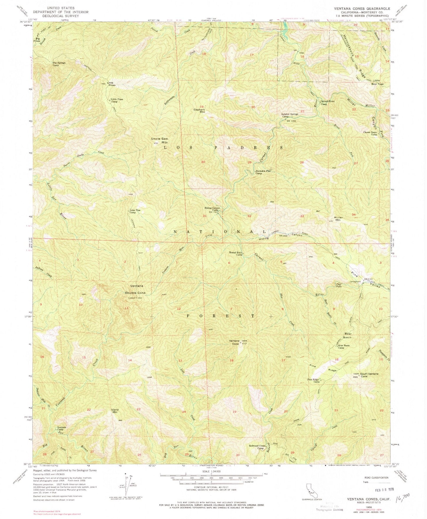
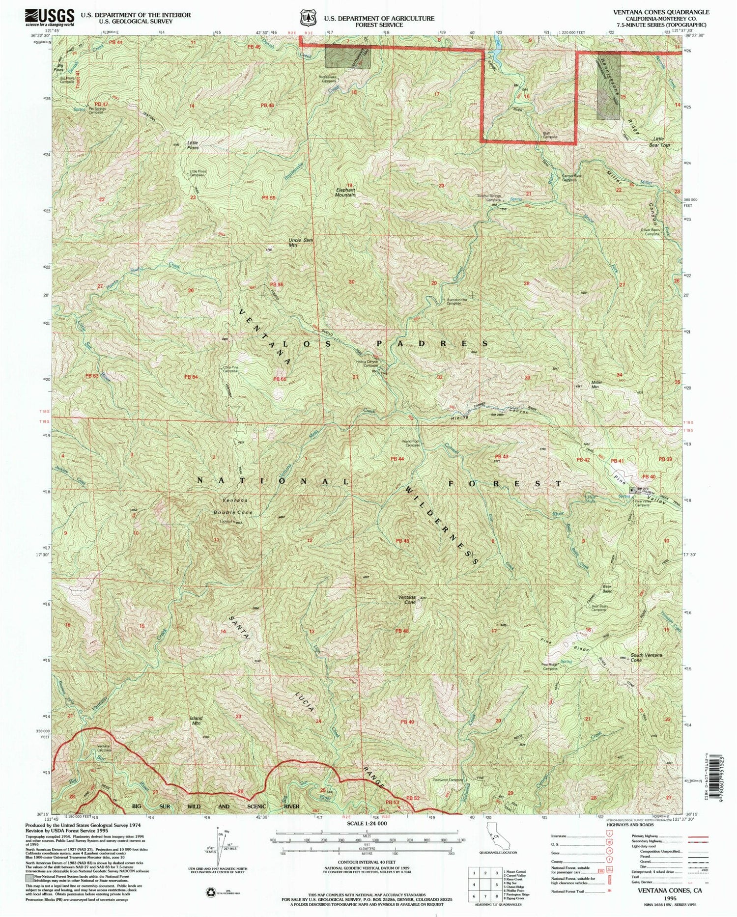
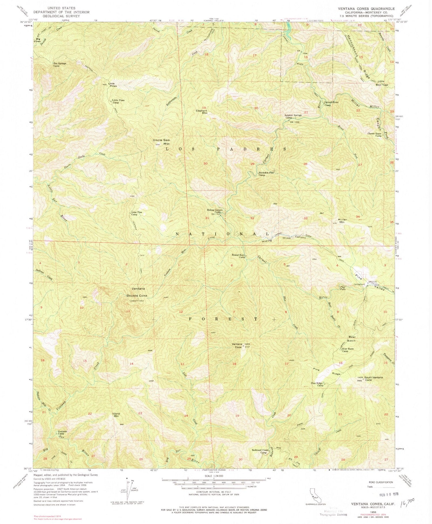
Historical USGS topographic quad map of Ventana Cones in the state of California. Typical map scale is 1:24,000, but may vary for certain years, if available. Print size: 24" x 27"
This quadrangle is in the following counties: Monterey.
The map contains contour lines, roads, rivers, towns, and lakes. Printed on high-quality waterproof paper with UV fade-resistant inks, and shipped rolled.
Contains the following named places: Bear Basin, Bear Basin Camp, Bear Basin Creek, Blue Creek, Bruce Fork, Buckskin Flat Camp, Carmel River Camp, Carmel River Trail, Clover Basin Camp, Danish Creek, Dolores Creek, Doolans Hole Creek, Hennicksons Ridge, Hennicksons Ridge Trail, Hiding Canyon, Hiding Canyon Camp, Island Mountain, Lion Creek, Little Bear Trap, Little Pines, Little Pines Camp, Lone Pine Camp, Miller Canyon, Miller Fork Carmel River, Miller Mountain, Pat Springs Camp, Pine Falls, Pine Ridge, Pine Ridge Camp, Pine Ridge Trail, Pine Valley, Puerto Suello Creek, Redwood Creek Camp, Round Rock Camp, Sulphur Springs Camp, Uncle Sam Mountain, Ventana Camp, Ventana Creek, Ventana Mesa Creek, Ventana Trail, South Ventana Cone, Ventana Cone, Ventana Double Cone, Miller Canyon Camp, Rattlesnake Campground, Sulpher Springs Camp, Pine Valley Rustic Campsite, Miller Canyon Rustic Campsite, Bluff Camp Recreation Site, Elephant Mountain, Sulphur Spring