MyTopo
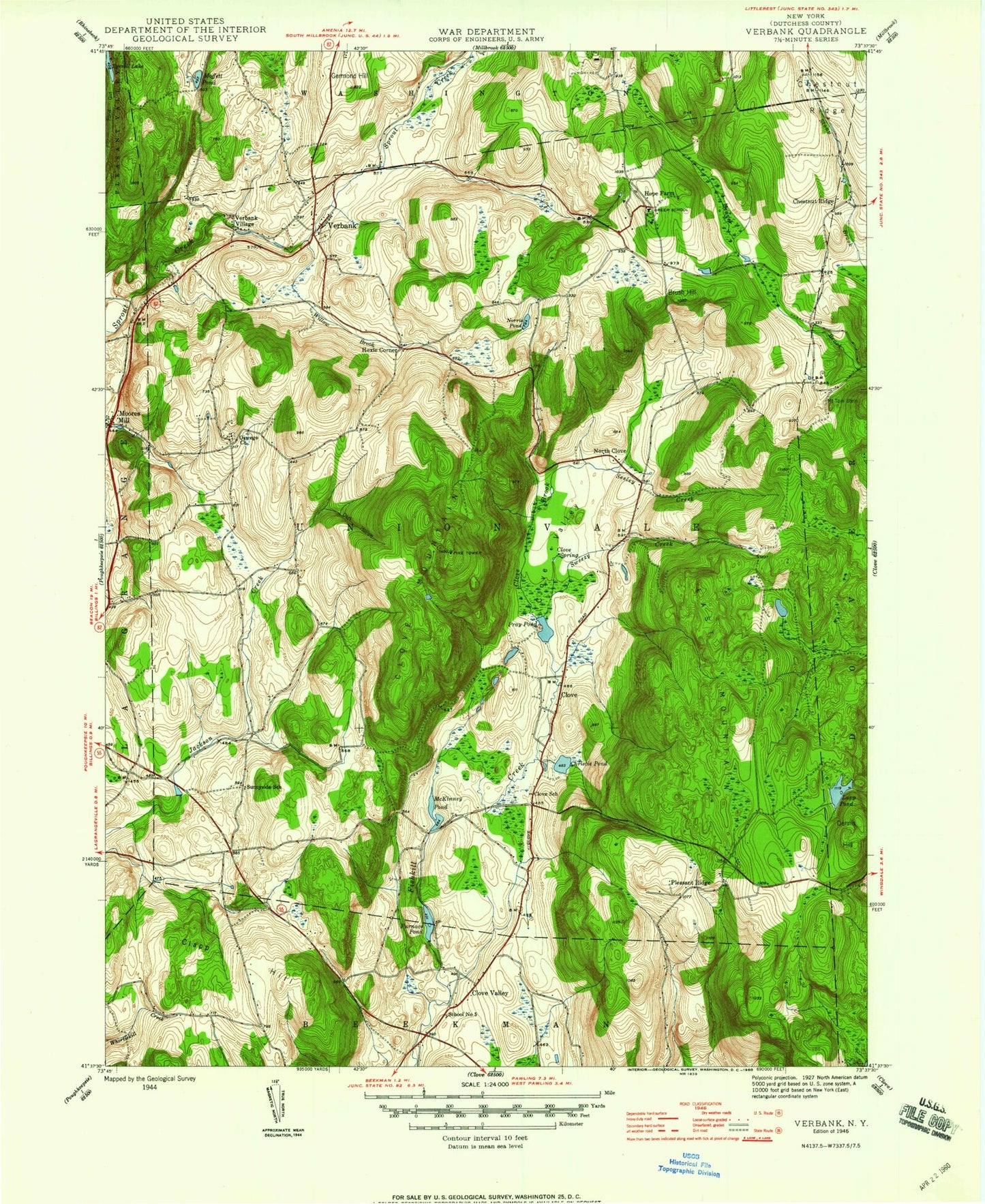
Classic USGS Verbank New York 7.5'x7.5' Topo Map
Couldn't load pickup availability
Historical USGS topographic quad map of Verbank in the state of New York. Typical map scale is 1:24,000, but may vary for certain years, if available. Print size: 24" x 27"
This quadrangle is in the following counties: Dutchess.
The map contains contour lines, roads, rivers, towns, and lakes. Printed on high-quality waterproof paper with UV fade-resistant inks, and shipped rolled.
Contains the following named places: Brush Hill, Camp Barbey, Chestnut Ridge, Chestnut Ridge, Christie Pond, Clapp Hill, Clove Brook, Clove Cemetery, Clove Mountain, Clove School, Clove Spring, Clove Valley, Clove Valley, Crouses Store, Dark Hollow, Dennis Hill, East Mountain, Furnace Pond, Germond Hill, Greer School, Hope Farm, McKinney Pond, Metropolitan Camps, Moffit Pond, Moores Mill, Norris Pond, Oswego Church, Pray Pond, Seeley Creek, Sprout Lake, Sweezy Creek, Mount Tom Stein, Verbank Village, Willow Brook, Camby, Clove, Hoxie Corner, North Clove, Pleasant Ridge, Verbank, Pell Lake, Sky Acres Airport, Sherman Field, Town of Union Vale, Godfrey Park, Tymore Park, Lakeside Grove Mobile Home Park, Crazy Acres Farm, Union Vale Middle School, Vail Farm Elementary School, Clove Valley Alliance Church, Valley Bible Fellowship Church, John 316 Christian Center, Verbank Methodist Church, Union Vale Town Hall, The Links at Union Vale, Beekman Library, Clove Hill Farm, Union Vale Fire Department, Union Vale Fire Company Station 2, Chestnut Ridge Friends Cemetery, Verbank Post Office