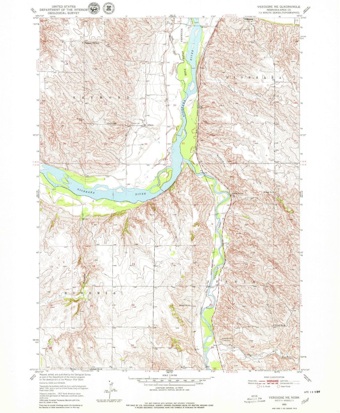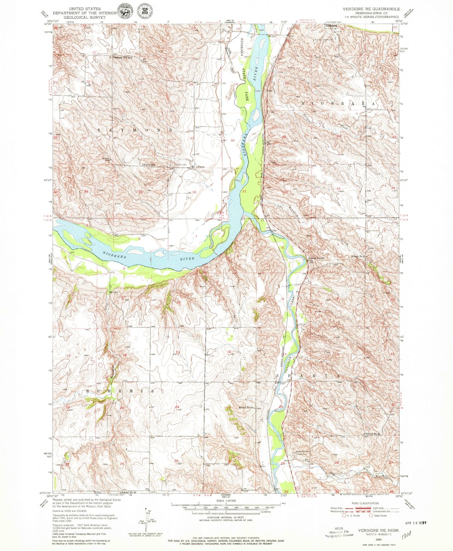
MyTopo
Classic USGS Verdigre NE Nebraska 7.5'x7.5' Topo Map
Couldn't load pickup availability
Historical USGS topographic quad map of Verdigre NE in the state of Nebraska. Map scale may vary for some years, but is generally around 1:24,000. Print size is approximately 24" x 27"
This quadrangle is in the following counties: Knox.
The map contains contour lines, roads, rivers, towns, and lakes. Printed on high-quality waterproof paper with UV fade-resistant inks, and shipped rolled.
Contains the following named places: Bingham Creek, Burgess Creek, Hillcrest Cemetery, L'eau Qui Court Cemetery, Mormon Canal, Niobrara Police Department, Niobrara Post Office, Niobrara State Park, Niobrara Trails, Niobrara Volunteer Fire Department, Paesl Dam, Paesl Reservoir, Pleasant Hill School, Ponca, Ponca School, Ponca Tribe Historical Marker, Ponca Trust Land, Sage Brothers Historical Marker, Saint Johns Cemetery, Schindler Creek, School Number 133, School Number 40, School Number 51, School Number 6, School Number 64, Township of Niobrara, Township of Sparta, Verdigre Creek, Village of Niobrara