MyTopo
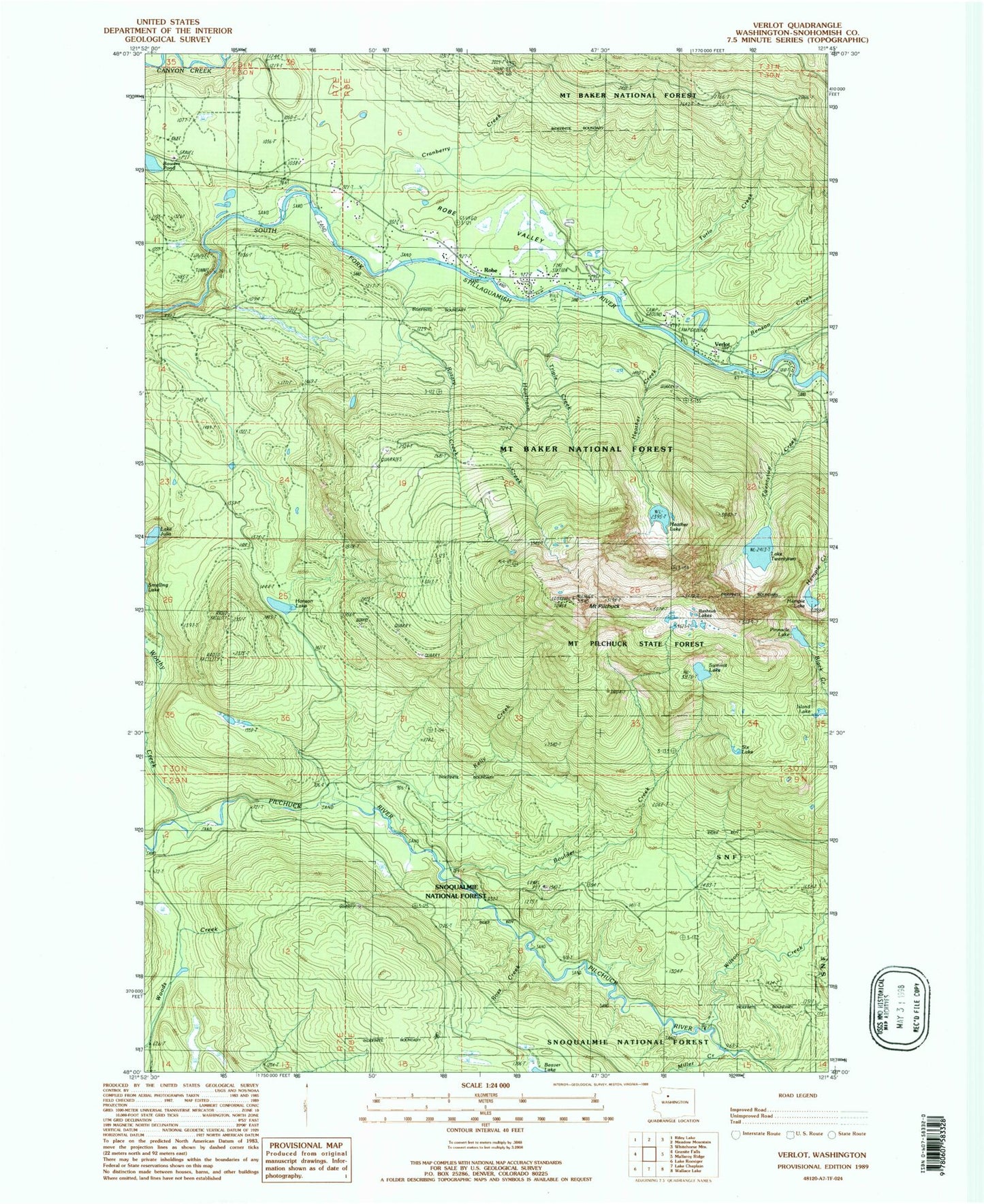
Classic USGS Verlot Washington 7.5'x7.5' Topo Map
Couldn't load pickup availability
Historical USGS topographic quad map of Verlot in the state of Washington. Typical map scale is 1:24,000, but may vary for certain years, if available. Print size: 24" x 27"
This quadrangle is in the following counties: Snohomish.
The map contains contour lines, roads, rivers, towns, and lakes. Printed on high-quality waterproof paper with UV fade-resistant inks, and shipped rolled.
Contains the following named places: Benson Creek, Boulder Creek, Cranberry Creek, Echo Lake Truck Trail, Hanson Lake, Hawthorn Creek, Heather Creek, Heather Lake, Hempel Lake, Lake Julia, Kelly Creek, Miller Creek, Mount Pilchuck, Pinnacle Lake, Robe, Ross Creek, Rotary Creek, Summit Lake, Triple Creek, Turlo Creek, Twentytwo Creek, Lake Twentytwo, Verlot, Wilson Creek, Worthy Creek, Six Lake, Bathtub Lakes, Mount Pilchuck State Forest, Turlo Campground, Mount Pilchuck Trailhead, Verlot Public Service Center, Verlot Campground, Island Lake, Lake Twentytwo Research Natural Area, Granite Falls Division, Verlot Census Designated Place, Snohomish County Fire District 23