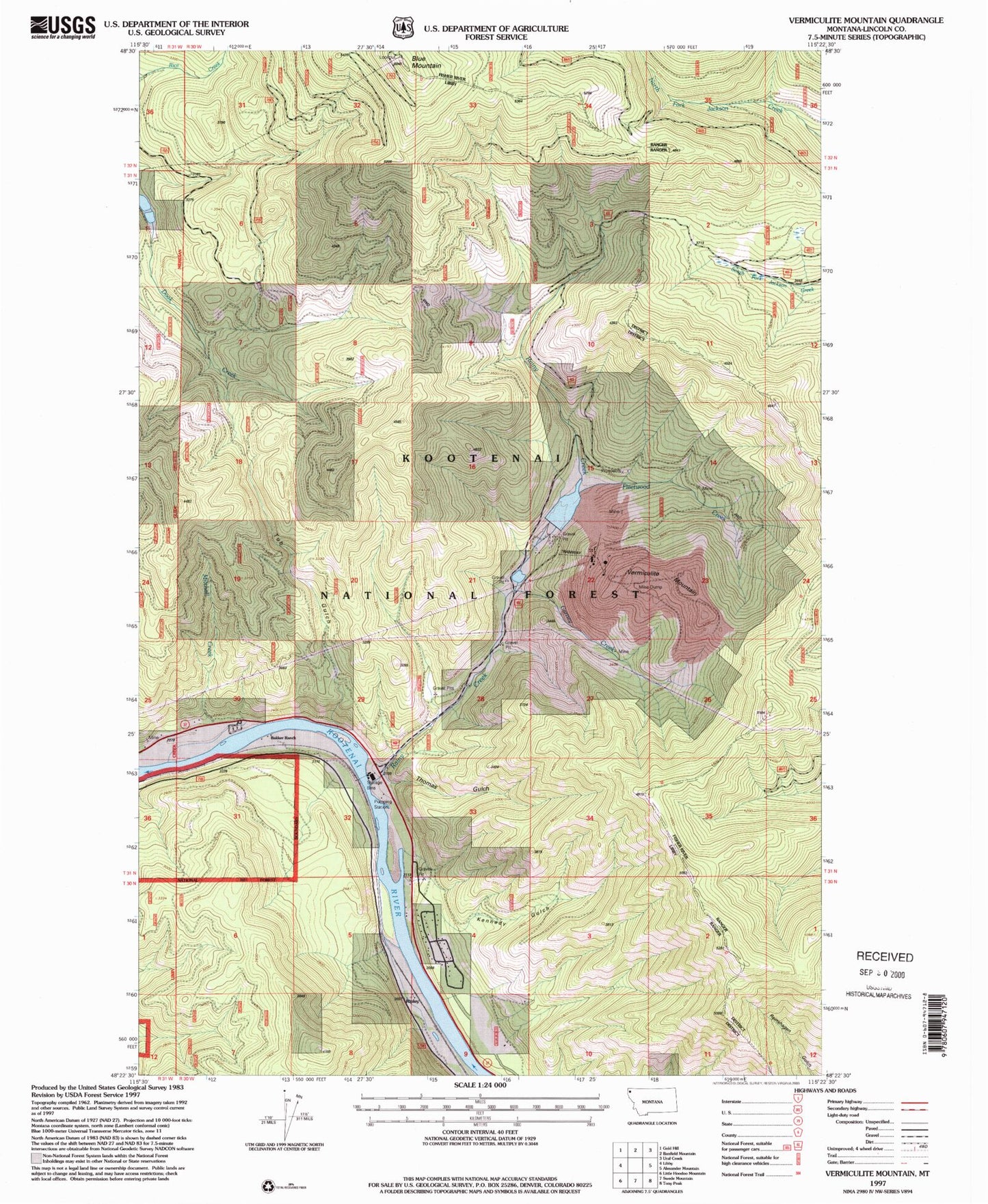
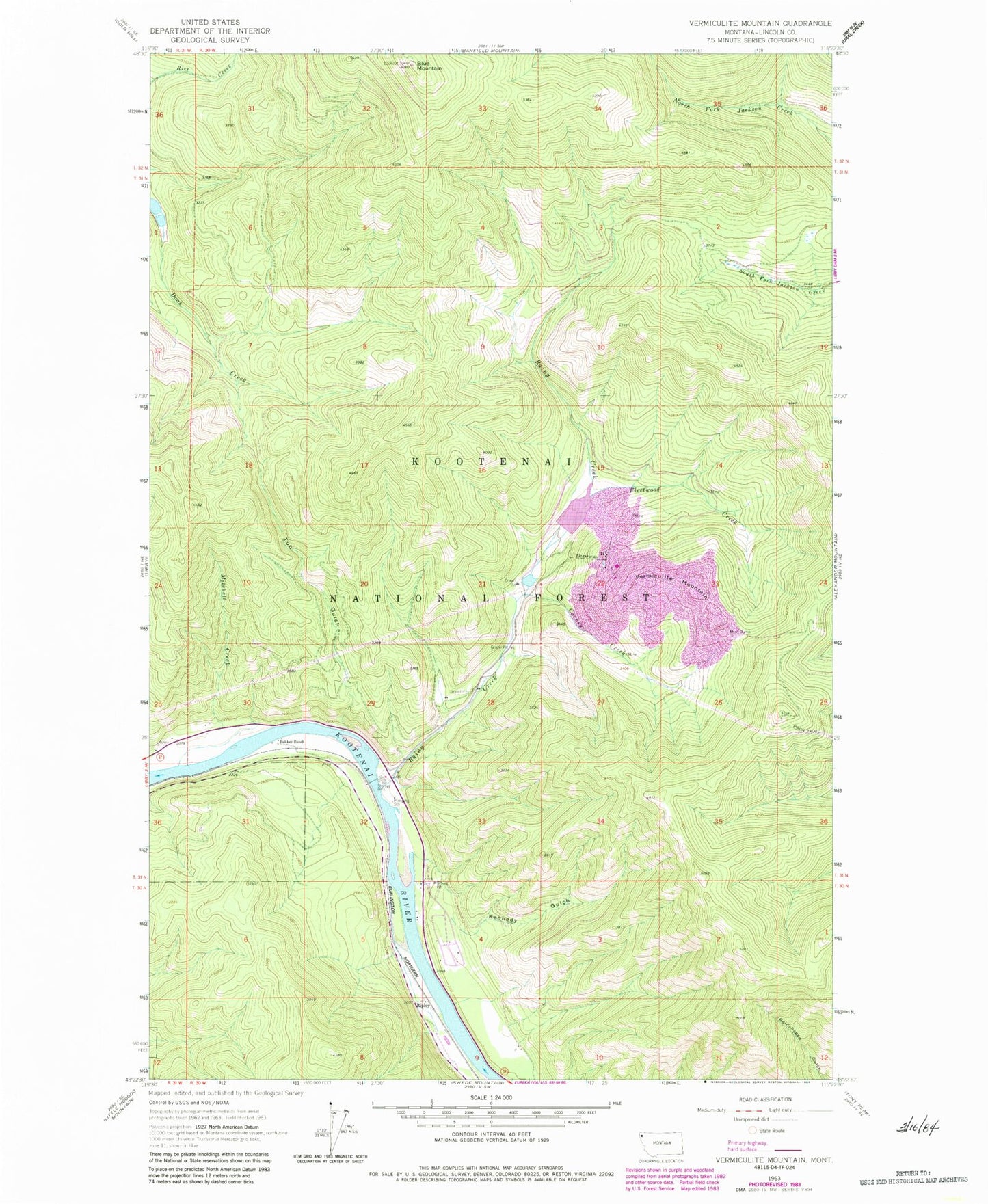
MyTopo
Classic USGS Vermiculite Mountain Montana 7.5'x7.5' Topo Map
Couldn't load pickup availability
Historical USGS topographic quad map of Vermiculite Mountain in the state of Montana. Map scale may vary for some years, but is generally around 1:24,000. Print size is approximately 24" x 27"
This quadrangle is in the following counties: Lincoln.
The map contains contour lines, roads, rivers, towns, and lakes. Printed on high-quality waterproof paper with UV fade-resistant inks, and shipped rolled.
Contains the following named places: 30N31W10DBB01_ Well, Bakker Ranch, Blue Mountain, Blue Mountain Lookout Station, Carney Creek, Fleetwood Creek, Kennedy Gulch, Kootenai Post, Leib Cemetery, Lincoln County Rural Fire District Station 2, Mitchell Creek, Mitchell Creek Mine, Rainy Creek, Ripley, Tub Gulch, Vermiculite Mountain, Zonolite Tailings Dam