MyTopo
Classic USGS Vermilion East Ohio 7.5'x7.5' Topo Map
Couldn't load pickup availability
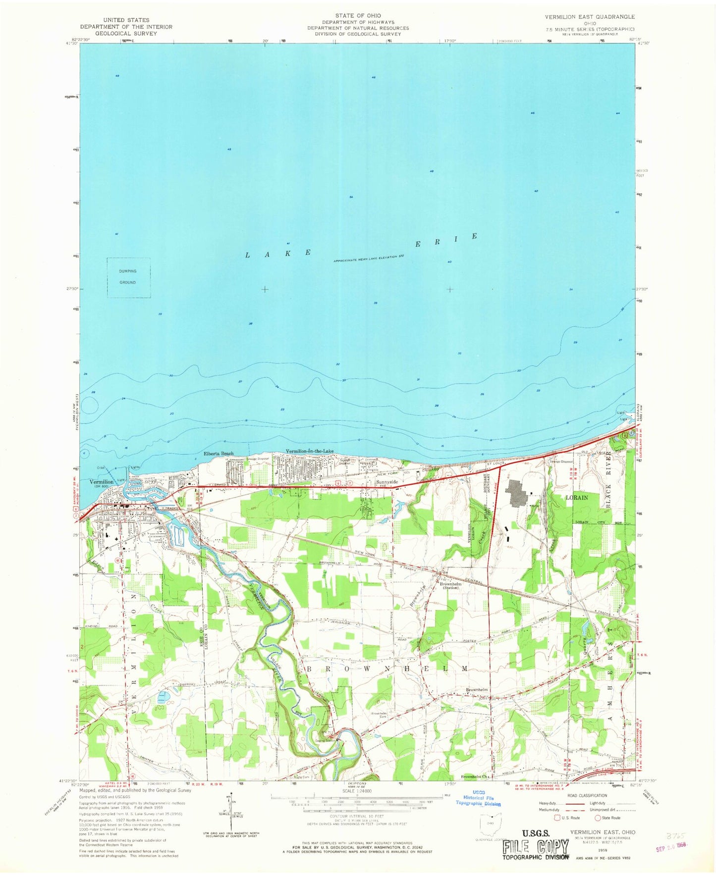
Historical USGS topographic quad map of Vermilion East in the state of Ohio. Map scale may vary for some years, but is generally around 1:24,000. Print size is approximately 24" x 27"
This quadrangle is in the following counties: Erie, Lorain.
The map contains contour lines, roads, rivers, towns, and lakes. Printed on high-quality waterproof paper with UV fade-resistant inks, and shipped rolled.
Contains the following named places: Beaver Creek, Brownhelm, Brownhelm Cemetery, Brownhelm Congregational United Church of Christ, Brownhelm Creek, Brownhelm Elementary School, Brownhelm Historic District, Brownhelm Post Office, Brownhelm Station, Brownhelm Station Post Office, Calvary Church, Christian Missionary Alliance Church, City of Vermilion, Claus Cemetery, Edson Creek, Elberta Beach, Erie Lagoon, Foursquare Gospel Church, Huron Lagoon, Inland Seas Maritime Museum, Jeavons Boat Yard, Kendeigh Corner, Kendeigh Corner Cemetery, Lake Elementary School, Lake Haven Estates Dam, Lake Haven Estates Reservoir, Lakeview Church, LifeCare Ambulance, Linwood Park, Lorain Industrial Park, Main Street Beach, Mill Hollow Bacon Woods Park, Ontario Lagoon, Quarry Creek, Ritter Public Library, Rugby, Rugby Cemetery, Rugby Post Office, Saint Mary Roman Catholic Church, Saint Marys School, Showse Park, South Shore Shopping Center, South Street Elementary School, Sunnyside, Superior Lagoon, Township of Brownhelm, Trinity Lutheran Church, Valley View School, Vermilion, Vermilion Boat Club, Vermilion Fire Department Station 1, Vermilion Fire Department Station 2, Vermilion High School, Vermilion Intermediate School, Vermilion Post Office, Vermilion River, Vermilion Township Fire Department, Vermilion-on-the-Lake, West Shore Boat Club, Willow Creek Golf Course