MyTopo
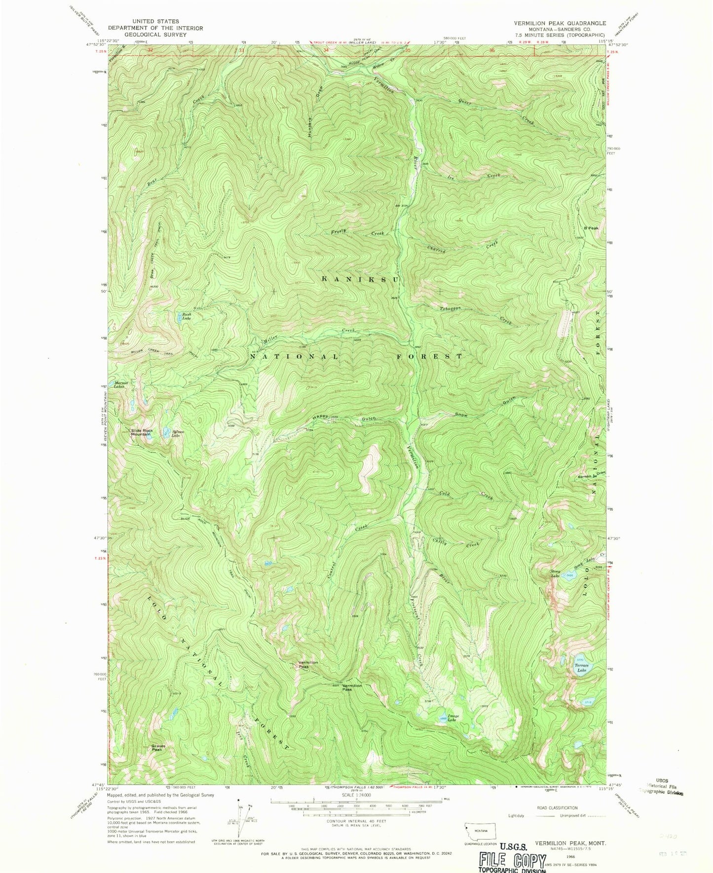
Classic USGS Vermilion Peak Montana 7.5'x7.5' Topo Map
Couldn't load pickup availability
Historical USGS topographic quad map of Vermilion Peak in the state of Montana. Map scale may vary for some years, but is generally around 1:24,000. Print size is approximately 24" x 27"
This quadrangle is in the following counties: Sanders.
The map contains contour lines, roads, rivers, towns, and lakes. Printed on high-quality waterproof paper with UV fade-resistant inks, and shipped rolled.
Contains the following named places: B Peak, Bear Creek Trail, Charred Creek, Chilly Creek, Cold Creek, Control Creek, Freezeout Creek, Frosty Creek, Graves Peak, Happy Gulch, Hunters Draw, Ice Creek, Image Lake, Miller Creek, Miller Creek Trail, Moose Gulch, Queer Creek, Rush Lake, Slide Rock Mountain, Slide Rock Mountain Trail, Snow Gulch, Stony Lake, Sylvan Lake, Terrace Lake, Toboggan Creek, Vermilion Pass, Vermilion Peak, Willow Creek, Willow Creek Campground, Willow Creek Recreation Site