MyTopo
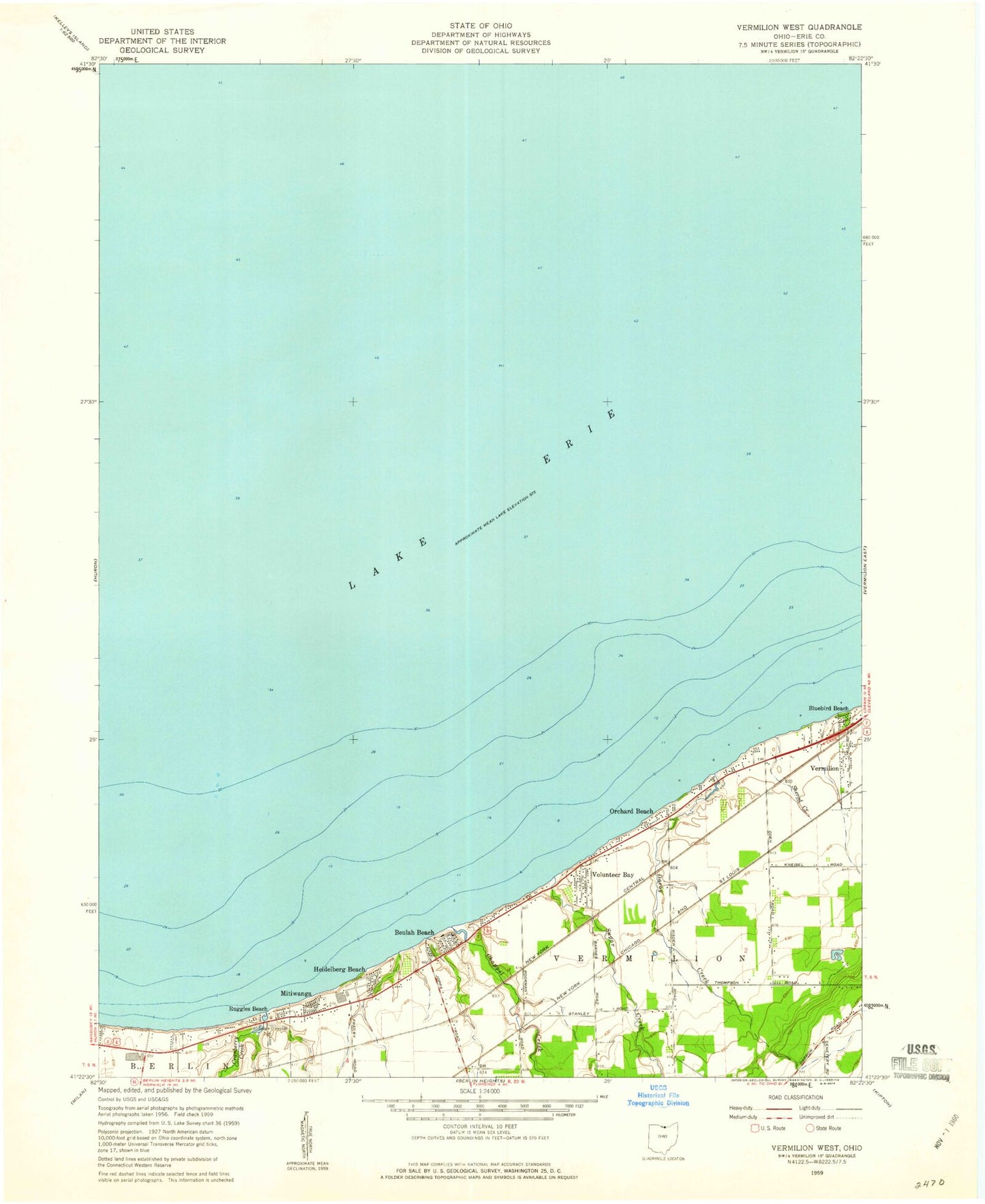
Classic USGS Vermilion West Ohio 7.5'x7.5' Topo Map
Couldn't load pickup availability
Historical USGS topographic quad map of Vermilion West in the state of Ohio. Map scale may vary for some years, but is generally around 1:24,000. Print size is approximately 24" x 27"
This quadrangle is in the following counties: Erie.
The map contains contour lines, roads, rivers, towns, and lakes. Printed on high-quality waterproof paper with UV fade-resistant inks, and shipped rolled.
Contains the following named places: Ashmont, Ashmont Post Office, Beulah Beach, Beulah Beach Census Designated Place, Beulah Beach Post Office, Bluebird Beach, Ceylon Junction, Chappel Creek, Colonial Villa, Cranberry Creek, Darby Creek, Darby Place Mobile Home Park, Grace Church, Heidelberg Beach, Mitiwanga, Mitiwanga Census Designated Place, Mitiwanga Post Office, Orchard Beach, Orchard Beach Cemetery, Portland Court, Ruggles Beach, Sherod Creek, Sherod Park, Sugar Creek, Township of Vermilion, Vacationland Mobile Home Park, Vermilion Golf Course, Volunteer Bay, Waterwood Heliport, Willoway Nursery, ZIP Code: 44089