
MyTopo
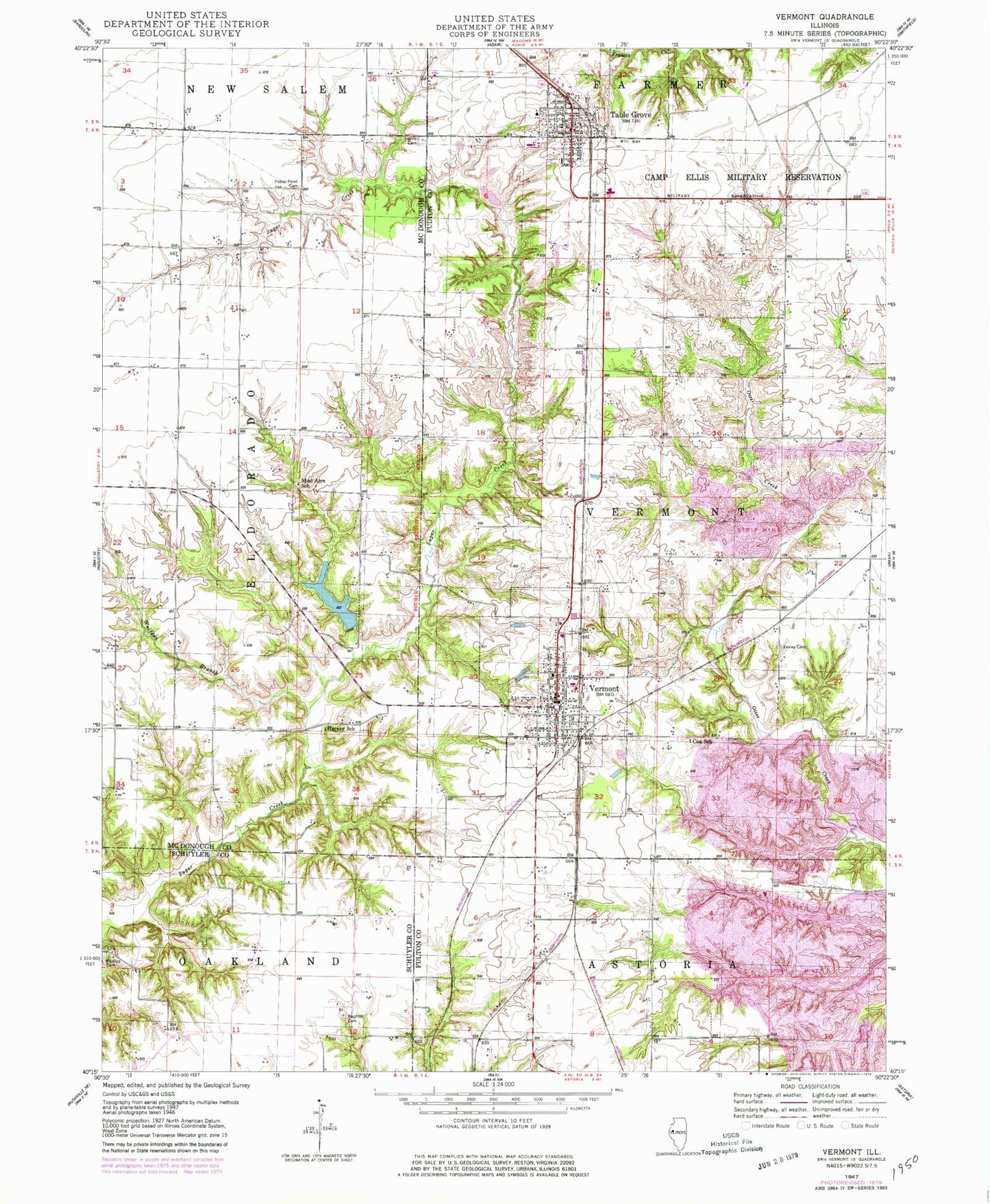
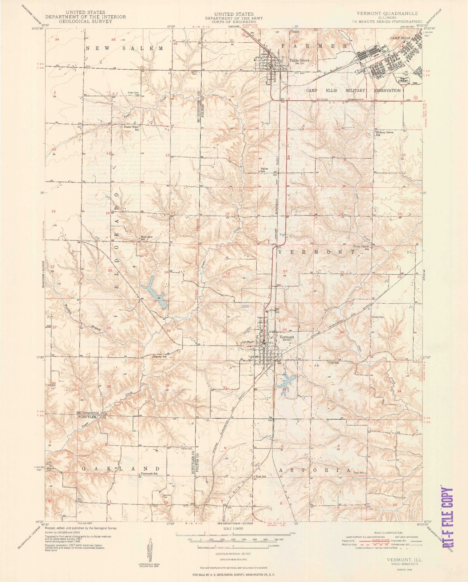
Classic USGS Vermont Illinois 7.5'x7.5' Topo Map
Couldn't load pickup availability
Historical USGS topographic quad map of Vermont in the state of Illinois. Map scale may vary for some years, but is generally around 1:24,000. Print size is approximately 24" x 27"
This quadrangle is in the following counties: Fulton, McDonough, Schuyler.
The map contains contour lines, roads, rivers, towns, and lakes. Printed on high-quality waterproof paper with UV fade-resistant inks, and shipped rolled.
Contains the following named places: Adams Cemetery, Bailey Cemetery, Bailey School, Beghtol Cemetery, Cox School, Dennis Cemetery, Diversion Drainage Dam, Diversion Drainage Lake, Easley Cemetery, Farr School, Flatwoods School, Foster Point Cemetery, Foster Point School, France Cemetery, Freshwater Lake, Freshwater Lake Dam, Harris Cemetery, Harvey School, Heller Lake, Heller Lake Dam, Hickory Grove School, Kost School, Miles Cemetery, Mud Acre School, Phillips Cemetery, Richmond Airport, Sugar Creek Cumberland Prestyterian Church, Table Grove, Table Grove Cemetery, Table Grove Community Church, Table Grove Fire Protection District, Table Grove Post Office, Table Grove School, Table Grove Village Square, Township of Vermont, Union Center School, Union Chapel Cemetery, V I T Junior-Senior High School, Vermont, Vermont Cemetery, Vermont Fire Protection District, Vermont New Lake, Vermont New Lake Dam, Vermont Post Office, Vermont School, Village of Table Grove, Village of Vermont, Wolfden Branch, ZIP Code: 61484