MyTopo
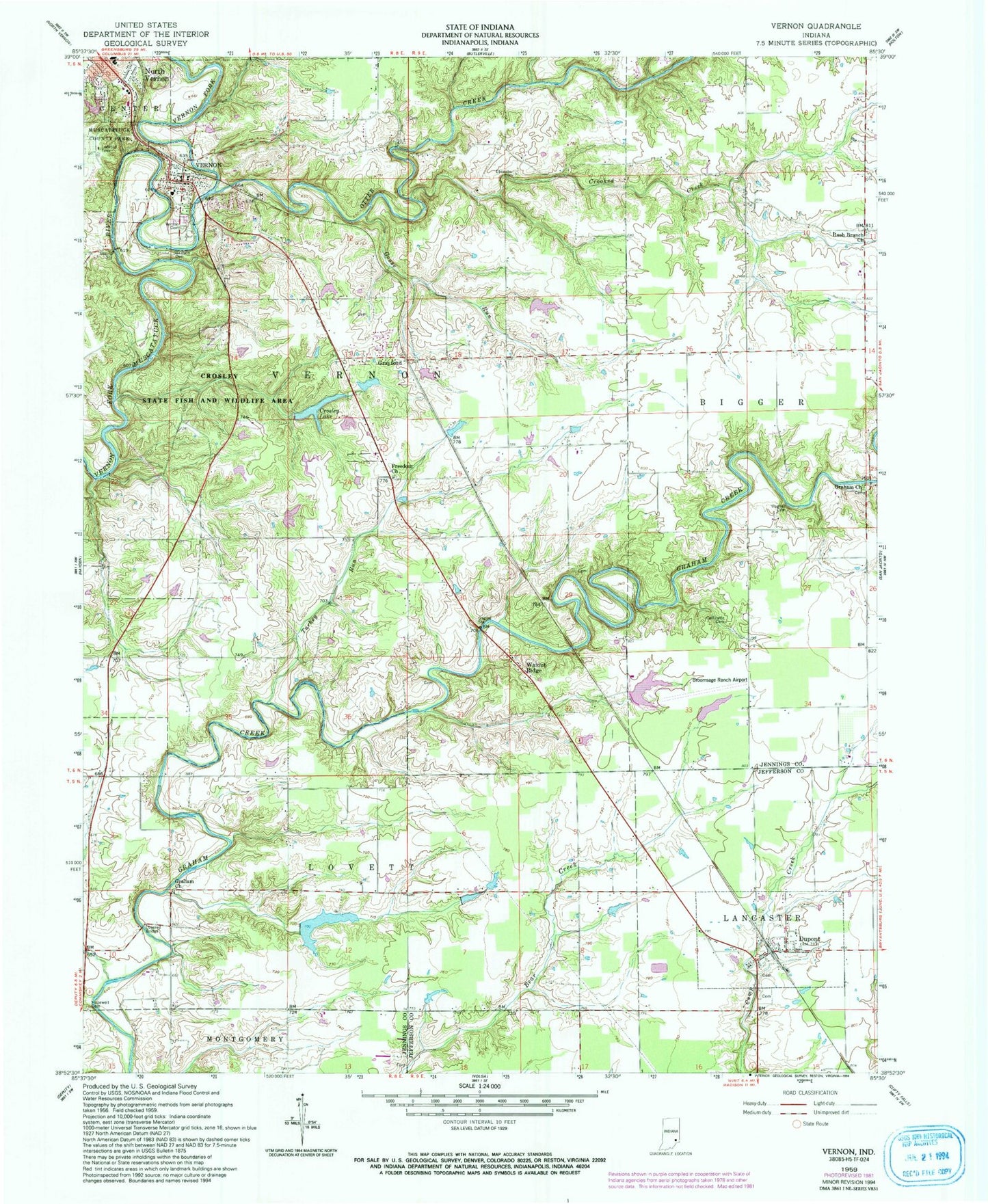
Classic USGS Vernon Indiana 7.5'x7.5' Topo Map
Couldn't load pickup availability
Historical USGS topographic quad map of Vernon in the state of Indiana. Typical map scale is 1:24,000, but may vary for certain years, if available. Print size: 24" x 27"
This quadrangle is in the following counties: Jefferson, Jennings.
The map contains contour lines, roads, rivers, towns, and lakes. Printed on high-quality waterproof paper with UV fade-resistant inks, and shipped rolled.
Contains the following named places: Baldwin Cemetery, Callicotte Cemetery, Camp Creek, Crooked Creek, Crosley State Fish and Wildlife Area, Dupont, Ebenezer Methodist Cemetery, Freedom Church, Goose Run, Graham Church, Graham Church, Grayford, Hopewell Cemetery, Huckleberry Branch, Hughes Cemetery, Otter Creek, Rush Branch Church, Turkey Run, Vernon, Vernon Cemetery, Walnut Ridge, Broomsage Ranch Lake Dam, Vernon Elementary School, Dupont Elementary School, Crosley Lake Dam, Hickory Lake Dam, Hickory Lake, Crosley Lake, Gaylord Stark Lake, Gaylord Stark Lake Dam, Whippoorwill Lake, Whippoorwill Lake Dam, Broomsage Ranch Airport (historical), Broomsage Lake, Township of Vernon, Town of Dupont, Town of Vernon, Lancaster Township Volunteer Fire Company Dupont Station, Vernon Volunteer Fire Department, Jennings County Emergency Medical Services, Jennings County Sheriff's Office, Vernon Post Office, Dupont Post Office