
MyTopo
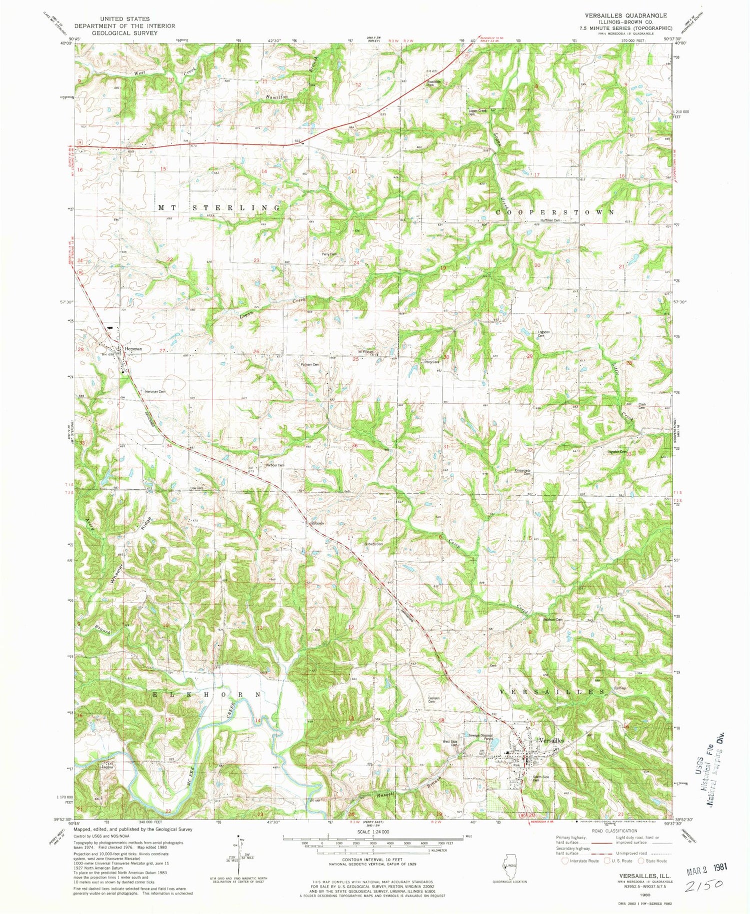
Classic USGS Versailles Illinois 7.5'x7.5' Topo Map
Couldn't load pickup availability
Historical USGS topographic quad map of Versailles in the state of Illinois. Map scale may vary for some years, but is generally around 1:24,000. Print size is approximately 24" x 27"
This quadrangle is in the following counties: Brown.
The map contains contour lines, roads, rivers, towns, and lakes. Printed on high-quality waterproof paper with UV fade-resistant inks, and shipped rolled.
Contains the following named places: Avery Branch, Barton School, Benjamin Robinson Burial Ground, Casteen Cemetery, Clark Cemetery, Cross Roads Cemetery, Crossroads School, Dawson Cemetery, Gilbirds, Gilbirds Cemetery, Hambaugh-Martin Number Five Reservoir, Hambaugh-Martin Structure Number 5 Dam, Harbour Cemetery, Harper School, Hazel Bell School, Hersman, Hersman Cemetery, Hill School, Howe School, Huffman Cemetery, Ichabod Perry Cemetery, Jaques, Kleinlein Farm Pond, Kleinlein Farm Pond Dam, Law Cemetery, Logan Creek Cemetery, Logsdon Number 1 Cemetery, Logsdon Number 2 Cemetery, McDaniel School, Mount Pleasant Church, North Bend School, Patterson School, Perry Cemetery, Perry School, Pleasant Hill School, Putman Cemetery, Robison School, South Side Cemetery, Township of Elkhorn, Township of Mount Sterling, Versailles, Versailles Fire Protection District, Versailles Grade School, Versailles Post Office, Versailles Springs, Village of Versailles, West Side Cemetery, Wheeler Ridge, ZIP Code: 62378


