MyTopo
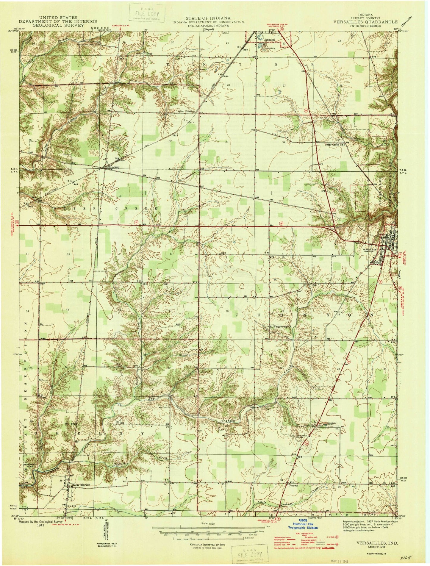
Classic USGS Versailles Indiana 7.5'x7.5' Topo Map
Couldn't load pickup availability
Historical USGS topographic quad map of Versailles in the state of Indiana. Map scale may vary for some years, but is generally around 1:24,000. Print size is approximately 24" x 27"
This quadrangle is in the following counties: Ripley.
The map contains contour lines, roads, rivers, towns, and lakes. Printed on high-quality waterproof paper with UV fade-resistant inks, and shipped rolled.
Contains the following named places: Allen Crossing, Bradshaw Cemetery, Campfire Creek, Cedar Creek, Cedar Creek Church, Coon Hollow, Correct, Dabney, Francis Airport, Holman Cemetery, Hungry Hollow, Indiana State Police District 42, Long Branch, New Marion, New Marion Volunteer Fire Department, North Fork Graham Creek, OBrien Cemetery, Otter Village, Otter Village Cemetery, Ripley County, Sheppard Cemetery, Southern Ripley County Emergency Life Squad Rescue 69, Tanglewood Church, Tanglewood Post Office, Town of Versailles, Versailles, Versailles Elementary School, Versailles Fire Department, Versailles Police Department, Versailles Post Office, ZIP Code: 47042