MyTopo
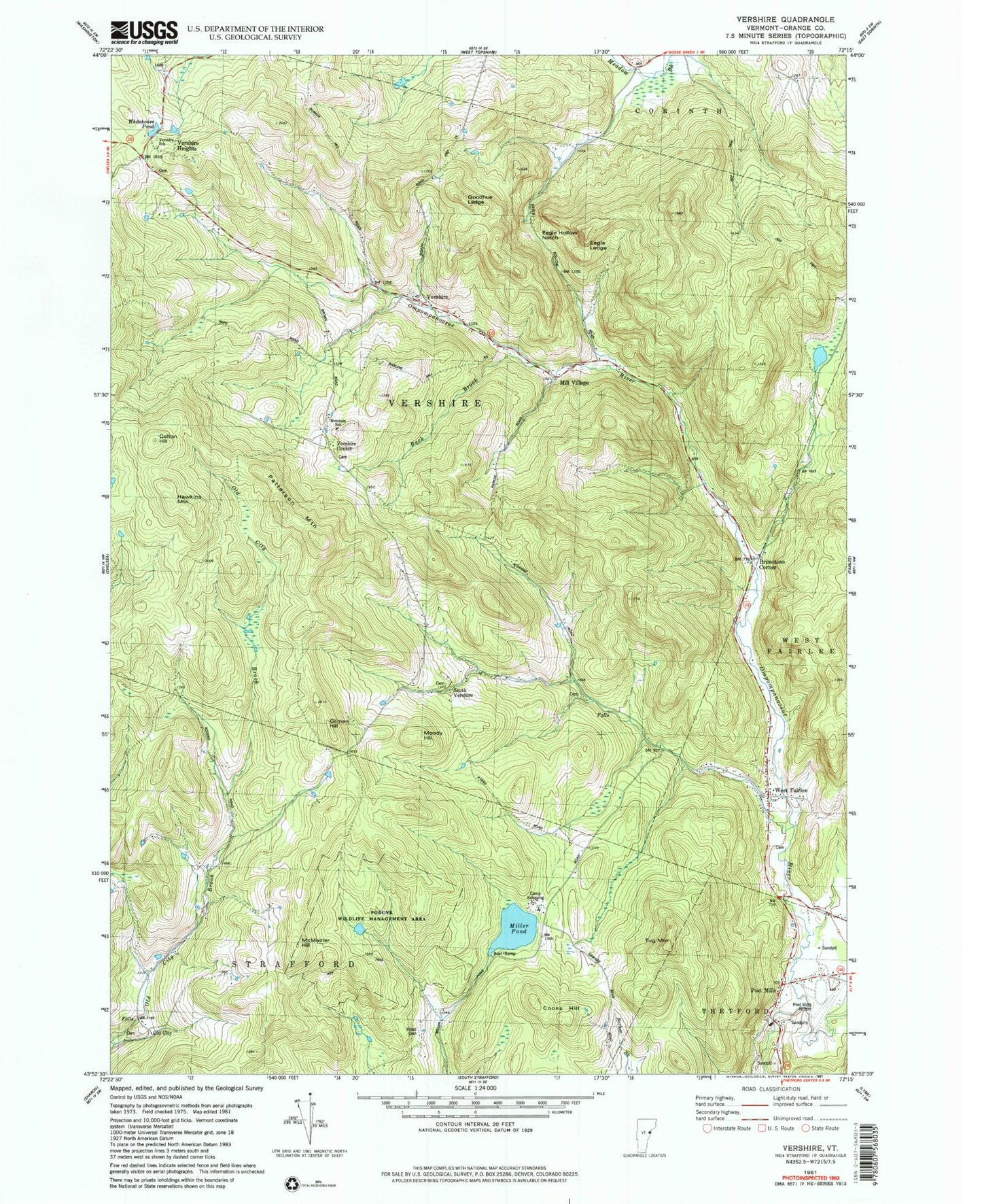
Classic USGS Vershire Vermont 7.5'x7.5' Topo Map
Couldn't load pickup availability
Historical USGS topographic quad map of Vershire in the state of Vermont. Typical map scale is 1:24,000, but may vary for certain years, if available. Print size: 24" x 27"
This quadrangle is in the following counties: Orange.
The map contains contour lines, roads, rivers, towns, and lakes. Printed on high-quality waterproof paper with UV fade-resistant inks, and shipped rolled.
Contains the following named places: Brimstone Corner, Colton Hill, Cooks Hill, Eagle Hollow Notch, Eagle Ledge, Ely Mine, Gilman Hill, Goodhue Ledge, Hawkins Mountain, McMaster Hill, Mill Village, Miller Pond, Old City, Old City Falls School, Patterson Mountain, Post Mills, Tug Mountain, Vershire, Warren Cemetery, West Fairlee, Beanville, South Vershire, Vershire Center, Vershire Heights, Post Mills Airport, Town of Vershire, Miller Pond Dam, Miller Pond, Cook - Huse - Fulton Cemetery, George Peabody Branch Thetford Town Library, Krook Meadow Cemetery, The Mountain School, Old City Cemetery, Podunk Wildlife Management Area, Post Mills Cemetery, Post Mills Post Office, Smith - Mill Village Cemetery, South Vershire Cemetery, Spear - Norris Cemetery, Vershire Bible Church, Vershire Center Cemetery, Vershire Elementary School, Vershire Post Office, Vershire Village Cemetery, West Fairlee Free Public Library, West Fairlee Municipal Forest, West Fairlee Village Cemetery, Whitehouse Pond, Wood Cemetery, Copperfield (historical), West Fairlee Volunteer Fire Department, Vershire Fire and Rescue Department, Thetford Volunteer Fire Department - Post Hills Station, Thetford Fire Department - Training Facility, Westshire Elementary School