MyTopo
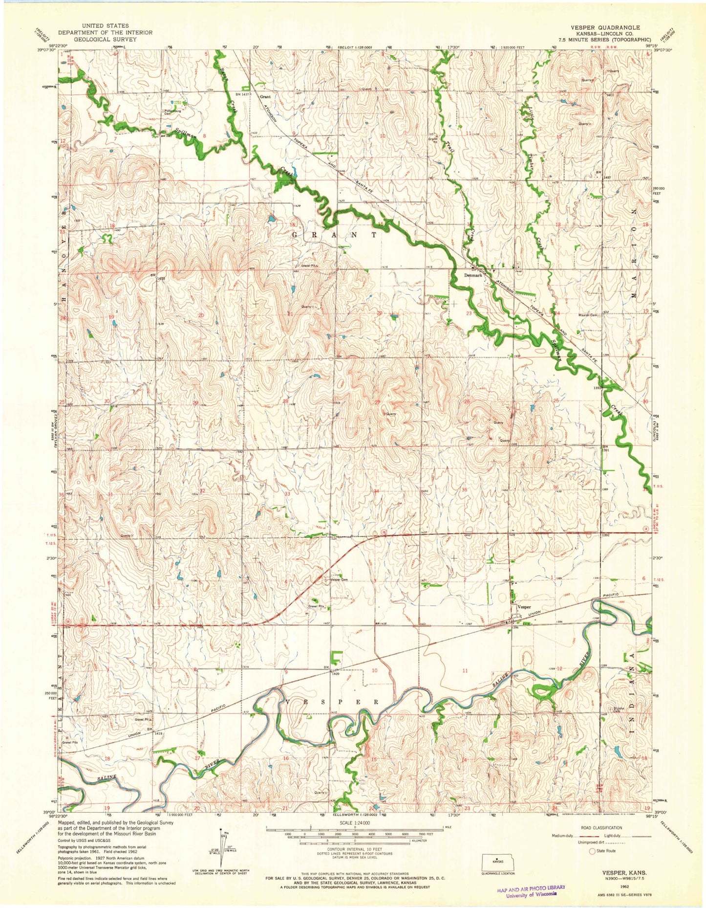
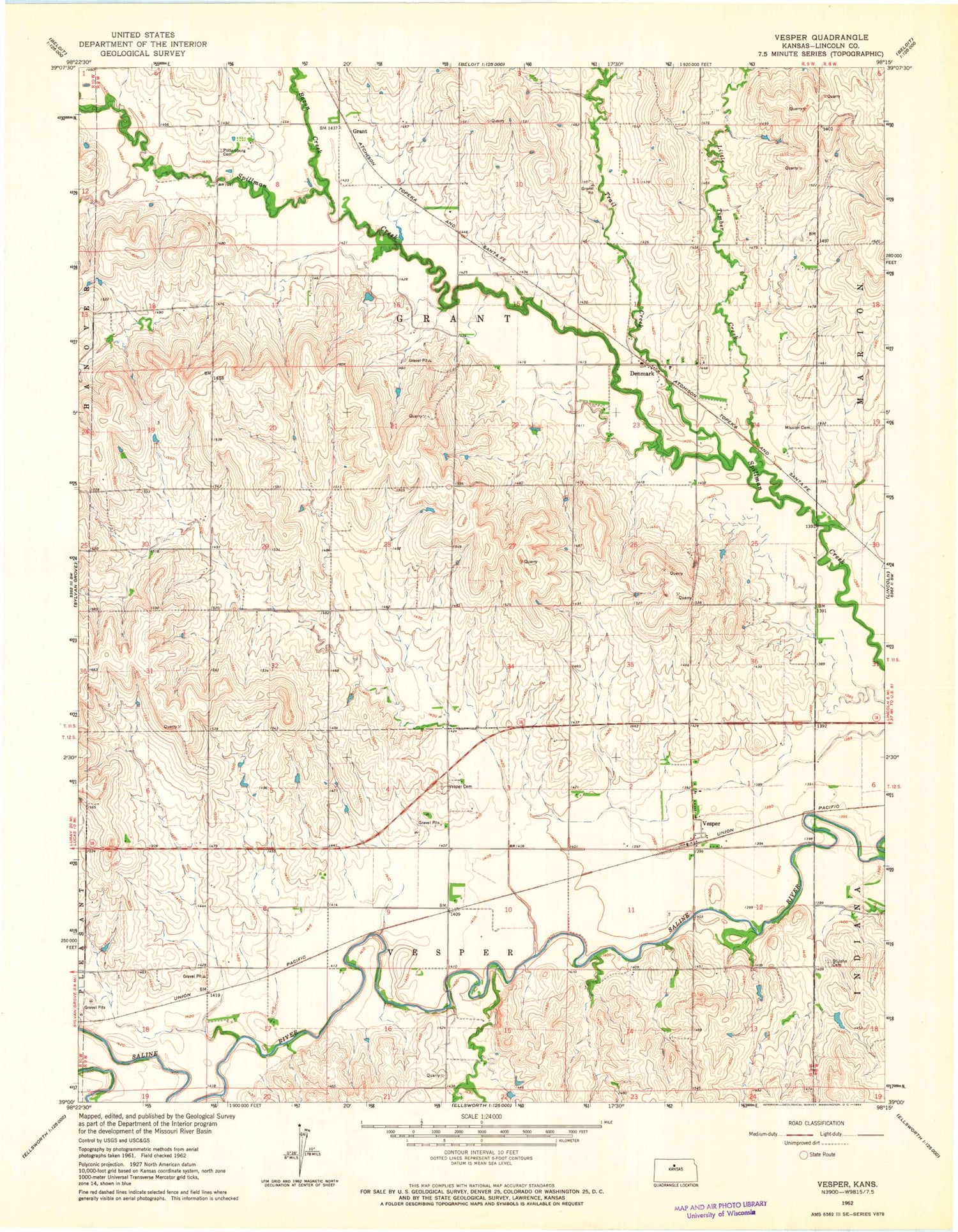
Classic USGS Vesper Kansas 7.5'x7.5' Topo Map
Couldn't load pickup availability
Historical USGS topographic quad map of Vesper in the state of Kansas. Map scale may vary for some years, but is generally around 1:24,000. Print size is approximately 24" x 27"
This quadrangle is in the following counties: Lincoln.
The map contains contour lines, roads, rivers, towns, and lakes. Printed on high-quality waterproof paper with UV fade-resistant inks, and shipped rolled.
Contains the following named places: Agmark Grain Elevator Number 19, Agmark Grain Elevator Number 6, Bacon Creek, Denmark, Denmark - Hunter Rural Fire Department, Denmark Lutheran Cemetery, Free Mission Cemetery, Grant, Little Timber Creek, Pottersburg, Pottersburg Cemetery, Saint John Cemetery, Township of Grant, Township of Vesper, Trail Creek, Vesper, Vesper Cemetery