MyTopo
Classic USGS Vick Arkansas 7.5'x7.5' Topo Map
Couldn't load pickup availability
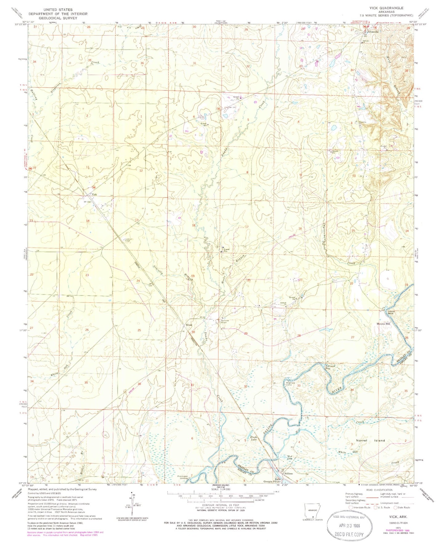
Historical USGS topographic quad map of Vick in the state of Arkansas. Map scale may vary for some years, but is generally around 1:24,000. Print size is approximately 24" x 27"
This quadrangle is in the following counties: Ashley, Bradley.
The map contains contour lines, roads, rivers, towns, and lakes. Printed on high-quality waterproof paper with UV fade-resistant inks, and shipped rolled.
Contains the following named places: Antioch Chapel, Antioch Church, Black Lake, Bogalusa Camp, Broad, Calvary Presbyterian Cemetery, Calvary Presbyterian Church, Gravelly Branch, Hampton Chapel African Methodist Episcopal Church, Hampton Chapel Cemetery, Improvement Creek, Johnsville, Johnsville Cemetery, Lake Georgia Pacific, Meeks Branch, Mill Creek, Moores Mill, Mud Lake, Newton School, Norrel Island, Oxbow Bend, Palestine Cemetery, Palestine Methodist Church, Pine Island Landing, Robinson Bay, Singleton Creek, Snake Creek, Stillions, Sunnyside School, Thompson Creek, Township of Palestine, Vick, White Oak Creek, Wilcox, ZIP Code: 71647