MyTopo
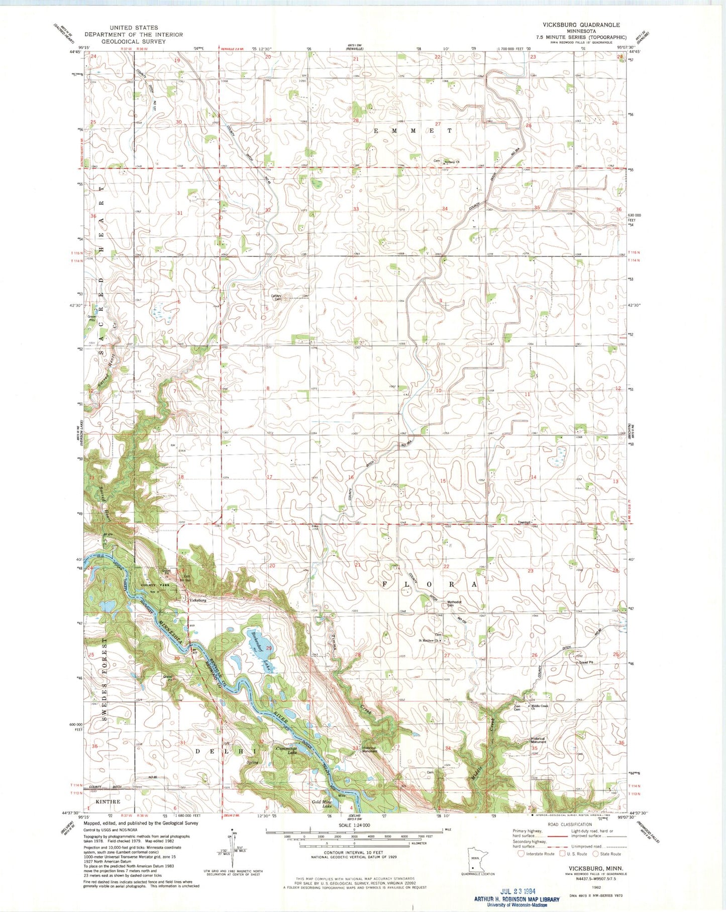
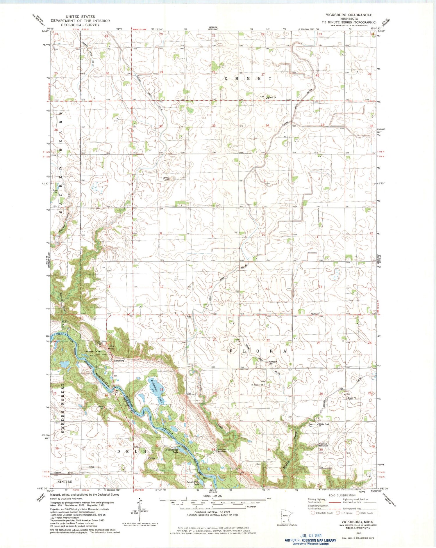
Classic USGS Vicksburg Minnesota 7.5'x7.5' Topo Map
Couldn't load pickup availability
Historical USGS topographic quad map of Vicksburg in the state of Minnesota. Map scale may vary for some years, but is generally around 1:24,000. Print size is approximately 24" x 27"
This quadrangle is in the following counties: Redwood, Renville.
The map contains contour lines, roads, rivers, towns, and lakes. Printed on high-quality waterproof paper with UV fade-resistant inks, and shipped rolled.
Contains the following named places: Anson C Fisk Family Plot, Beckendorf Lake, Bethany Church, Bethany Lutheran Cemetery, Calgary Cemetery, County Ditch Number Ninetyfive, County Ditch Number One Hundred Twenty, County Park Number Two, Cummings Lake, Ditch Number Eightynine, Ditch Number Thirtyfive A, First Flora Lutheran Cemetery, Flora Lutheran Cemetery, Gold Mine Lake, Methodist Cemetery, Middle Creek Church, Sacred Heart Creek, Saint Matthew Church, Schmitt Family Cemetery, School Number 55, School Number 8, School Number 97, Timms Creek, Township of Flora, Vicksburg Cemetery, Zion Cemetery