MyTopo
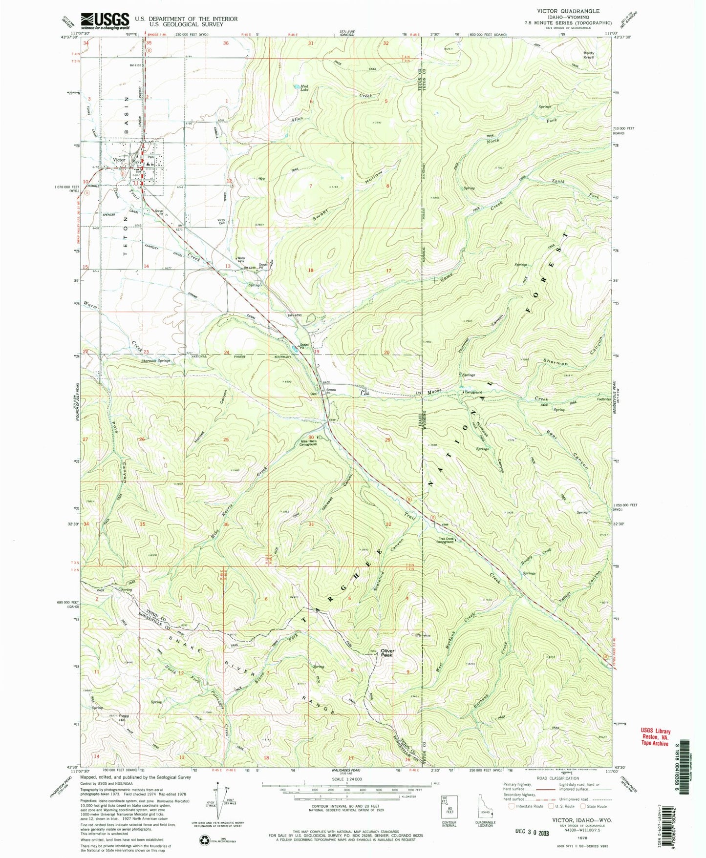
Classic USGS Victor Idaho 7.5'x7.5' Topo Map
Couldn't load pickup availability
Historical USGS topographic quad map of Victor in the states of Idaho, Wyoming. Typical map scale is 1:24,000, but may vary for certain years, if available. Print size: 24" x 27"
This quadrangle is in the following counties: Bonneville, Teton.
The map contains contour lines, roads, rivers, towns, and lakes. Printed on high-quality waterproof paper with UV fade-resistant inks, and shipped rolled.
Contains the following named places: Stateline Canyon, Allen Creek, Elbow Fork, Fogg Hill, Game Creek, Kearsley Canal, Kimball Canal, Mike Harris Creek, Mikesell Canyon, Mud Lake, Nordell Canyon, Oliver Peak, Pole Canyon, Sherman Springs, String Canal, Sweet Hollow, Victor Cemetery, Mike Harris Camnpground, Victor, The String, Victor Elementary School, Moose Creek, City of Victor, Teton County Fire Protection District Station 2, Victor Post Office, Burbank Creek, West Burbank Creek, Baldy Knoll, Bear Canyon, Hungry Creek, Nordwall Canyon, Plummer Canyon, Talbot Canyon, Trail Creek Campground, North Fork Game Creek, Sherman Canyon, South Fork Game Creek, Squaw Canyon