MyTopo
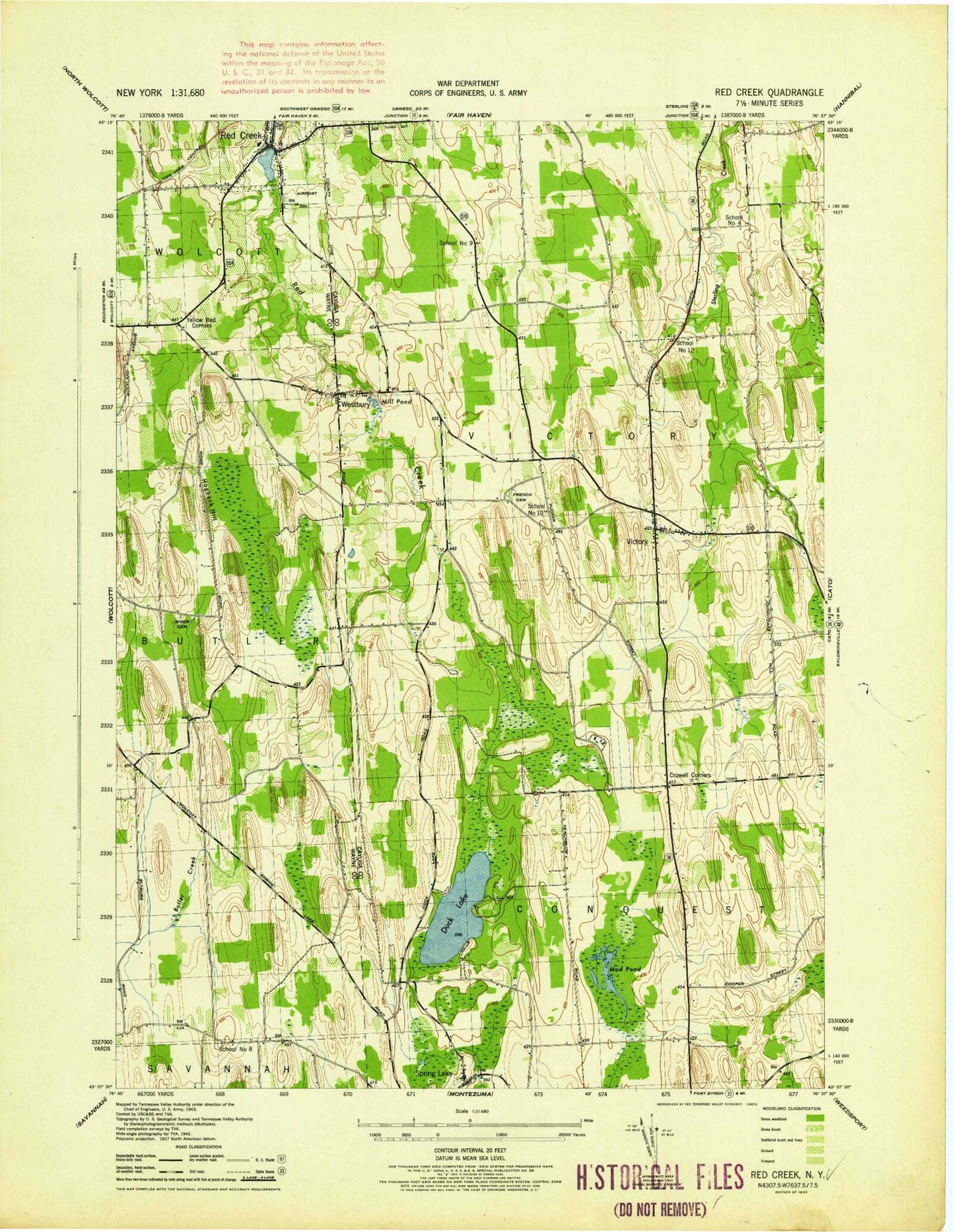
Classic USGS Victory New York 7.5'x7.5' Topo Map
Couldn't load pickup availability
Historical USGS topographic quad map of Victory in the state of New York. Map scale may vary for some years, but is generally around 1:24,000. Print size is approximately 24" x 27"
This quadrangle is in the following counties: Cayuga, Wayne.
The map contains contour lines, roads, rivers, towns, and lakes. Printed on high-quality waterproof paper with UV fade-resistant inks, and shipped rolled.
Contains the following named places: Armour of Light Baptist Church, Butler Correctional Facility, Butler Quarry, Cuddeback Hill, Duck Lake, French Cemetery, Hogback Hill, Joyful Acres, Little Sodus Creek, Margaret W Cuyler Elementary School, Mud Pond, Old Westbury Cemetery, Paradise Airport, Red Creek, Red Creek Free Library, Red Creek High School, Red Creek Middle School, Red Creek Post Office, School Number 10, School Number 12, School Number 4, School Number 8, School Number 9, Snyders Tree Farm, Southside Cemetery, Spring Lake, Spring Lake Cemetery, Spring Lake Church, Town of Victory, Victory, Victory Fire Department, Victory Union Cemetery, Village of Red Creek, Westbury, Westbury Cemetery, Wood Cemetery, Yellow Red Corners, ZIP Code: 13143