MyTopo
Classic USGS Villa Grove Illinois 7.5'x7.5' Topo Map
Couldn't load pickup availability
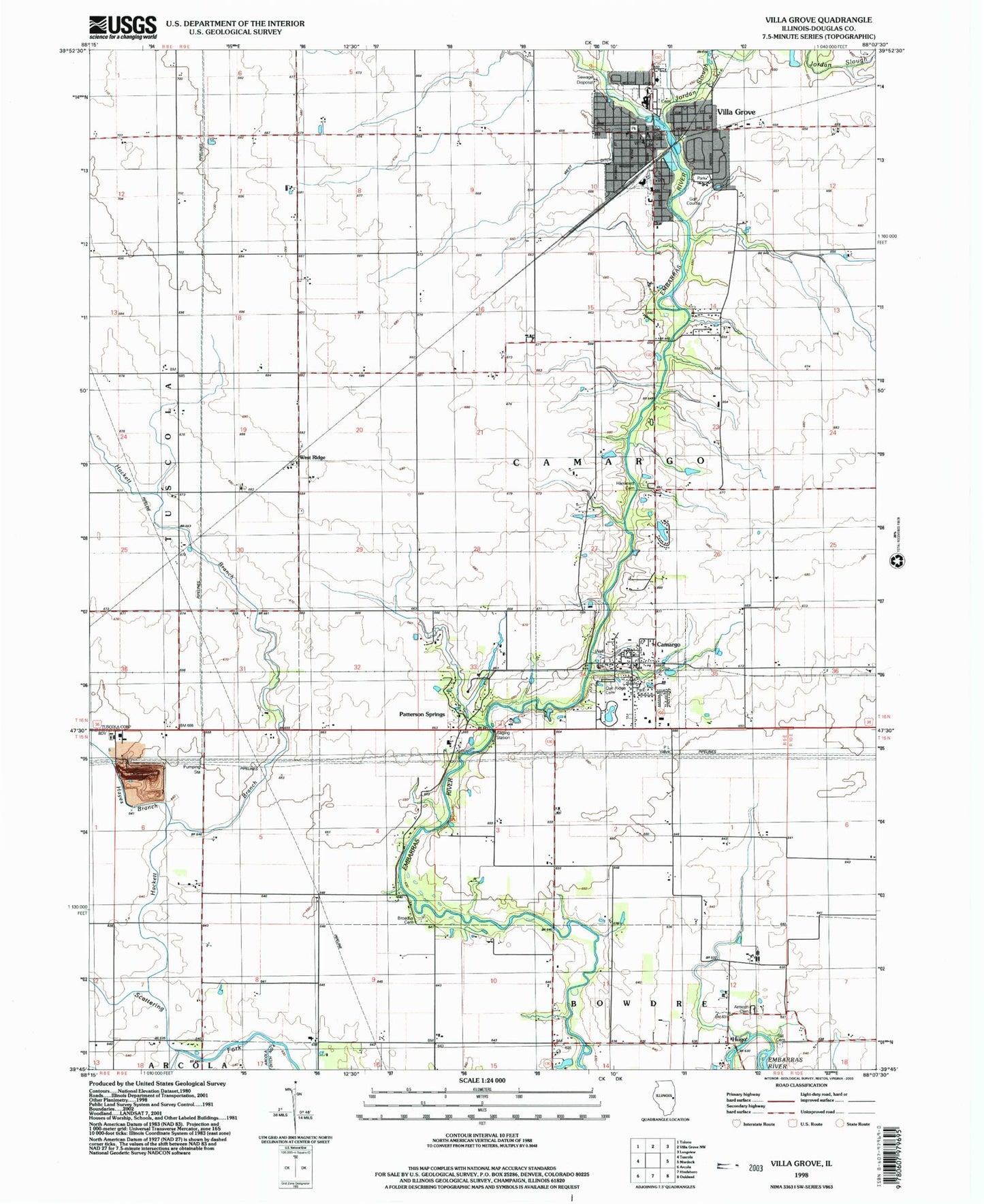
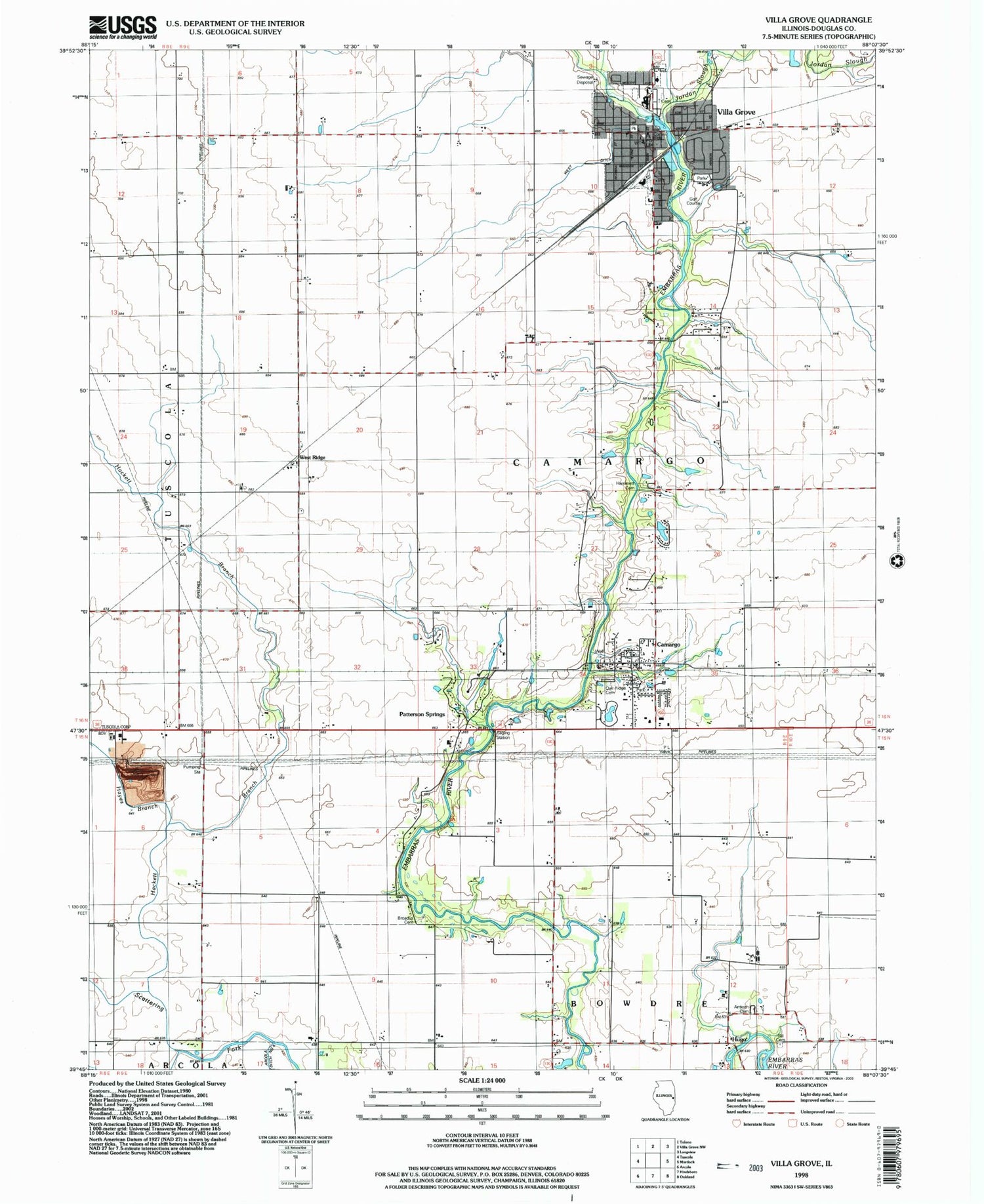
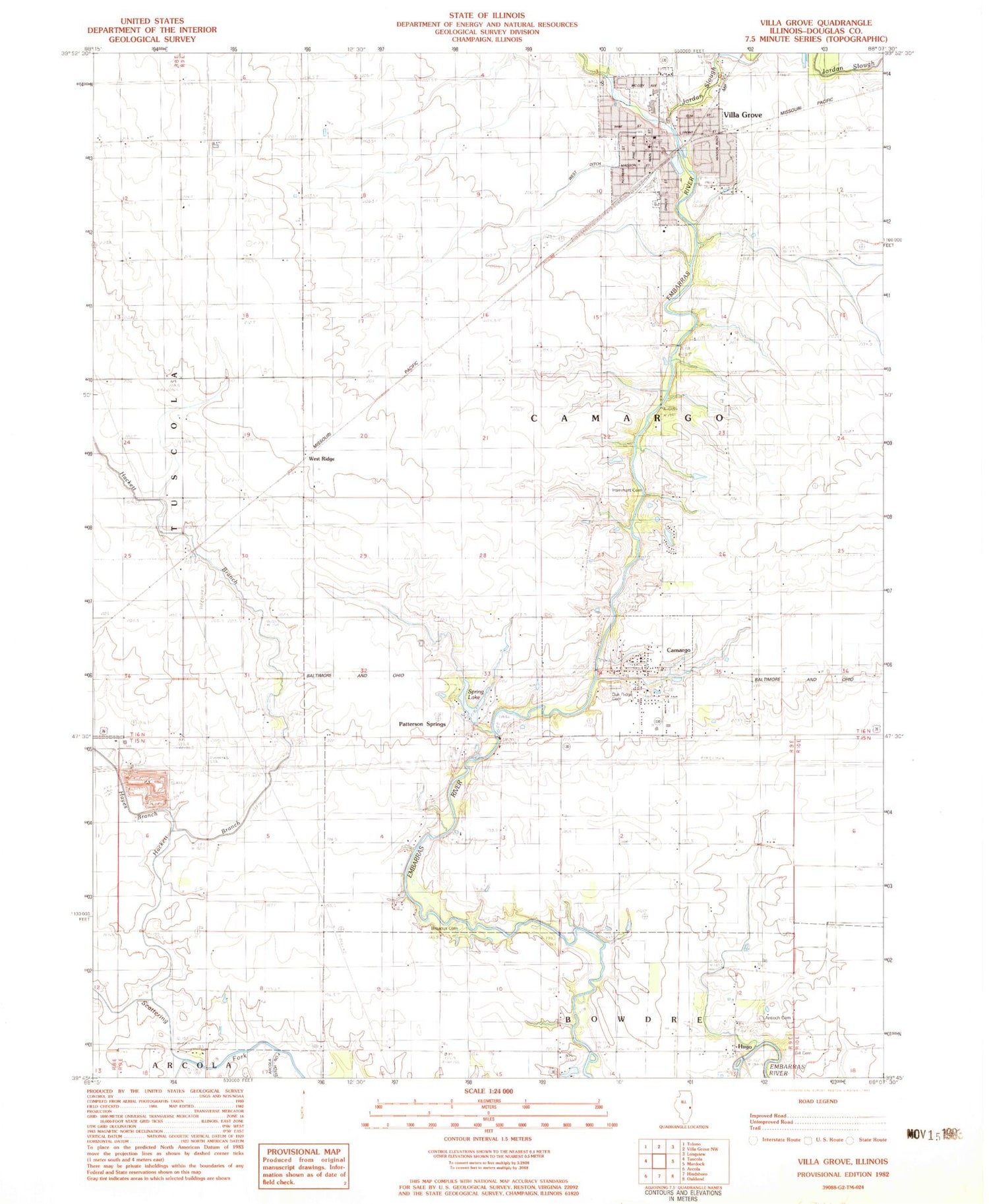
Historical USGS topographic quad map of Villa Grove in the state of Illinois. Map scale may vary for some years, but is generally around 1:24,000. Print size is approximately 24" x 27"
This quadrangle is in the following counties: Douglas.
The map contains contour lines, roads, rivers, towns, and lakes. Printed on high-quality waterproof paper with UV fade-resistant inks, and shipped rolled.
Contains the following named places: Antioch - Hugo Cemetery, Broadus Cemetery, Camargo, Camargo Countryside Fire Protection District Camargo, Camargo Post Office, Camargo Township Library, Camargo United Methodist Church, City of Villa Grove, Douglas County, First Christian Church, Gill Cemetery, Hackett Branch, Hammett Cemetery, Hayes Branch, Hugo, Jordan Slough, Living Hope Fellowship Church, Oak Ridge Cemetery, Patterson Springs, Patterson Springs Lake, Patterson Springs Lake Dam, Sacred Heart Catholic Church, Spring Lake, Township of Camargo, Tuscola Quarry, Victory Church, Villa Grove, Villa Grove Community Building, Villa Grove High School, Villa Grove Post Office, Village of Camargo, West Ditch, West Ridge, ZIP Codes: 61919, 61956