MyTopo
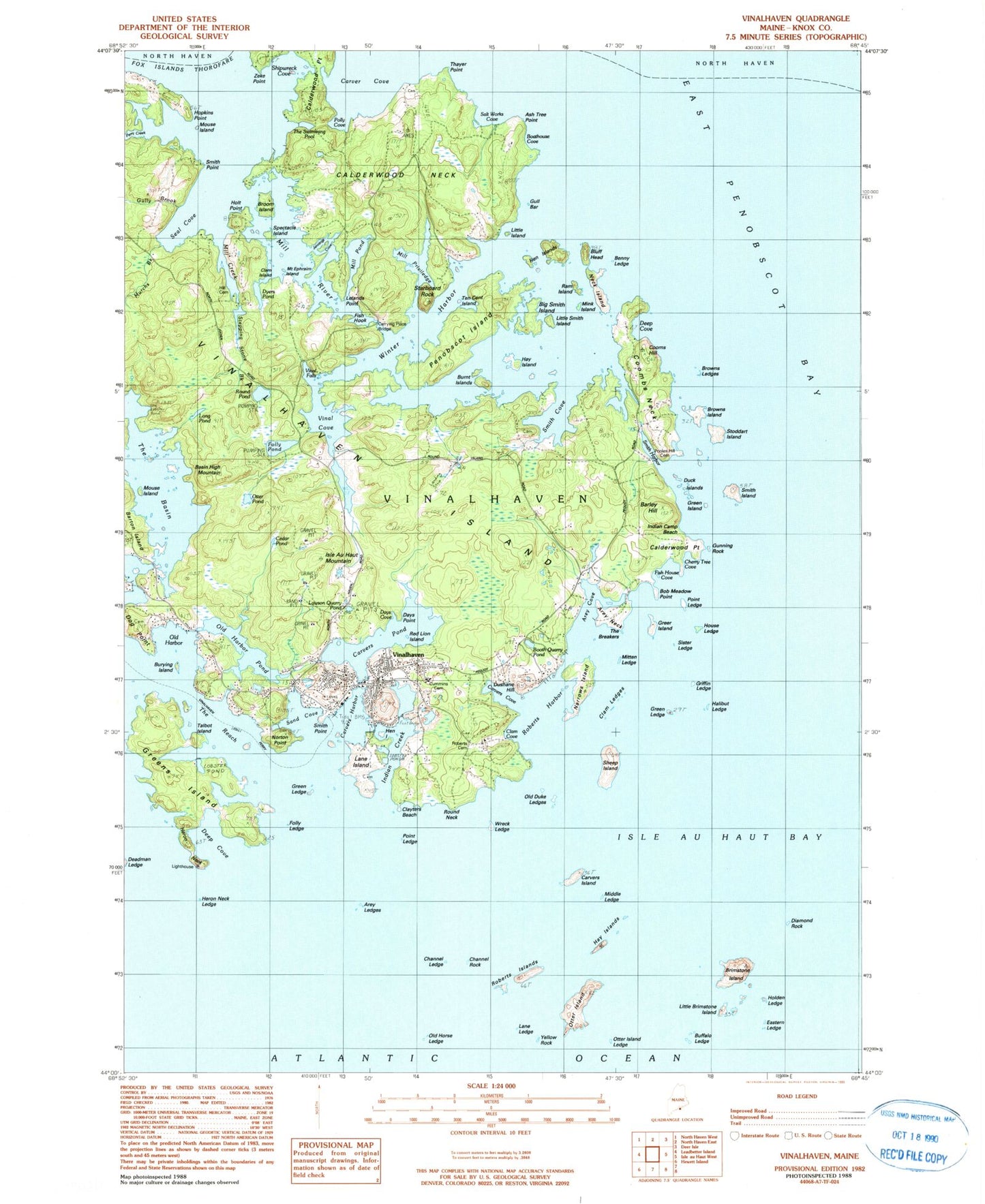
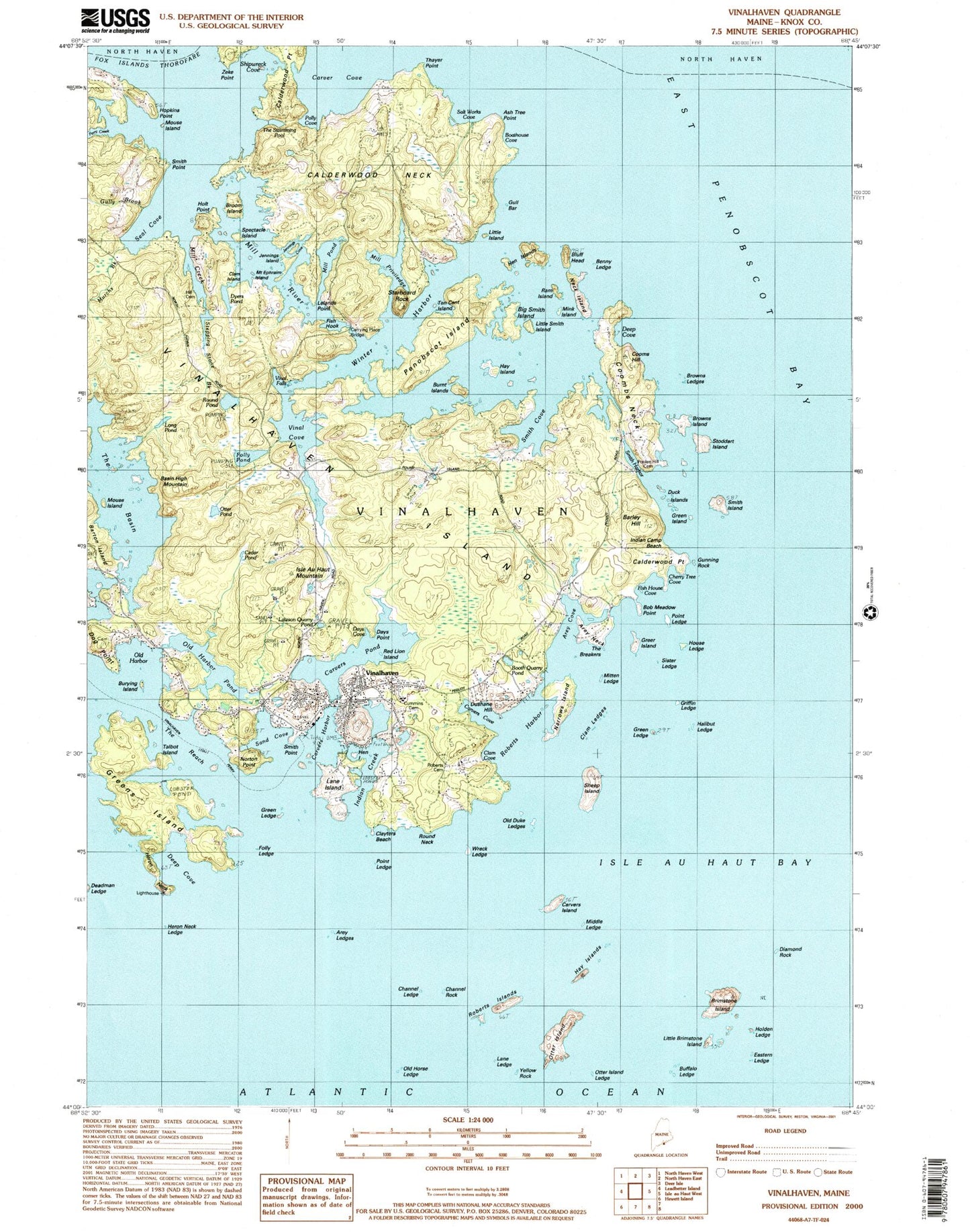
USGS Classic Vinalhaven Maine 7.5'x7.5' Topo Map
Couldn't load pickup availability
Historical USGS topographic quad map of Vinalhaven in the state of Maine. Scale: 1:24000. Print size: 24" x 27"
This quadrangle is in the following counties: Knox.
The map contains contour lines, roads, rivers, towns, lakes, and grids including latitude / longitude and UTM / MGRS. Printed on high-quality waterproof paper with UV fade-resistant inks.
Contains the following named places: Arey Cove, Arey Ledges, Arey Neck, Barley Hill, Barton Island, Bluff Head, Brimstone Island, Broom Island, Browns Island, Calderwood Neck, Calderwood Point, Carver Cove, Carvers Harbor, Carvers Island, Carvers Pond, Cedar Pond, Channel Rock, Cooms Hill, Coombs Neck, Deep Cove, Diamond Rock, Folly Ledge, Folly Pond, Greens Island, Green Island, Hay Island, Heron Neck, Heron Neck Ledge, Holden Ledge, Hopkins Point, House Ledge, Indian Creek, Isle Au Haut Mountain, Lane Island, Little Brimstone Island, Long Pond, Mill River, Mitten Ledge, Narrows Island, Norton Point, Old Harbor, Old Harbor Pond, Otter Island, Otter Pond, Penobscot Island, Perry Creek, Potato Island, Roberts Harbor, Round Pond, Round Rock, Sand Cove, Seal Bay, Seal Cove, Sheep Island, Smith Cove, Smith Island, Starboard Rock, Stoddart Island, The Basin, The Reach, Vinal Cove, Vinalhaven, Winter Harbor, Yellow Rock, Zeke Point, Burnt Island, Duck Island, Roberts Island, Dog Point, Hill Cemetery, Clam Island, Gully Brook, Holt Point, Murchs Brook, Dyers Pond, Mill Creek, Vinal Falls, Basin High Mountain, Hen Island, Lawson Quarry Pond, Mouse Island, Burying Island, Talbot Island, Roberts Cemetery, Clayters Beach, Round Neck, Wreck Ledge, Middle Ledge, Lower Ledge, Otter Island Ledge, Buffalo Ledge, Hay Islands, Channel Ledge, Old Horse Ledge, Clam Ledges, Halibut Ledge, Griffin Ledge, Clam Cove, Old Duke Ledges, Carvers Cove, Days Point, Red Lion Island, Cummins Cemetery, Eastern Ledge, Carrying Place Bridge, Days Cove, Fish House Cove, Cherry Tree Cove, Sister Ledge, Booth Quarry Pond, Greer Island, Pooles Hill Cemetery, Smith Harbor, Browns Ledge, Bob Meadow Point, Cunning Rock, Indian Camp Beach, Benny Ledge, Ram Island, Davids Island, Little Smith Island, Mink Island, Neck Island, Ash Tree Point, Thayer Point, Polly Cove, Little Island, Gull Bar, Boathouse Cove, The Swimming Pool, Spectacle Island, Shipwreck Cove, Salt Works Cove, Ten Cent Island, Jennings Cove, Mill Pond, Mill Priviledge, Lelands Point, Fish Hook, Stepping Stone Brook, Mouse Island, Mount Ephraim Island, Big Shoal, The Breakers, Bunker Ledge, Colt Ledge, Crosby Ledge, Diamond Rock Ledge, Grindstone Ledge, Iron Point Ledge, Knubble Ledge, Little Triangle Ledge, Shag Rock, Sheep Island Ledge, Triangle Ledge, Vinalhaven Airport, Green Ledge, Green Ledge, Hen Islands, Smith Point, Point Ledge, Point Ledge, Smith Point, Town of Vinalhaven, Areys Neck Woods, Armburst Hill Wildlife Preserve, Big Hen Island, Booths Quarry (historical), Dushane Hill, Greens Island Cove, Gunning Rock, Heron Neck Light Station, Island Community Medical Center, John Carver Cemetery, Lane Family Cemetery, Lane Ledge, Lanes Island Preserve, Lawsons Quarry (historical), Lincoln Elementary School, Little Hen Island, Reindeer Cove, Sands Cove, Seal Bay, Turning Rock, Union Church of Vinalhaven, Vinalhaven School, Vinalhaven Historical Society Museum, Vinalhaven Island, Vinalhaven Post Office, Vinalhaven Public Library, Vinalhaven Fire Department, Vinalhaven Police Department