MyTopo
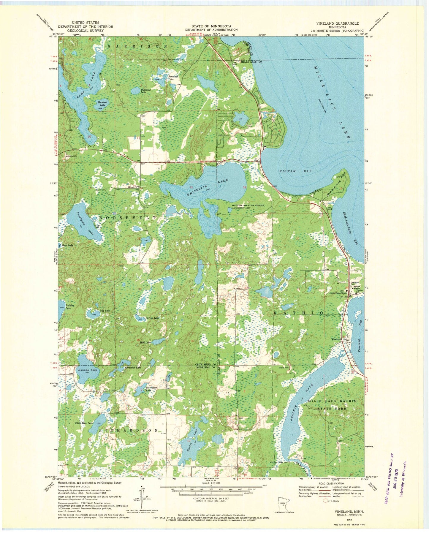
Classic USGS Vineland Minnesota 7.5'x7.5' Topo Map
Couldn't load pickup availability
Historical USGS topographic quad map of Vineland in the state of Minnesota. Map scale may vary for some years, but is generally around 1:24,000. Print size is approximately 24" x 27"
This quadrangle is in the following counties: Aitkin, Crow Wing, Mille Lacs, Morrison.
The map contains contour lines, roads, rivers, towns, and lakes. Printed on high-quality waterproof paper with UV fade-resistant inks, and shipped rolled.
Contains the following named places: Alliance Mission, Bullhead Lake, Hannah Lake, Horseshoe Lake, Humbolt Lake, Jennison Lake, Kutil Lake, Lakewood Cemetery, Lily Lake, Little Flower Mission, Mille Lacs Tribal Police Department, Mud Lake, Ogechie Lake, Ogechie Lake Dam, Sewell Post Office, Shah-bush-kung Bay, Shah-bush-kung Point, Spring Lake, Starvation Lake, Township of Roosevelt, Twelve Lake, Twentytwo Lake, Vineland, Vineland Census Designated Place, Vineland School, White Bear Lake, Whitefish Lake, Whitefish Lake State Wildlife Management, Wigwam Bay, ZIP Code: 56450