MyTopo
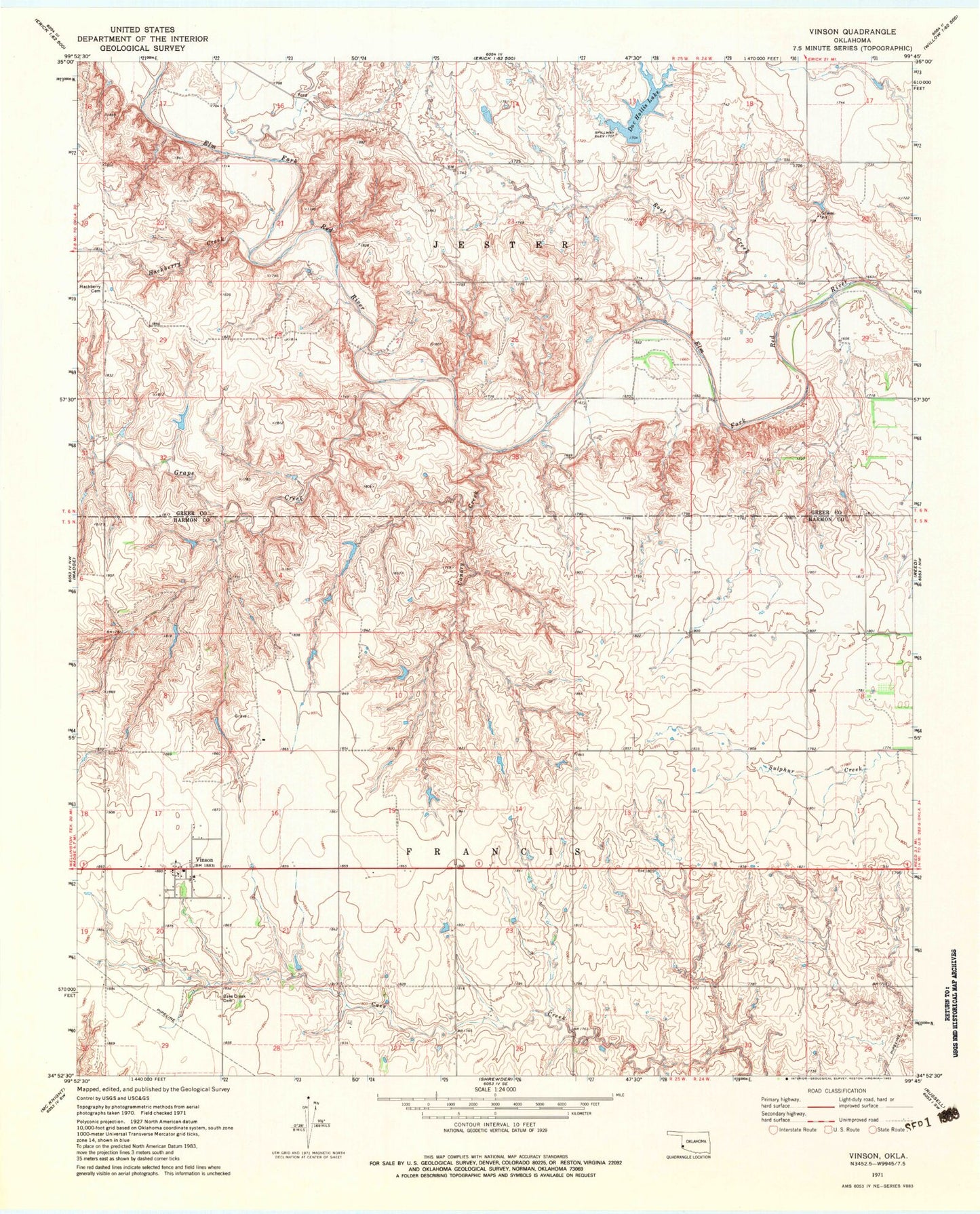
Classic USGS Vinson Oklahoma 7.5'x7.5' Topo Map
Couldn't load pickup availability
Historical USGS topographic quad map of Vinson in the state of Oklahoma. Map scale may vary for some years, but is generally around 1:24,000. Print size is approximately 24" x 27"
This quadrangle is in the following counties: Greer, Harmon.
The map contains contour lines, roads, rivers, towns, and lakes. Printed on high-quality waterproof paper with UV fade-resistant inks, and shipped rolled.
Contains the following named places: Canary Creek, Cave Creek Cemetery, Doc Hollis Lake, Grape Creek, Hackberry Cemetery, Hackberry Creek, Hollis 118 Dam, Hollis Division, J B Hollis Dam, J B Hollis Reservoir, Root Creek, Russell Overton Dam, Russell Overton Reservoir, Township of Francis, Township of Jester, Vinson, Vinson Natural Bridge, Vinson Post Office, Vinson Rural Volunteer Fire Department