MyTopo
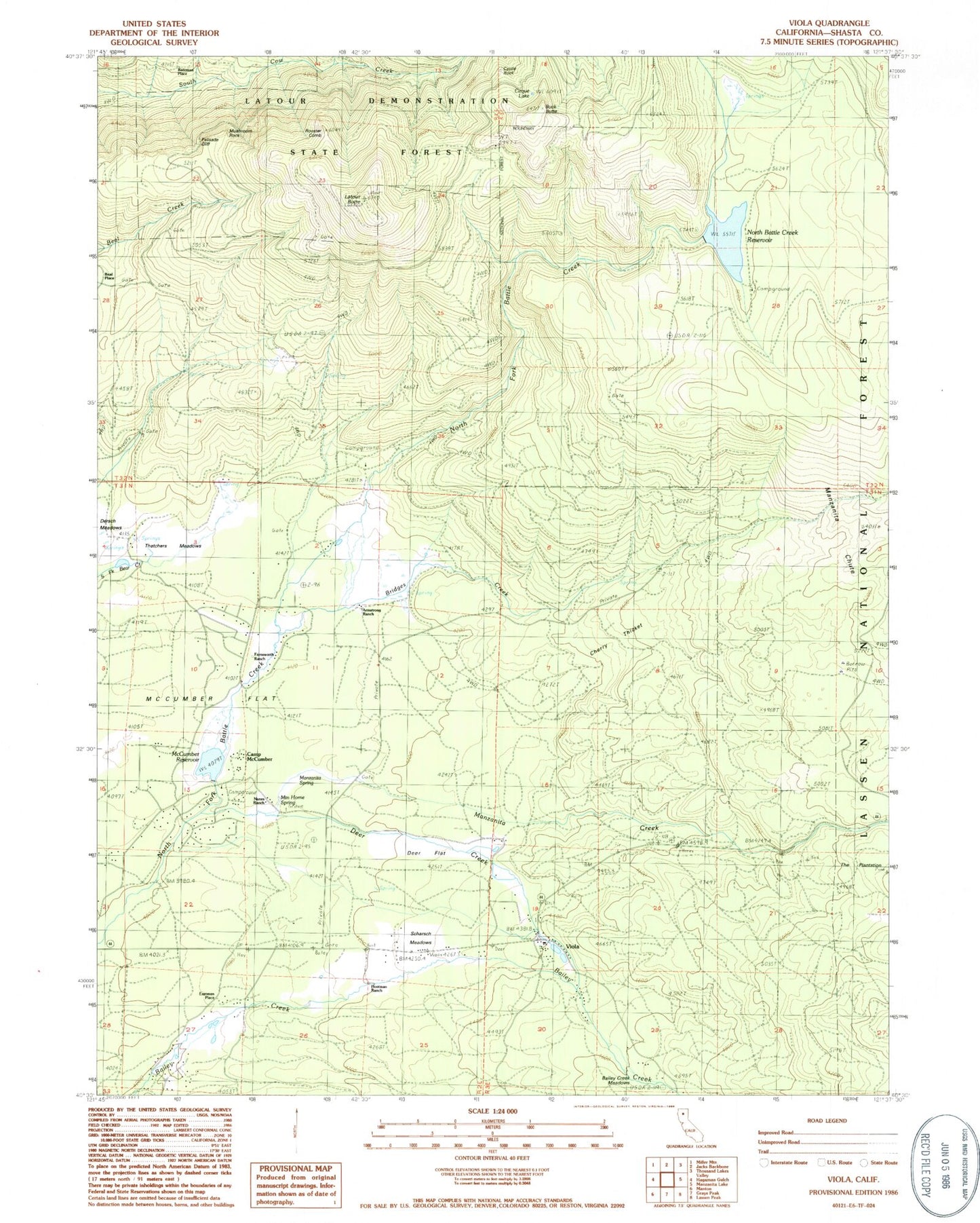
Classic USGS Viola California 7.5'x7.5' Topo Map
Couldn't load pickup availability
Historical USGS topographic quad map of Viola in the state of California. Map scale may vary for some years, but is generally around 1:24,000. Print size is approximately 24" x 27"
This quadrangle is in the following counties: Shasta.
The map contains contour lines, roads, rivers, towns, and lakes. Printed on high-quality waterproof paper with UV fade-resistant inks, and shipped rolled.
Contains the following named places: Armstrong Ranch, Bailey Creek Meadows, Bateman Place, Beal Place, Bridges Creek, Buck Butte, Bullhock Creek, Camp McCumber, Castle Rock, Cherry Thicket, Cirque Lake, Deer Creek, Deer Flat, Eastman Place, Farnsworth Ranch, Hootman Ranch, Latour Butte, Manzanita Creek, Manzanita Spring, McCumber 97-094 Dam, McCumber Flat, McCumber Reservoir, Mountain Home Spring, Mushroom Rock, North Battle Creek 97-096 Dam, North Battle Creek Reservoir, Nunes Ranch, Palisade Cliff, Reservoir Public Camp, Rooster Comb, Scharsch Meadows, Scharsch Ranch, Thatchers Meadows, Viola, Viola Post Office