
MyTopo
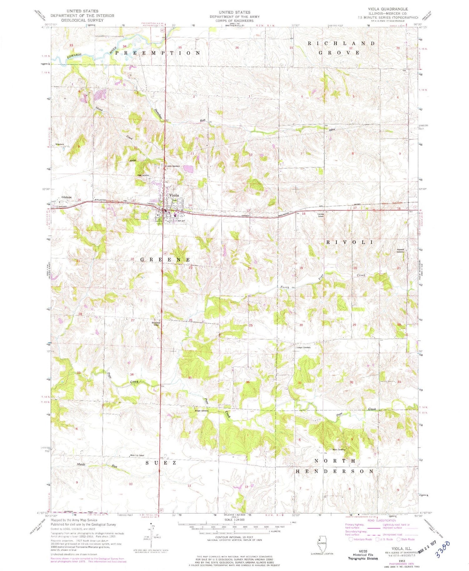
Classic USGS Viola Illinois 7.5'x7.5' Topo Map
Couldn't load pickup availability
Historical USGS topographic quad map of Viola in the state of Illinois. Map scale may vary for some years, but is generally around 1:24,000. Print size is approximately 24" x 27"
This quadrangle is in the following counties: Mercer.
The map contains contour lines, roads, rivers, towns, and lakes. Printed on high-quality waterproof paper with UV fade-resistant inks, and shipped rolled.
Contains the following named places: Adams School, Bridger Cemetery, Brushwood School, Cooper Cemetery, Donohue Run, Fairview School, First Apostolic Church, Gilchrist, Green Summit School, Greenbower School, Hopewell Cemetery, Mann Cemetery, Miles Memorial Park, North Pope Creek, Pleasant Hill School, Saint John's Cemetery, Saint Johns Church, Silver Lake School, Skunk Creek, Township of Greene, Village of Viola, Viola, Viola Cemetery, Viola Fire Station, Viola Police Department, Viola Post Office, Viola Public Library, Viola United Church, Viola United Methodist Church, White Lily School, Winola School, Young Airport, ZIP Code: 61486


