MyTopo
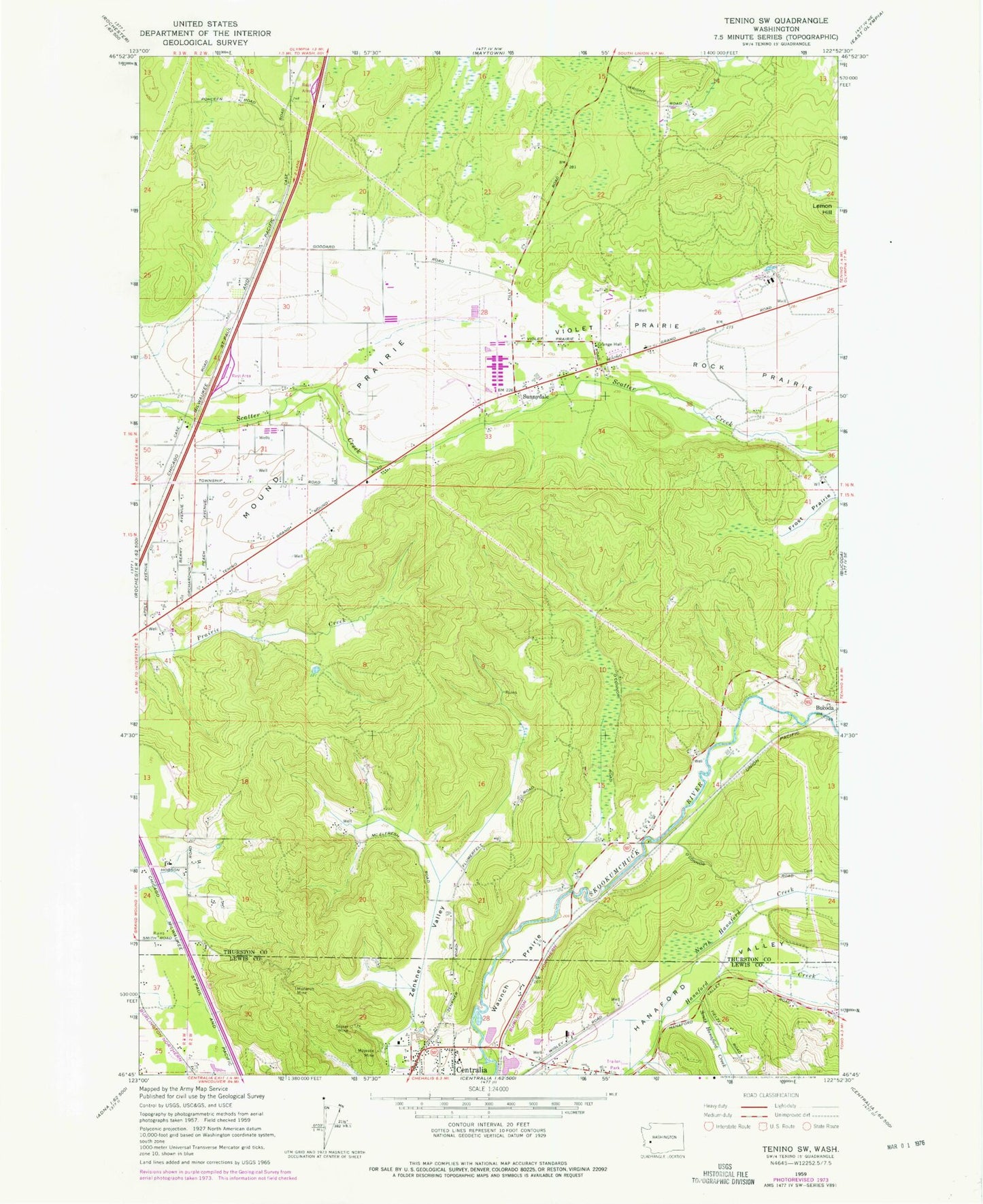
Classic USGS Violet Prairie Washington 7.5'x7.5' Topo Map
Couldn't load pickup availability
Historical USGS topographic quad map of Violet Prairie in the state of Washington. Map scale may vary for some years, but is generally around 1:24,000. Print size is approximately 24" x 27"
This quadrangle is in the following counties: Lewis, Thurston.
The map contains contour lines, roads, rivers, towns, and lakes. Printed on high-quality waterproof paper with UV fade-resistant inks, and shipped rolled.
Contains the following named places: Cupacoffee Creek, Davis Hill, Dunlap Pond, Dunlap Pond Dam, Foran, Grand Mound Prairie, Hanaford Valley, Kiwanis Vocational School, Kyte Dam, Lemon Hill, Lewis County Fire District 12 Riverside Fire Authority Station 3, Majestic Mine, Monarch Mine, Monte Vista Poultry Detention Pond, Monte Vista Poultry Detention Pond Dam, North Hanaford Creek, Rock Prairie, Sorrell Airport, South Hanaford Creek, Stoker Mine, Sunnydale, Thurston County Fire District 12 Tenino Fire Department Station 12 - 2, Thurston County Fire District 16 Gibson Valley Fire Department, Violet Prairie, Wissler's Airport, Zenkner Valley