MyTopo
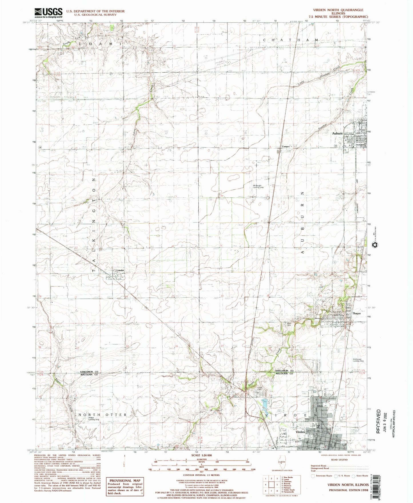
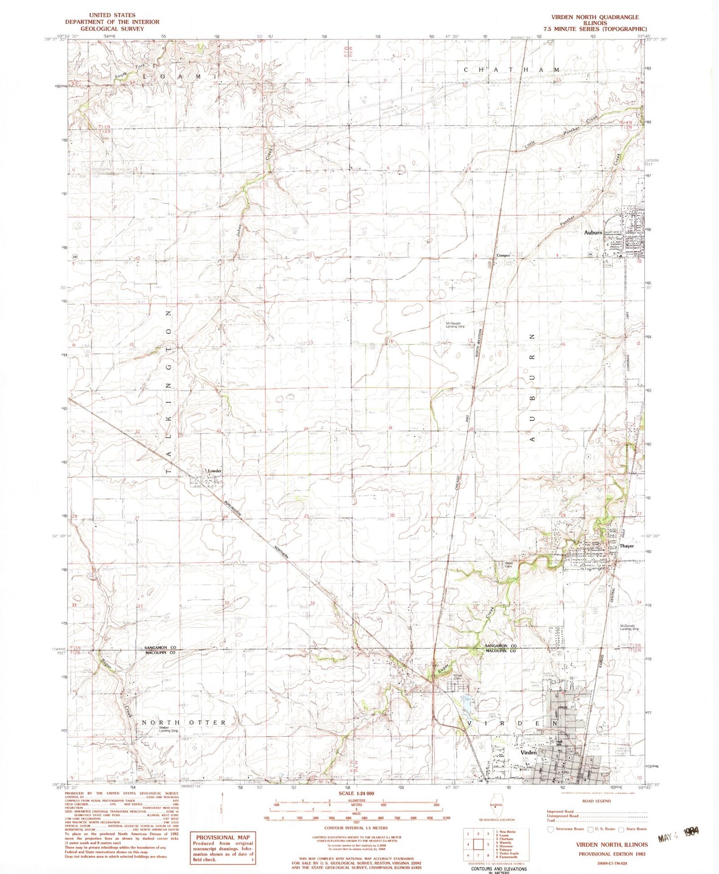
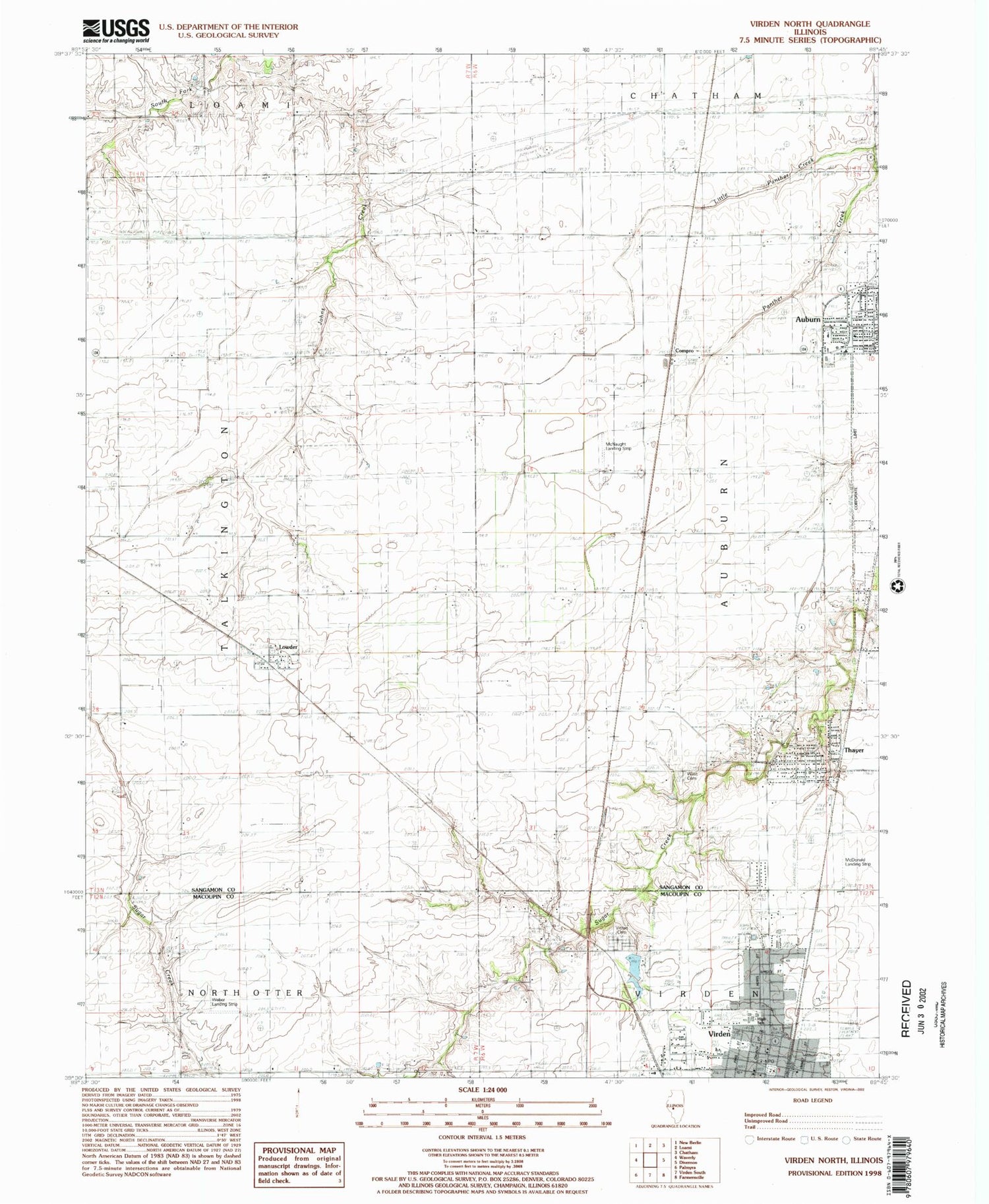
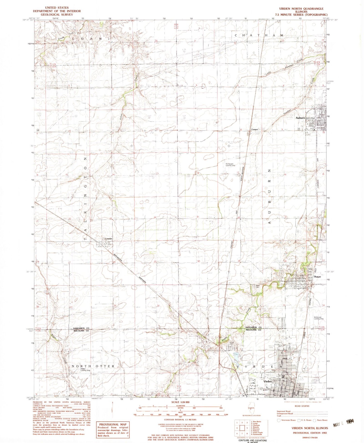
Classic USGS Virden North Illinois 7.5'x7.5' Topo Map
Couldn't load pickup availability
Historical USGS topographic quad map of Virden North in the state of Illinois. Map scale may vary for some years, but is generally around 1:24,000. Print size is approximately 24" x 27"
This quadrangle is in the following counties: Macoupin, Sangamon.
The map contains contour lines, roads, rivers, towns, and lakes. Printed on high-quality waterproof paper with UV fade-resistant inks, and shipped rolled.
Contains the following named places: Auburn Fire Protection District - Auburn Emergency Squad, Bumgarner School, Central School, Christian Church of Auburn, Church of the Brethren, Church of the Nazarene, City of Virden, Compro, Coultas School, Countyline School, First Baptist Church, First Christian Church, First Presbyterian Church, Fletcher School, Full Gospel Tabernacle, Grand Prairie of the West Public Library, Holzwarth Flying Service, Johns Creek School, Kingdom Hall of Jehovahs Witnesses, Larabee School, Lemmon, Little Panther Creek, Lowder, McDonald Landing Strip, McNaught Landing Strip, Prosperity School, Pullhall School, Sacred Heart Church, Saint Catherines Roman Catholic Church, Thayer, Thayer Police Department, Thayer Post Office, Tower Heights, Township of Auburn, Township of Talkington, Township of Virden, Trinity Lutheran Church, Victory School, Village of Thayer, Virden, Virden Cemetery, Virden City Hall, Virden Fire Protection District, Virden Fire Protection District Thayer Station, Virden High School, Virden Police Department, Virden Post Office, Virden Recreation Club Lake, Virden Recreation Club Lake Dam, West Cemetery, ZIP Codes: 62615, 62689, 62690