
MyTopo
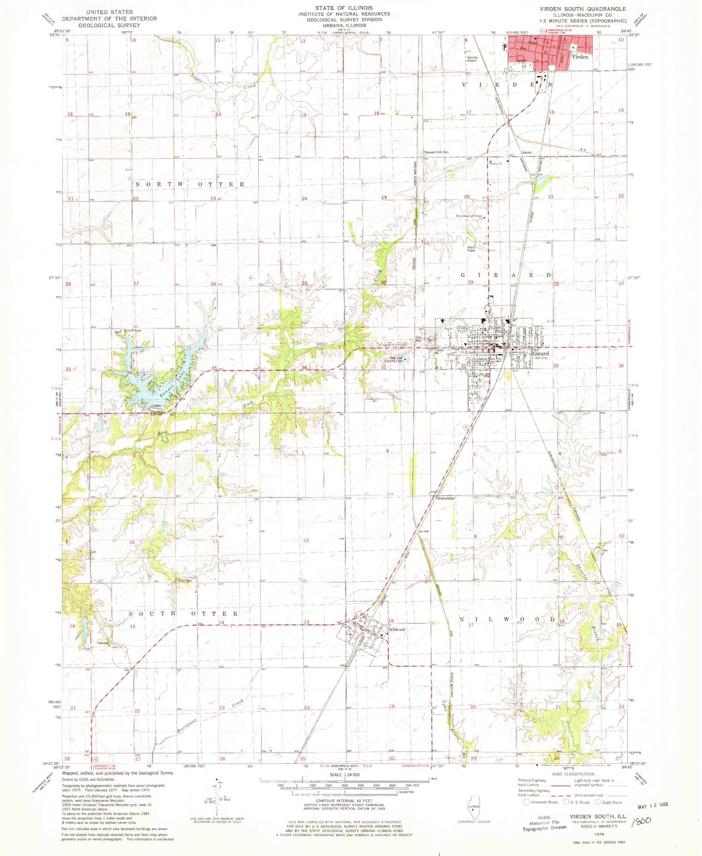
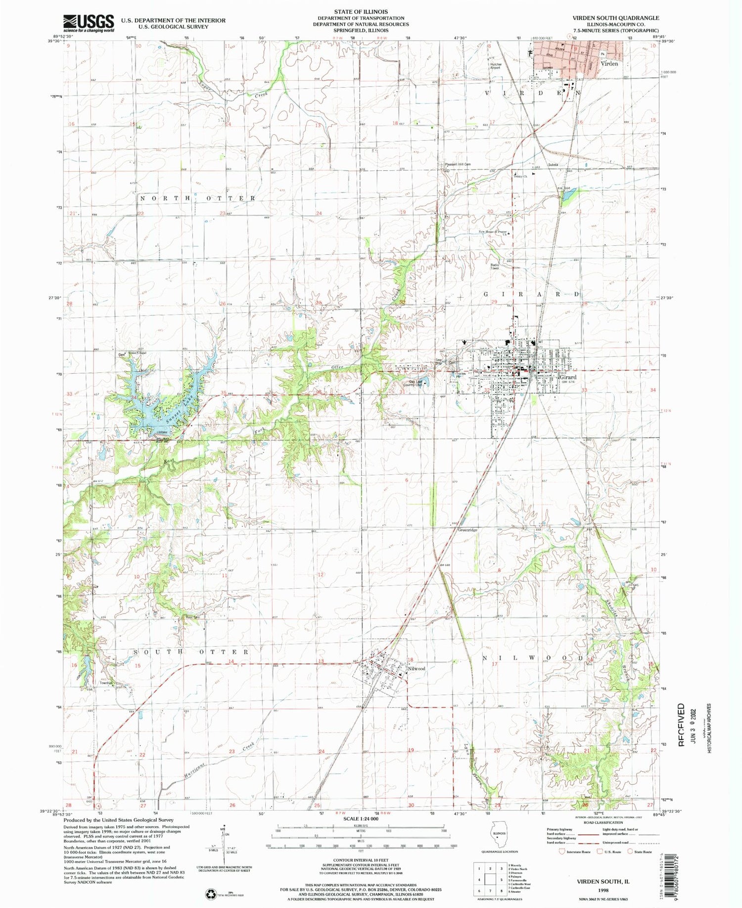
Classic USGS Virden South Illinois 7.5'x7.5' Topo Map
Couldn't load pickup availability
Historical USGS topographic quad map of Virden South in the state of Illinois. Map scale may vary for some years, but is generally around 1:24,000. Print size is approximately 24" x 27"
This quadrangle is in the following counties: Macoupin.
The map contains contour lines, roads, rivers, towns, and lakes. Printed on high-quality waterproof paper with UV fade-resistant inks, and shipped rolled.
Contains the following named places: Cherry Grove School, City of Girard, East Public School, First Baptist Church, First Methodist Episcopal Church, Franklin School, Girard, Girard Cemetery, Girard City Cemetery, Girard Fire Protection District, Girard High School, Girard Post Office, Girard Sunset Lake, Girard Sunset Lake Dam, Greenridge, Hazel Green School, Hickory Point School, Hulcher RLA Airport, Lynchburg School, New House of Prayer Church, Nilwood, Nilwood Post Office, Oak Leaf Country Club, Pleasant Hill Cemetery, Pleasant Hill School, Prairieland Community Ambulance Service, Ross Cemetery, South Otter Townhall, Sugar Creek School, Sunset Lake, Town of Nilwood, Township of Girard, Township of Nilwood, Township of North Otter, Township of South Otter, Trinity Lutheran Church, Union Chapel, Union Chapel Cemetery, United Methodist Church of Girard, Whites Pond, Whites Pond Dam, ZIP Codes: 62640, 62672