MyTopo
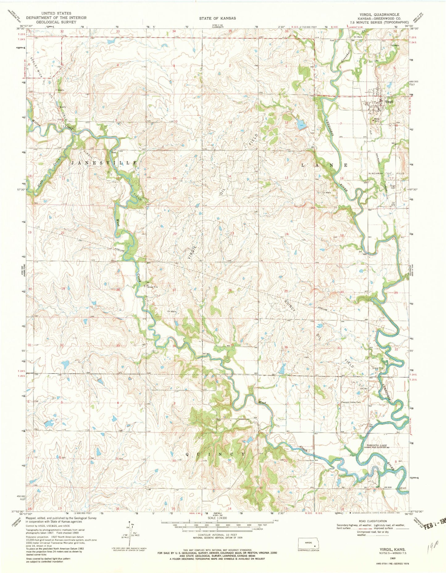
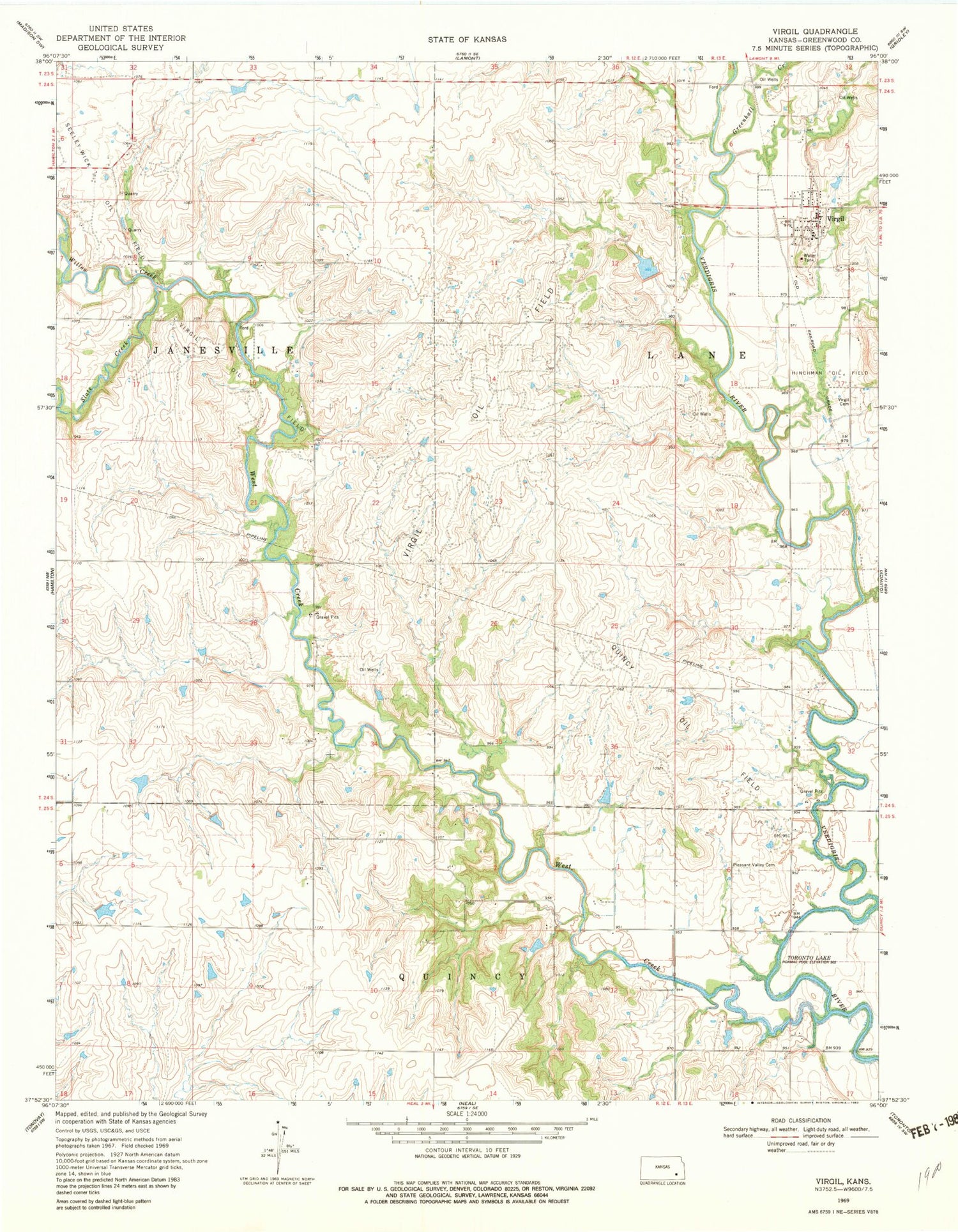
Classic USGS Virgil Kansas 7.5'x7.5' Topo Map
Couldn't load pickup availability
Historical USGS topographic quad map of Virgil in the state of Kansas. Map scale may vary for some years, but is generally around 1:24,000. Print size is approximately 24" x 27"
This quadrangle is in the following counties: Greenwood.
The map contains contour lines, roads, rivers, towns, and lakes. Printed on high-quality waterproof paper with UV fade-resistant inks, and shipped rolled.
Contains the following named places: City of Virgil, Greenhall Creek, Hinchman Oil Field, Homer Creek, Pleasant Valley Cemetery, Quincy Oil Field, Slate Creek, Sleeley-Wick Oil Field, Township of Lane, Virgil, Virgil Cemetery, Virgil City Hall, Virgil Oil Field, Virgil Post Office, Virgil Volunteer Fire Department, Virgil Wastewater Treatment Facility, West Creek, Willow Creek, Woodson County Co - Operative Association Grain Elevator Number 2, ZIP Code: 66870