MyTopo
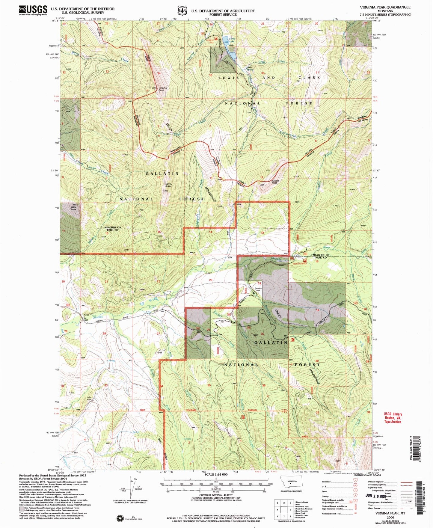
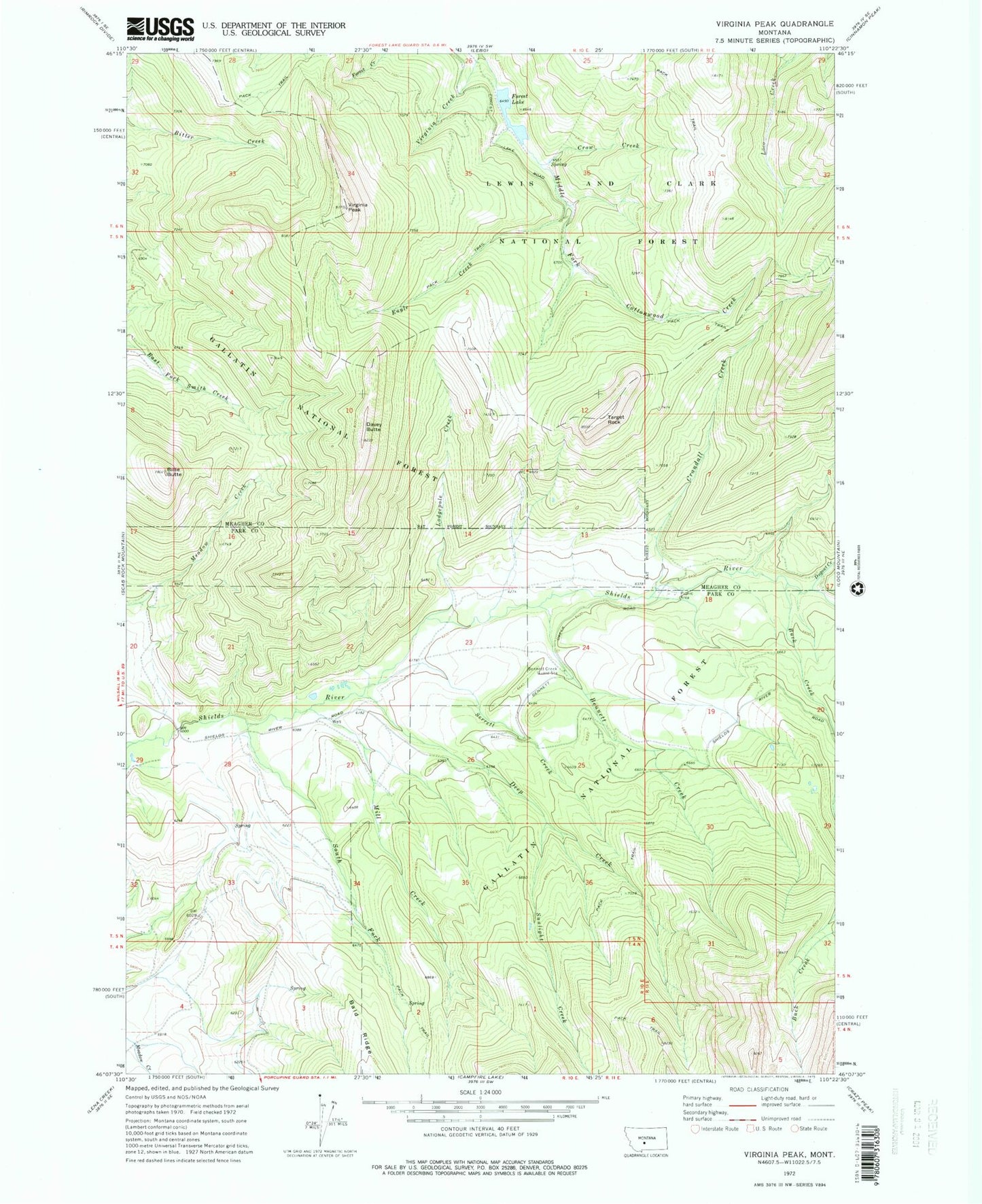
Classic USGS Virginia Peak Montana 7.5'x7.5' Topo Map
Couldn't load pickup availability
Historical USGS topographic quad map of Virginia Peak in the state of Montana. Typical map scale is 1:24,000, but may vary for certain years, if available. Print size: 24" x 27"
This quadrangle is in the following counties: Meagher, Park.
The map contains contour lines, roads, rivers, towns, and lakes. Printed on high-quality waterproof paper with UV fade-resistant inks, and shipped rolled.
Contains the following named places: Virginia Creek, Bennett Creek, Bennett Creek Guard Station, Billie Butte, Buck Creek, Crandall Creek, Crow Creek, Davey Butte, Deep Creek, Dugout Creek, Eagle Creek, Forest Lake, Lodgepole Creek, Mill Creek, Serrett Creek, South Fork Shields River, Sunlight Creek, Target Rock, Virginia Peak, Shields River Recreation Site