
MyTopo
Classic USGS Vista Florida 7.5'x7.5' Topo Map
Regular price
$16.95
Regular price
Sale price
$16.95
Unit price
per
Couldn't load pickup availability
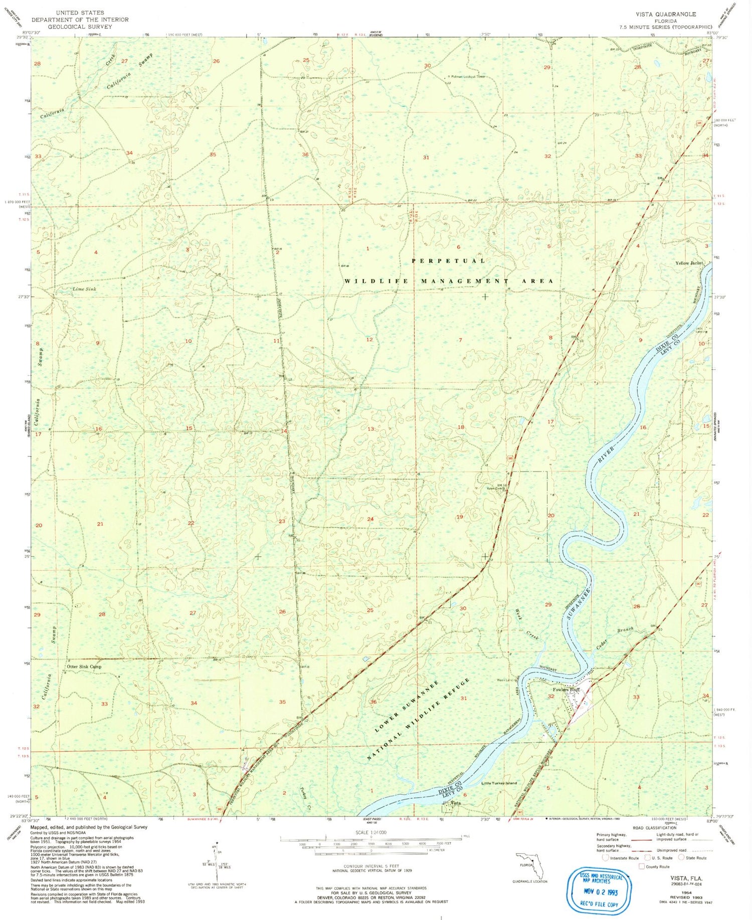
Historical USGS topographic quad map of Vista in the state of Florida. Map scale may vary for some years, but is generally around 1:24,000. Print size is approximately 24" x 27"
This quadrangle is in the following counties: Dixie, Levy.
The map contains contour lines, roads, rivers, towns, and lakes. Printed on high-quality waterproof paper with UV fade-resistant inks, and shipped rolled.
Contains the following named places: Cedar Branch, Fowlers Bluff, Fowlers Bluff Volunteer Fire Department, Keen Cemetery, Lime Sink, Little Turkey Island, Lower Suwannee National Wildlife Refuge, Otter Sink Camp, Putnam Lookout Tower, Vista, WDFL-FM (Cross City), Week Creek, Week Landing, Yellow Jacket


