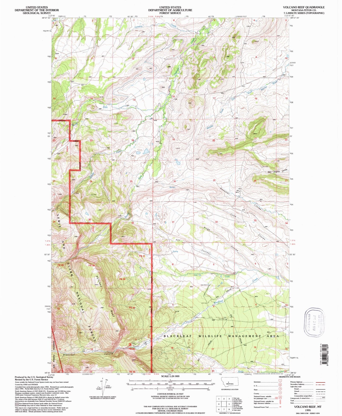
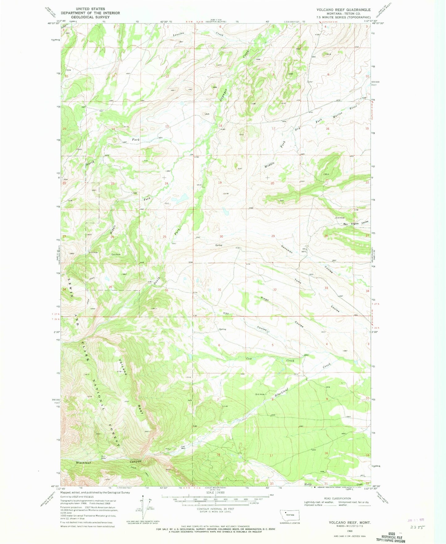
MyTopo
Classic USGS Volcano Reef Montana 7.5'x7.5' Topo Map
Regular price
$16.95
Regular price
Sale price
$16.95
Unit price
per
Couldn't load pickup availability
Historical USGS topographic quad map of Volcano Reef in the state of Montana. Map scale may vary for some years, but is generally around 1:24,000. Print size is approximately 24" x 27"
This quadrangle is in the following counties: Teton.
The map contains contour lines, roads, rivers, towns, and lakes. Printed on high-quality waterproof paper with UV fade-resistant inks, and shipped rolled.
Contains the following named places: Blackleaf Canyon, Cow Creek, Hoy Coulee, Lenstra Creek, Middle Fork Dupuyer Creek, North Fork Dupuyer Creek, Pings Coulee, South Fork Dupuyer Creek, Theodore Roosevelt Memorial Ranch, Volcano Reef