MyTopo
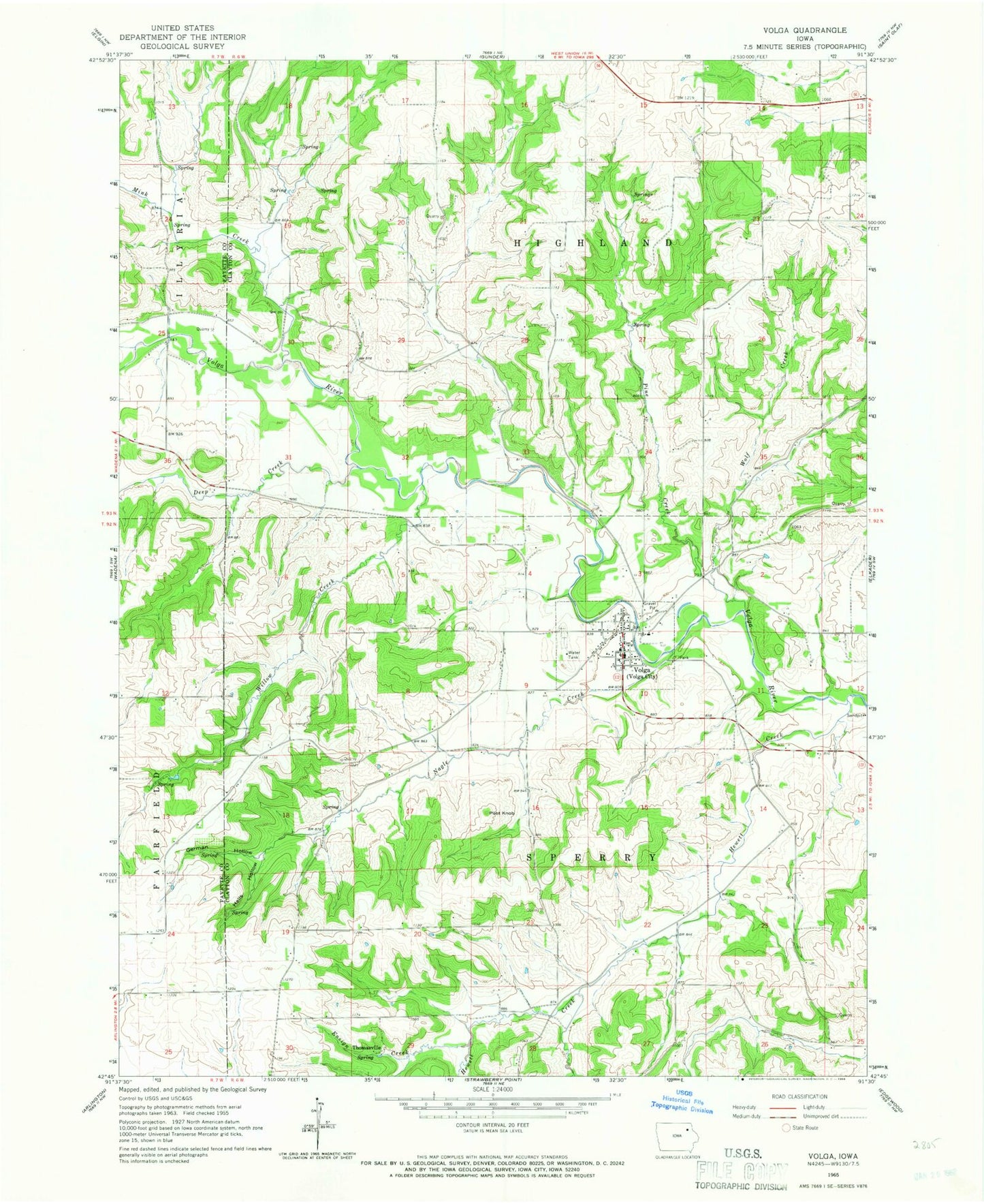
Classic USGS Volga Iowa 7.5'x7.5' Topo Map
Couldn't load pickup availability
Historical USGS topographic quad map of Volga in the state of Iowa. Map scale may vary for some years, but is generally around 1:24,000. Print size is approximately 24" x 27"
This quadrangle is in the following counties: Clayton, Fayette.
The map contains contour lines, roads, rivers, towns, and lakes. Printed on high-quality waterproof paper with UV fade-resistant inks, and shipped rolled.
Contains the following named places: Calvary Baptist Church, City of Volga, Deep Creek, Duff Cemetery, Ensign Creek, German Hollow, Hells Hollow, Hewett Creek, Hewitt-Ensign Creek Wildlife Management Area, High Grove Post Office, Mink Creek, Nagle Creek, Old Stone School Cemetery, Old Volga City Opera House, Pilot Knob, Pine Creek, Rothfusz Cemetery, Sacred Heart Cemetery, Sacred Heart Church, Saint Paul Lutheran Church, Thomasville, Township of Highland, Township of Sperry, Volga, Volga Central Community School, Volga City Hall, Volga City Park, Volga Fire Department, Volga First Responders, Volga Post Office, Volga White Pine Forest Preserve, Wolf Creek, ZIP Code: 52077