MyTopo
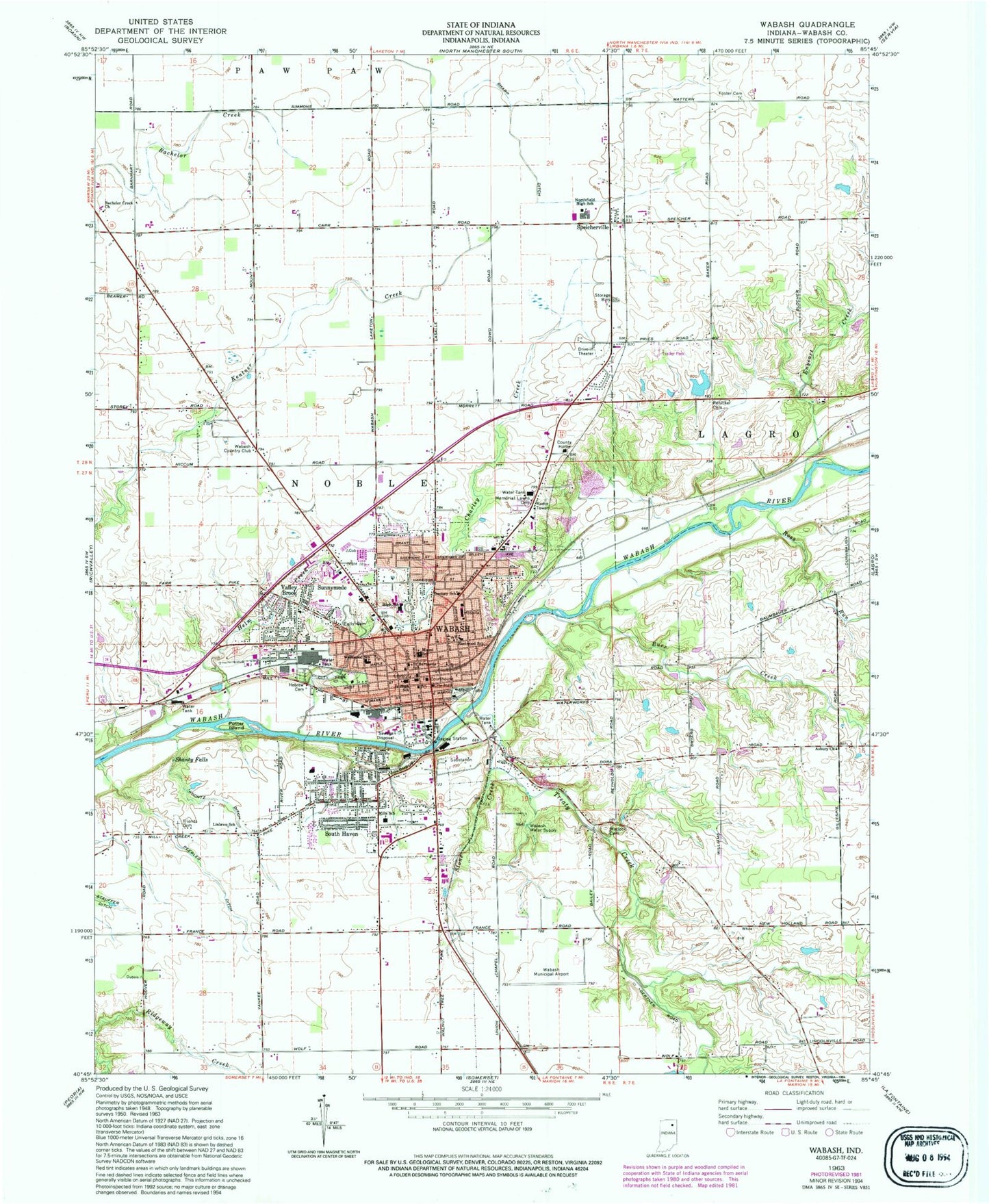
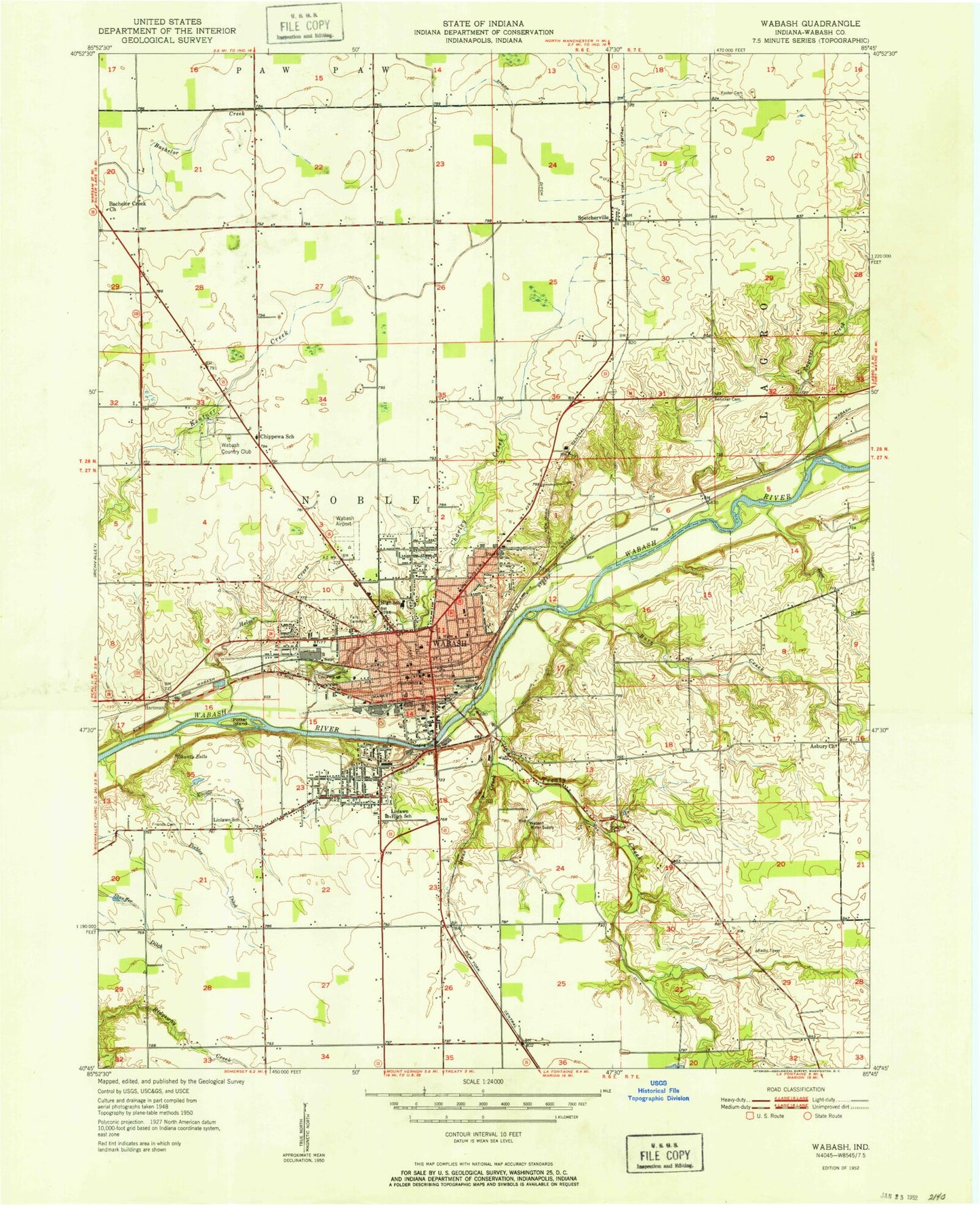
Classic USGS Wabash Indiana 7.5'x7.5' Topo Map
Couldn't load pickup availability
Historical USGS topographic quad map of Wabash in the state of Indiana. Map scale may vary for some years, but is generally around 1:24,000. Print size is approximately 24" x 27"
This quadrangle is in the following counties: Wabash.
The map contains contour lines, roads, rivers, towns, and lakes. Printed on high-quality waterproof paper with UV fade-resistant inks, and shipped rolled.
Contains the following named places: Asbury Church, Bachelor Creek Church, Burr Creek, Century School, Charley Creek, Chippewa School, City of Wabash, Eastwood Elementary School, Enyeart Creek, Foster Cemetery, Friends Cemetery, Helm Creek, J Camberlain Pond, J Chamberlain Pond Dam, Koontz Ditch, Linlawn School, Matlock Cemetery, Memorial Lawns Cemetery, Miami Elementary School, Noble Township Volunteer Fire Department, Noble Township Volunteer Fire Department North, Northfield Junior-Senior High School, Parkview Wabash Hospital, Peebles Ditch, Potter Island, Renicker Cemetery, Reserve Number Fifteen, Reserve Number Fifty-five, Reserve Number Nineteen, Reserve Number Seventeen, Reserve Number Sixteen, Reserve Number Twenty-three, Rodef Sholem Cemetery, Ross Run, Saint Bernard Elementary School, Shanty Falls, South Haven, Speicherville, Stone Creek, Sunnymede, Township of Noble, Treaty Creek, Valley Brook, W C Mills Elementary School, Wabash, Wabash Country Club, Wabash County, Wabash County Sheriff's Office, Wabash Fire Department North Station, Wabash Fire Department South Station, Wabash Junior-Senior High School, Wabash Municipal Airport, Wabash Police Department, Wabash Post Office, WAYT-AM (Wabash), Westwood School, WKUZ-FM (Wabash), ZIP Code: 46992